Hill forts · North East England
Coria
In or near Corbridge.
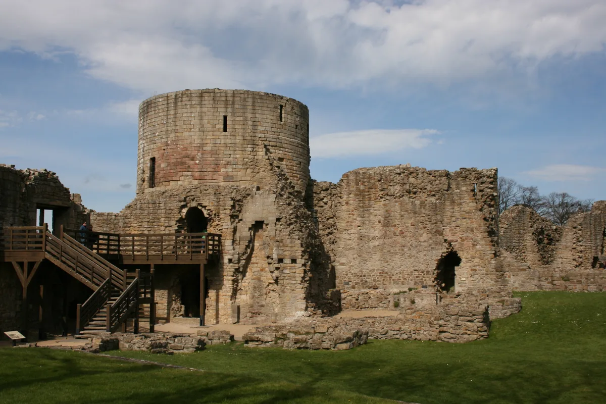
Coria — archaeological site in Corbridge, Northumberland, England, UK.

Wikimedia Commons contributors — see linked file page for photographer and licence licence
_-_geograph.org.uk_-_3355778.jpg)
Plan your visit
- Typical visit
- 1 h–2 h
- Nearest railway station
- Corbridge · 1.8 km
- Free entry
- Family-friendly
- Dog-friendly
- Limited wheelchair access
Getting there & planning your visit
Coria is located in the Scottish Lowlands, with the nearest railway station being Corbridge, which is 1.8 km away. Entry to the site is free, but wheelchair access is limited. The postcode for sat-nav is NE45 5NT.
About
Coria is a hill fort in the United Kingdom. It covers approximately 81 km². Built in the ancient Roman architecture style. Heritage designation: scheduled monument. Owned by English Heritage. Managed by English Heritage. Part of Hadrian's Wall. Wikidata describes it as: "archaeological site in Corbridge, Northumberland, England, UK". Coordinates: 54.9805°, -2.0331°.
Photo gallery
See it from the streetimagery from 2020
Imagery © Mapillary contributors, CC BY-SA 4.0
Summary from the official site
Corbridge Roman Town is an archaeological site that reveals how people lived and worked in the northernmost town of the Roman Empire. Visitors can explore the remains of the Roman main street and view a museum showcasing significant artifacts, including the Corbridge Hoard, which offers insights into Roman life and beliefs.
Read more on the official property page.
From the Wikipedia article
Coria was a fort and town 2.5 miles (4.0 km) south of Hadrian's Wall, in the Roman province of Britannia. It was strategically located on the junction of a major Roman north–south road (Dere Street) with the River Tyne and the Roman Stanegate road, which was also the first frontier line which ran east–west between Coria and Luguvalium (the modern Carlisle). Corbridge Roman Site is in the village of Corbridge in the county of Northumberland. It is in the guardianship of English Heritage and is partially exposed as a visitor attraction, including a site museum.
Excerpt from Wikipedia under CC BY-SA 4.0. See the source article linked in Sources below.
- Coordinates
- 54.9805, -2.0331
- District
- Northumberland
- Parish
- Corbridge
- Postcode
- NE45 5NT
- Parliamentary constituency
- Hexham
- Phone
- 01434 632349
- Nearest railway station
- Corbridge — 1.8 km
- Opening
- Daily 10am–5pm; last entry at 4.30pm
- Official site
- www.english-heritage.org.uk
Sources
- wikidata: Q3819299 (CC0)
- wikipedia: Coria (Corbridge) (CC BY-SA 4.0)
- commons: Corstopitum - east and west compounds (3) - geograph.org.uk - 3355778.jpg (CC BY-SA 4.0)
Other places nearby

Corstopitum Visitor's Centre
Museums · 0.3 km

Corbridge Lion
Public art & sculpture · 0.3 km

Corbridge Roman Town Fort
Archaeological sites · 0.4 km

Corbridge Roman Bridge (Site of)
Historic bridges · 0.5 km

Bridge On Old Road Over Cor Burn
Historic bridges · 0.7 km

Corbridge Roman Bridge
Historic bridges · 0.7 km

Church of St Andrew
Historic churches · 1.1 km

The Vicars Pele
Cemeteries · 1.1 km

The Vicars Pele
Historic pubs · 1.1 km

Corbridge
Towns & cities · 1.2 km

Town Hall With Shops
Historic houses · 1.2 km

Bridge Bank Cottage And Adjacent Workshop To North
Historic bridges · 1.2 km
Nearby
📷 3Museums · North East England
Corstopitum Visitor's Centre
Corstopitum Visitor's Centre — a museum in scotland-lowlands, United Kingdom.
📷 4Public art & sculpture · North East England
Corbridge Lion
Corbridge Lion in Scotland Lowlands, United Kingdom.
📷 3Archaeological sites · North East England
Corbridge Roman Town Fort
Corbridge Roman Town Fort — a other in scotland-lowlands, United Kingdom.
📷 3Historic bridges · North East England
Corbridge Roman Bridge (Site of)
Corbridge Roman Bridge (Site of) — a bridge in scotland-lowlands, United Kingdom.
📷 3Historic bridges · North East England
Bridge On Old Road Over Cor Burn
Bridge On Old Road Over Cor Burn — Grade II listed building-listed bridge in scotland-lowlands, United Kingdom.
📷 3Historic bridges · North East England
Corbridge Roman Bridge
Corbridge Roman Bridge — a bridge in scotland-lowlands, United Kingdom.
Where to eat & stay near Coria
Places to stay
 📷 5
📷 5Campsites · North East England
Dilston Scout Camp
Dilston Scout Camp — a campsite in scotland lowlands.
 📷 5
📷 5B&Bs · North East England
The Station Inn
The Station Inn — a bed-and-breakfast in scotland lowlands.
 📷 5
📷 5Hotels · North East England
County Hotel
County Hotel — a hotel in scotland lowlands.
 📷 5
📷 5Caravan parks · North East England
Tyne Green Holiday Park
Tyne Green Holiday Park — a caravan park in scotland lowlands.
 📷 5
📷 5Caravan parks · North East England
Riverside Leisure Holiday Park
Riverside Leisure Holiday Park — a caravan park in scotland lowlands.
 📷 5
📷 5Campsites · North East England
Fallowfield Caravan Park
Fallowfield Caravan Park — a campsite in scotland lowlands.
Places to eat & drink
📷 7Historic pubs · North East England
The Vicars Pele
The Vicars Pele in Scotland Lowlands, United Kingdom.
 📷 6
📷 6 📷 5
📷 5 📷 5
📷 5Historic pubs · North East England
Wellington Inn
Wellington Inn in Scotland Lowlands, United Kingdom.
 📷 5
📷 5Historic pubs · North East England
Travellers' Rest Inn
Travellers' Rest Inn in Scotland Lowlands, United Kingdom.
 📷 4
📷 4More places run by English Heritage
 Flagship📷 10
Museums · London
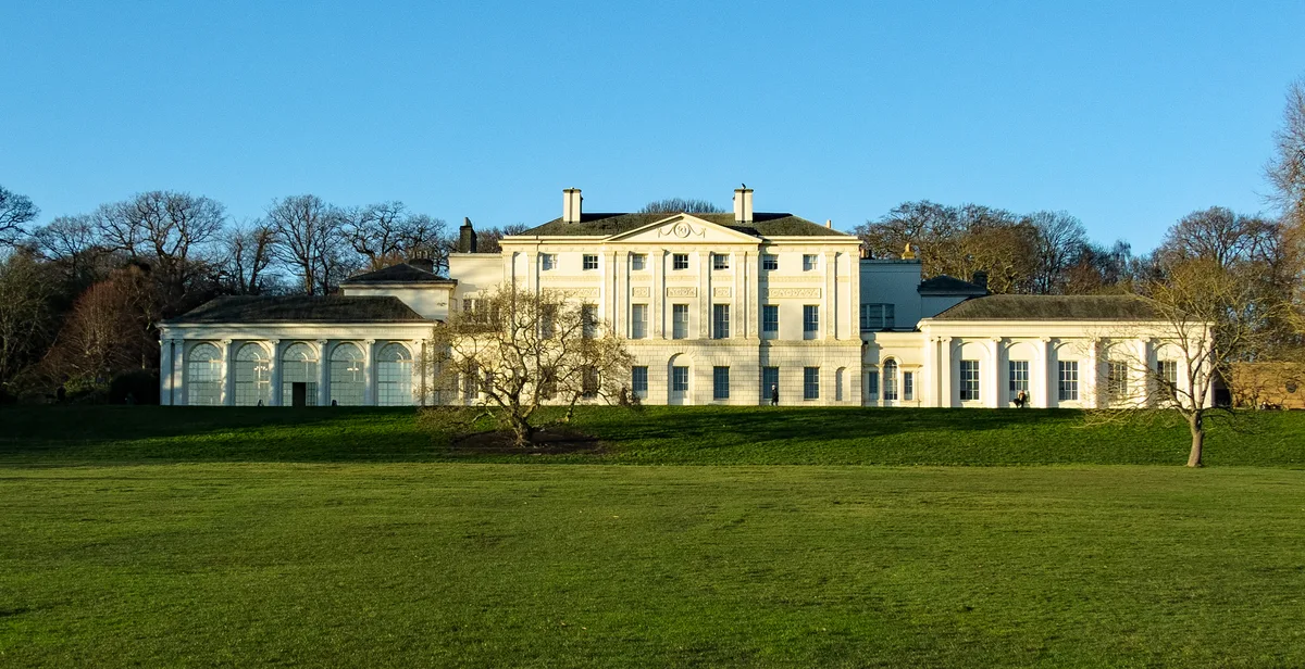
Kenwood House
Kenwood House — art museum and historic house in Hampstead, London.
 📷 5
📷 5Galleries · London
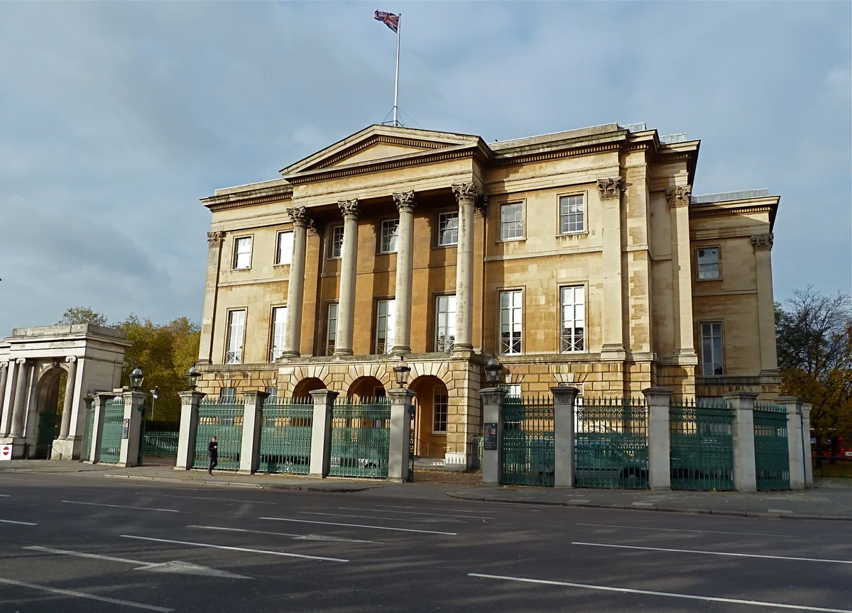
Apsley House
Apsley House — London townhouse of the Dukes of Wellington.
 📷 5
📷 5Castles · London
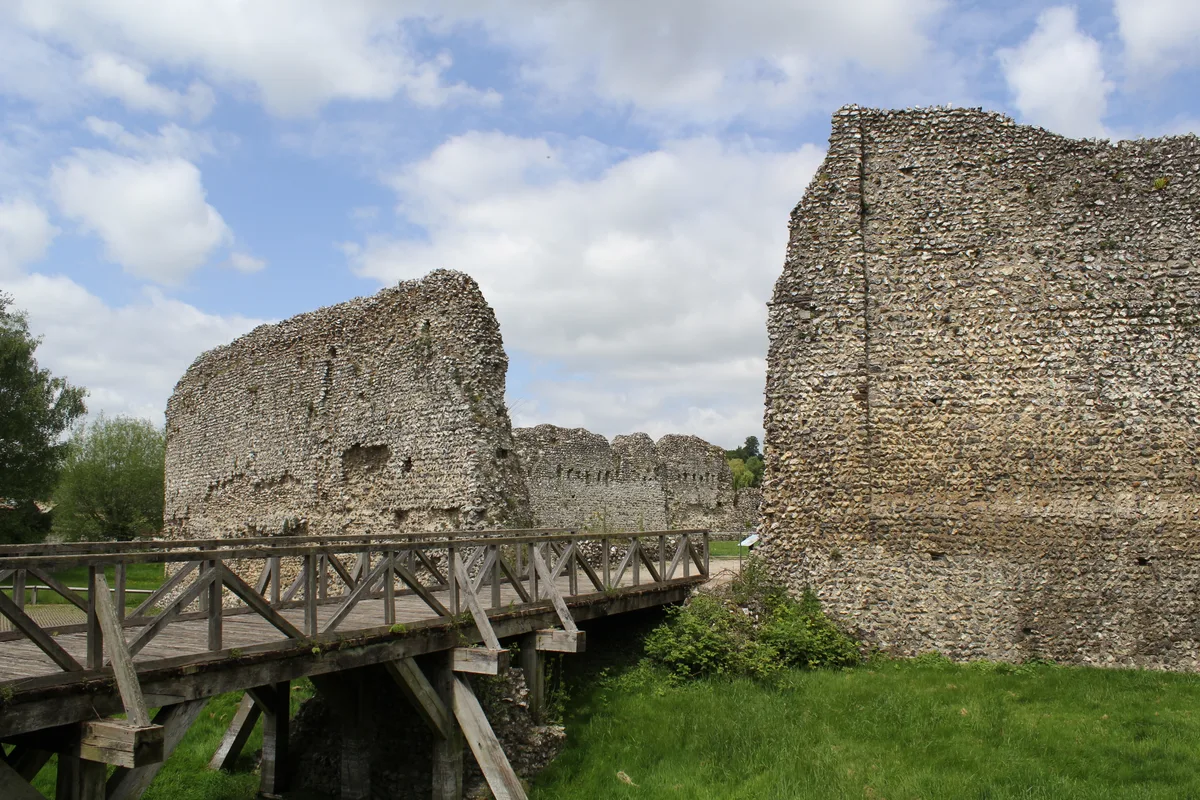
Eynsford Castle
Eynsford Castle — castle, now ruinous, in Eynsford, Kent, England, UK.
 📷 5
📷 5Museums · London
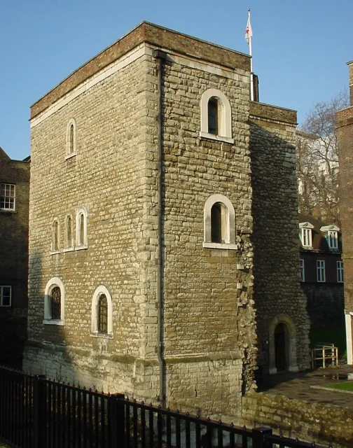
Jewel Tower
Jewel Tower — medieval tower in Westminster, London, England, UK.
More places in this region
 📷 3
📷 3Hill forts · North East England
Barnard Castle
Barnard Castle is a hill fort in the United Kingdom.
 📷 3
📷 3Hill forts · North East England
Stainsby
Stainsby — abandoned village in North Yorkshire, England, UK.
 📷 4
📷 4Hill forts · North East England
Street House Anglo-Saxon cemetery
Street House Anglo-Saxon cemetery — cemetery in North Yorkshire, England.
 📷 3
📷 3Hill forts · North East England
Pittington Hill
Pittington Hill in England North East, United Kingdom.
Frequently asked questions
- Where is Coria?
- Coria is in the Scottish Lowlands, United Kingdom (postcode NE45 5NT), in the parish of Corbridge.
- What is Coria?
- Coria — archaeological site in Corbridge, Northumberland, England, UK.
- How do I get to Coria?
- The nearest railway station is Corbridge, about 1.8 km away. Drivers can use postcode NE45 5NT.
- Who runs Coria?
- Coria is operated by English Heritage.
- Is Coria a listed building?
- Coria is officially recognised as scheduled monument listed.
- Is Coria free to visit?
- Yes, Coria is free to enter.
- How do I get to Coria?
- The nearest railway station is Corbridge, about 1.8 km away. Drivers can navigate to postcode NE45 5NT.