
Towns & cities · East of England
Cople
Cople — village and civil parish in Bedfordshire, UK.

Wikimedia Commons contributors — see linked file page for photographer and licence licence

Plan your visit
- Typical visit
- 3 h–6 h
- Nearest railway station
- Bedford St Johns · 5.4 km
- Free entry
- Family-friendly
- Dog-friendly
About
Cople is a town, city, village or settlement in the United Kingdom. Recent population estimates put it at around 722 people. Address: MK44. Wikidata describes it as: "village and civil parish in Bedfordshire, UK". Coordinates: 52.1220°, -0.3890°.
Photo gallery
See it from the streetimagery from 2026
Imagery © Mapillary contributors, CC BY-SA 4.0
From the Wikipedia article
Cople is a village and civil parish in the English county of Bedfordshire. The name Cople is derived from the phrase Cock Pool, a place where chickens were kept, that was mentioned in the Domesday Book.
Excerpt from Wikipedia under CC BY-SA 4.0. See the source article linked in Sources below.
Background
History
Cople is part of the ancient hundred of Wixamtree. The centre of Cople is dominated by All Saints Church, originally built soon after 1087 by the de Beauchamp family and which later became part of Chicksands Priory. The list of Vicars maintained by the church dates back to 1237. All Saints Church was rebuilt in the 15th century, some parts of it a little earlier, by the families who owned the local manors. The church was extended in the first part of the 16th century. It is Grade I listed. A toll house stands at the junction with the A603 (Bedford to Sandy road); the house dates from around 1770 and was used to collect tolls from the road users. It is one of only two toll houses that still…
Sourced from Wikipedia under CC BY-SA 4.0.
- Coordinates
- 52.1220, -0.3890
- District
- Bedford
- Parish
- Cople
- Postcode
- MK44
- Parliamentary constituency
- North Bedfordshire
- Population
- 722
- Nearest railway station
- Bedford St Johns — 5.4 km
Sources
- wikidata: Q1520369 (CC0)
- wikipedia: Cople (CC BY-SA 4.0)
- commons: The five bells - geograph.org.uk - 191401.jpg (CC BY-SA 4.0)
Other places nearby
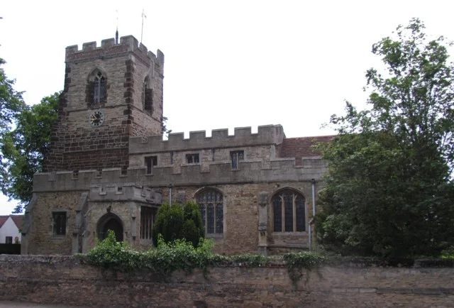
Church of All Saints, Cople
Historic churches · 0.2 km

Cople Pits
Forests & woodlands · 0.9 km
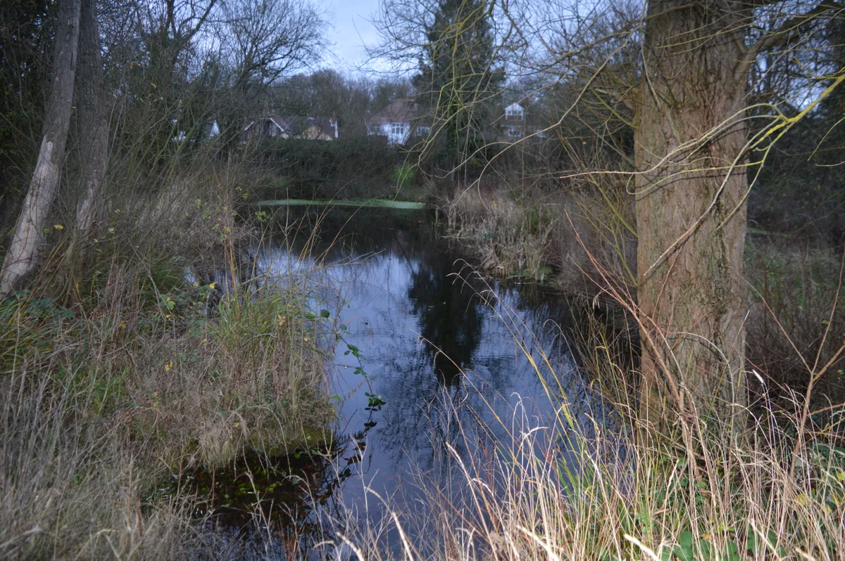
Cople Pits
Wildlife reserves · 0.9 km

Settlement site N of Chapel End Farm
Vineyards · 1.2 km

Willington Stables
Natural landmarks · 1.6 km
Willington Dovecote
Natural landmarks · 1.7 km

Cardington
Towns & cities · 1.8 km

R101 memorial
Memorials & monuments · 1.9 km

Cardington Bridge
Historic bridges · 2.0 km
Cardington Cross
Memorials & monuments · 2.1 km

Cardington railway station
Heritage railway stations · 2.2 km

Mooring Tower
Historic houses · 2.7 km
Cople is a village located in the London region with a population of 722. Our guide lists N attractions within reach.
At a glance
- Population
- 722
- Constituency
- North Bedfordshire
- Top categories near here
Things to see in Cople
5 attractions within 12 km.
📷 5Historic churches · East of England
Church of All Saints, Cople
Church of All Saints, Cople — Grade I listed church in Cople, Bedford, Bedfordshire, England, UK.
📷 5Forests & woodlands · East of England
Cople Pits
Cople Pits is a forest or woodland in the United Kingdom.
📷 5Wildlife reserves · East of England
Cople Pits
Cople Pits — nature reserve in the United Kingdom.
📷 5Natural landmarks · East of England
Willington Dovecote
Willington Dovecote — a other in england-london, United Kingdom.
📷 5Natural landmarks · East of England
Willington Stables
Willington Stables — a other in england-london, United Kingdom.
Nearby
📷 5Historic churches · East of England
Church of All Saints, Cople
Church of All Saints, Cople — Grade I listed church in Cople, Bedford, Bedfordshire, England, UK.
📷 5Forests & woodlands · East of England
Cople Pits
Cople Pits is a forest or woodland in the United Kingdom.
📷 5Wildlife reserves · East of England
Cople Pits
Cople Pits — nature reserve in the United Kingdom.
📷 3Vineyards · East of England
Settlement site N of Chapel End Farm
Settlement site N of Chapel End Farm — a UK vineyard in england london, producing English or Welsh wine from cool-climate grape varieties.
📷 5Natural landmarks · East of England
Willington Stables
Willington Stables — a other in england-london, United Kingdom.
📷 5Natural landmarks · East of England
Willington Dovecote
Willington Dovecote — a other in england-london, United Kingdom.
Where to eat & stay near Cople
Places to stay
 📷 5
📷 5Campsites · East of England
Jordans Close Scout Activity Centre
Jordans Close Scout Activity Centre — a campsite in england london.
 📷 7
📷 7 📷 7
📷 7B&Bs · East of England
Old Warden Guest House
Old Warden Guest House — a bed-and-breakfast in england london.
 📷 5
📷 5 📷 5
📷 5
Places to eat & drink
 📷 5
📷 5Historic pubs · East of England
The Anchor Public House
The Anchor Public House in England East, United Kingdom.
 📷 5
📷 5Historic pubs · East of England
Kings Arms Public House
Kings Arms Public House in England East, United Kingdom.
 📷 5
📷 5 📷 5
📷 5 📷 5
📷 5 📷 5
📷 5Historic pubs · East of England
Ye Olde Plough Public House
Ye Olde Plough Public House in England East, United Kingdom.
More towns in this region
 Flagship📷 10
 Flagship📷 10
Towns & cities · East of England
Cambridge
Cambridge — city in Cambridgeshire, England.
 Flagship📷 10
Towns & cities · East of England
Chelmsford
Chelmsford — city in Essex, United Kingdom.
 Flagship📷 10
Towns & cities · East of England
Colney Heath
Colney Heath — village and civil parish in St Albans, Hertfordshire, England, UK.
Frequently asked questions
- Where is Cople?
- Cople is in London, United Kingdom (postcode MK44), in the parish of Cople.
- What is Cople?
- Cople — village and civil parish in Bedfordshire, UK.
- How do I get to Cople?
- The nearest railway station is Bedford St Johns, about 5.4 km away. Drivers can use postcode MK44.
- Is Cople free to visit?
- Yes, Cople is free to enter.
- How do I get to Cople?
- The nearest railway station is Bedford St Johns, about 5.4 km away. Drivers can navigate to postcode MK44.