
Forests & woodlands · South West England
Coombe Hill Nature Reserve
In or near Tredington.
Coombe Hill Nature Reserve is a forest or woodland in the United Kingdom.

Wikimedia Commons contributors — see linked file page for photographer and licence licence

Plan your visit
- Typical visit
- 1 h–3 h
- Nearest railway station
- Cheltenham Spa · 8.1 km
- Free entry
- Family-friendly
- Dog-friendly
Getting there & planning your visit
To visit Coombe Hill Nature Reserve, the nearest railway station is Cheltenham Spa, located 8.1 km away. The postcode for sat-nav is GL19 4DS, and entry to the reserve is free.
About
Coombe Hill Nature Reserve is a named forest, woodland or nature reserve in the United Kingdom. Coordinates: 51.9420°, -2.1936°. This entry is part of The Great Britain Guide, a free, ad-free, open-data tourist directory.
Photo gallery
Protected designations
- Site of Special Scientific Interest: Coombe Hill Canal SSSI
- Area of Outstanding Natural Beauty: Cotswolds
Designations sourced from Natural England open data under OGL v3.
From the Wikipedia article
Coombe Hill Canal lies in the Vale of Gloucester, south west England, north of Leigh and runs west 2.75 miles (4.43 km) from Coombe Hill Basin to the River Severn near Wainlode Hill. It opened in 1796 and closed 80 years later in 1876, after the only lock was damaged by flooding. The Gloucestershire Wildlife Trust purchased the Coombe Hill Canal nature reserve in 1985 and the area is managed by the trust. Adjacent to the Coombe Hill Canal is a large area of wet meadowland situated midway between Gloucester and Tewkesbury to the west of the A38, which was purchased by the trust in 1999. There is a north and a south meadow. This land and the canal itself often flood in winter, which attracts hundreds of wildfowl.
Excerpt from Wikipedia under CC BY-SA 4.0. See the source article linked in Sources below.
Background
History
The canal was authorised by the Leigh and Deerhurst Canal Act 1792 (32 Geo. 3. c. 83) and was probably open in 1796. The cost of construction was about £5,000 and the completed canal could take barges of 60-70 tons. It was meant to carry goods to Cheltenham but the local geography made that impossible. There was a gap of nearly five miles between the canal and the town, so the canal was not as useful as it might have been. In 1810 the canal was leased to a group of three men for £400 per annum. In 1822 the canal was leased to a number of committeemen from the Worcester and Birmingham Canal. In 1829 they renewed their lease for another 21 years at £500 per year and in 1844 offered to buy the…
Description
|coordinates = |area=20.16 hectare |notifydate=1954 |enref=1000789 }} Fuller information is provided in the Gloucestershire Wildlife Trust nature reserves handbook. The canal was built to link the Forest of Dean coalfields with Cheltenham via the Severn, but competition and other reasons led to its closure. The trust has carried out management work with aid of Severn Trent Water and the then Nature Conservancy Council to restore the derelict canal. The nature reserve has two wooden bird hides, Teal and Wigeon (formally Grundon). Wigeon hide is on the canal side of the reserve and accessed via a raised walkway. Teal hide is on the northern side of the reserve and accessed through fields…
Sourced from Wikipedia under CC BY-SA 4.0.
- Coordinates
- 51.9420, -2.1936
- County
- Gloucestershire
- District
- Tewkesbury
- Parish
- Deerhurst
- Postcode
- GL19 4DS
- Parliamentary constituency
- Tewkesbury
- Established
- 1796
- Nearest railway station
- Cheltenham Spa — 8.1 km
Sources
- osm: w98860430 (ODbL)
- wikipedia: Coombe Hill Canal (CC BY-SA 4.0)
- commons: Coombe Hill Canal geograph 2190439.jpg (CC BY-SA 4.0)
Other places nearby

Leigh
Villages · 0.9 km

Apperley Court
Manor houses · 1.3 km

Barnes Monument, In The Churchyard, About 8 Metres East Of North East Corner Of Church Of St Catherine
Memorials & monuments · 1.3 km
Huntington Monument, In The Churchyard, About 1 Metre South Of South Chancel Window, Church Of St Catherine
Memorials & monuments · 1.3 km
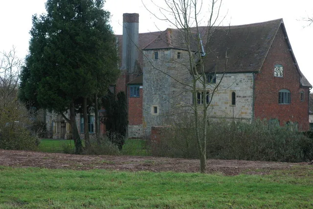
Wightfield Manor
Stately homes · 1.7 km

Fieldview Caravan Park
Caravan parks · 1.8 km

Coombe Hill
Villages · 1.9 km
Coombe Hill Canal
Canals · 2.0 km

The Red Lion Caravan and Camping Park
Campsites · 2.1 km

River Chelt
Museums · 2.2 km

Deerhurst
Villages · 2.5 km

Wainlode Cliff
Natural landmarks · 2.6 km
Nearby
📷 5📷 3Manor houses · South West England
Apperley Court
Apperley Court — a manor in england-west-midlands, United Kingdom.
📷 3Memorials & monuments · South West England
Barnes Monument, In The Churchyard, About 8 Metres East Of North East Corner Of Church Of St Catherine
Barnes Monument, In The Churchyard, About 8 Metres East Of North East Corner Of Church Of St Catherine — Grade II listed building-listed memorial in england-west-midlands, United Kingdom.
📷 3Memorials & monuments · South West England
Huntington Monument, In The Churchyard, About 1 Metre South Of South Chancel Window, Church Of St Catherine
Huntington Monument, In The Churchyard, About 1 Metre South Of South Chancel Window, Church Of St Catherine — Grade II listed building-listed memorial in england-west-midlands, United Kingdom.
Flagship📷 3Stately homes · South West England
Wightfield Manor
Wightfield Manor — manor house in Deerhurst, Gloucestershire, England, UK.
📷 5Caravan parks · South West England
Fieldview Caravan Park
Fieldview Caravan Park — a caravan park in england west midlands.
Where to eat & stay near Coombe Hill Nature Reserve
Places to stay
📷 5Caravan parks · South West England
Fieldview Caravan Park
Fieldview Caravan Park — a caravan park in england west midlands.
📷 5Campsites · South West England
The Red Lion Caravan and Camping Park
The Red Lion Caravan and Camping Park — a campsite in england west midlands.
 📷 5
📷 5Hotels · South West England
Hatherley Manor Hotel
Hatherley Manor Hotel — a hotel in england west midlands.
 📷 5
📷 5Campsites · South West England
Court Farm Camping
Court Farm Camping — a campsite in england west midlands.
 📷 5
📷 5Caravan parks · South West England
The Willows
The Willows — a caravan park in england west midlands.
 📷 5
📷 5Caravan parks · South West England
Mill Avon Holiday Park
Mill Avon Holiday Park — a caravan park in england west midlands.
Places to eat & drink
📷 5Historic pubs · South West England
Lower Lode Hotel
Lower Lode Hotel in England South East, United Kingdom.
 📷 7
📷 7Cafés · South West England
The Abbey Tea Rooms
The Abbey Tea Rooms — a café in england west midlands. Cuisine: tea;cake;sandwich;coffee shop.
 📷 7
📷 7Historic pubs · South West England
Jessop House Hotel
Jessop House Hotel in England South East, United Kingdom.
 📷 7
📷 7Historic pubs · South West England
The Royal Hop Pole
The Royal Hop Pole — Historic pub — listed building or notable heritage status.
 📷 5
📷 5Cafés · South West England
Jelly Roll Cafe
Jelly Roll Cafe — a café in england west midlands.
 📷 4
📷 4Historic pubs · South West England
Nottingham Arms
Nottingham Arms — Historic pub — listed building or notable heritage status.
More forests in this region
 📷 5
📷 5Forests & woodlands · South West England
Avebury Stone Circle
Avebury Stone Circle is a forest or woodland in the United Kingdom.
 📷 5
📷 5Forests & woodlands · South West England
Bowerchalke Downs SSSI
Bowerchalke Downs SSSI is a forest or woodland in the United Kingdom.
 📷 5
📷 5Forests & woodlands · South West England
Broadcroft Quarry Butterfly Reserve
Broadcroft Quarry Butterfly Reserve is a forest or woodland in the United Kingdom.
 📷 5
📷 5Forests & woodlands · South West England
Chickengrove Bottom SSSI
Chickengrove Bottom SSSI is a forest or woodland in the United Kingdom.
Frequently asked questions
- Where is Coombe Hill Nature Reserve?
- Coombe Hill Nature Reserve is in Gloucestershire, South-West England, United Kingdom (postcode GL19 4DS), in the parish of Deerhurst.
- What is Coombe Hill Nature Reserve?
- Coombe Hill Nature Reserve is a forest or woodland in the United Kingdom.
- How do I get to Coombe Hill Nature Reserve?
- The nearest railway station is Cheltenham Spa, about 8.1 km away. The nearest town is Tredington. Drivers can use postcode GL19 4DS.
- When was Coombe Hill Nature Reserve built?
- Built or established in 1796.
- Is Coombe Hill Nature Reserve a protected site?
- Yes — Coombe Hill Nature Reserve is part of the Coombe Hill Canal SSSI Site of Special Scientific Interest and the Cotswolds National Landscape (AONB).
- Is Coombe Hill Nature Reserve free to visit?
- Yes, Coombe Hill Nature Reserve is free to enter.
- How do I get to Coombe Hill Nature Reserve?
- Drivers can navigate to postcode GL19 4DS. It sits within the Tewkesbury parliamentary constituency.