
Hill forts · North West England
Coggabata
In or near Bowness-on-Solway.
Coggabata is a hill fort in the United Kingdom.

Wikimedia Commons contributors — see linked file page for photographer and licence licence

Plan your visit
- Typical visit
- 1 h–2 h
- Nearest railway station
- Annan · 9.7 km
- Free entry
- Dog-friendly
Getting there & planning your visit
To visit Coggabata, the nearest railway station is Annan, located 9.7 km away. The postcode for Coggabata is CA7 5DP, which you can use for sat-nav. Entry to the site is free.
About
Coggabata is a hill fort in the United Kingdom. Part of Hadrian's Wall. Coordinates: 54.9270°, -3.1480°. This entry is part of The Great Britain Guide, a free, ad-free, open-data tourist directory.
Photo gallery
See it from the streetimagery from 2024
Imagery © Mapillary contributors, CC BY-SA 4.0
Protected designations
- Site of Special Scientific Interest: Upper Solway Flats & Marshes SSSI
- Area of Outstanding Natural Beauty: Solway Coast
- Ramsar wetland: Upper Solway Flats & Marshes
Designations sourced from Natural England open data under OGL v3.
From the Wikipedia article
Coggabata, or Congavata / Concavata, (with the modern name of Drumburgh) was a Roman fort on Hadrian's Wall, between Aballava (Burgh by Sands) to the east and Mais (Bowness-on-Solway) to the west. It was built on a hill commanding views over the flatter land to the east and west and to the shore of the Solway Firth to the north. Its purpose was to guard the southern end of two important Solway fords, the Stonewath and the Sandwath. The Notitia Dignitatum gives the name of the fort as 'Congavata', but the Staffordshire Moorlands Pan gives the name as 'Coggabata'.
Excerpt from Wikipedia under CC BY-SA 4.0. See the source article linked in Sources below.
Background
Description
The fort was an oblong and built of stone, with the Wall running along its northern side, and measured 270 ft north to south by 316 ft east to west, occupying an area of just less than 2 acre. The Wall at this point is nine feet seven inches wide, and is made of stone. It was constructed on the foundations of the levelled Turf Wall. There were gates on each side, with the north gate giving access beyond the wall. A Roman road has been proved by LIDAR photography to have linked Coggabata with the nearby Roman fort at Kirkbride to the south-west. There is a pele tower, Drumburgh Castle (shown above right), lying across the line of the north wall of the fort, built entirely of Roman stones.
Sourced from Wikipedia under CC BY-SA 4.0.
- Coordinates
- 54.9270, -3.1480
- District
- Cumberland
- Parish
- Bowness
- Postcode
- CA7 5DP
- Parliamentary constituency
- Penrith and Solway
- Nearest railway station
- Annan — 9.7 km
Sources
- wikidata: Q3682385 (CC0)
- wikipedia: Coggabata (CC BY-SA 4.0)
- commons: Drumburgh Castle - geograph.org.uk - 912711.jpg (CC BY-SA 4.0)
Other places nearby
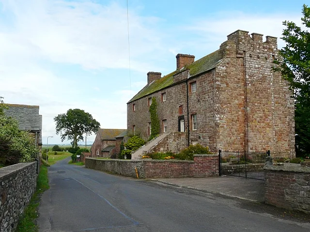
Drumburgh Castle
Castles · 0.1 km

Drumburgh
Villages · 0.2 km

Milecastle (site of)
Archaeological sites · 0.7 km

Milecastle 77 (site of)
Archaeological sites · 1.3 km

Milecastle 77 (site of)
Archaeological sites · 1.3 km

Glasson Bridge
Historic bridges · 1.4 km

Glasson
Villages · 1.6 km

Cottage and Glendale Holiday Park
Caravan parks · 2.4 km

Fingland
Villages · 2.8 km

Boustead Hill Bridge
Historic bridges · 3.0 km

Carlisle Canal
Canals · 3.4 km

Port Carlisle
Villages · 3.5 km
Nearby
📷 3Castles · North West England
Drumburgh Castle
Drumburgh Castle — castle in Cumbria, England, UK.
📷 5📷 3Archaeological sites · North West England
Milecastle (site of)
Milecastle (site of) — an archaeological site in North West England, United Kingdom.
📷 3Archaeological sites · North West England
Milecastle 77 (site of)
Milecastle 77 (site of) — an archaeological site in North West England, United Kingdom.
📷 5Archaeological sites · North West England
Milecastle 77 (site of)
Milecastle 77 (site of) — archaeological in scotland lowlands.
📷 3Historic bridges · North West England
Glasson Bridge
Glasson Bridge — Grade II listed building-listed bridge in scotland-lowlands, United Kingdom.
Where to eat & stay near Coggabata
Places to stay
📷 5Caravan parks · North West England
Cottage and Glendale Holiday Park
Cottage and Glendale Holiday Park — a caravan park in scotland lowlands.
 📷 5
📷 5Campsites · North West England
The Bush Inn
The Bush Inn — a campsite in scotland lowlands.
 📷 5
📷 5Caravan parks · North West England
Braids Caravan Park
Braids Caravan Park — a caravan park in scotland lowlands.
 📷 5
📷 5 📷 5
📷 5Caravan parks · North West England
Galabank Camping and Caravan Park
Galabank Camping and Caravan Park — a caravan park in scotland lowlands.
 📷 5
📷 5Caravan parks · North West England
Crofton Hall CL
Crofton Hall CL — a caravan park in scotland lowlands.
Places to eat & drink
 📷 7
📷 7Historic pubs · North West England
The Greyhound Inn
The Greyhound Inn in Scotland Lowlands, United Kingdom.
 📷 7
📷 7Historic pubs · North West England
Queensberry Arms Hotel
Queensberry Arms Hotel in Scotland Lowlands, United Kingdom.
 📷 5
📷 5Historic pubs · North West England
Kings Arms Walter Willsons
Kings Arms Walter Willsons in Scotland Lowlands, United Kingdom.
 📷 5
📷 5Historic pubs · North West England
Horse And Farrier Public House
Horse And Farrier Public House in Scotland Lowlands, United Kingdom.
 📷 5
📷 5Historic pubs · North West England
Milbourne Arms Public House
Milbourne Arms Public House in Scotland Lowlands, United Kingdom.
 📷 5
📷 5Historic pubs · North West England
The Boardroom Public House
The Boardroom Public House in Scotland Lowlands, United Kingdom.
More places in this region
 📷 5
📷 5Hill forts · North West England
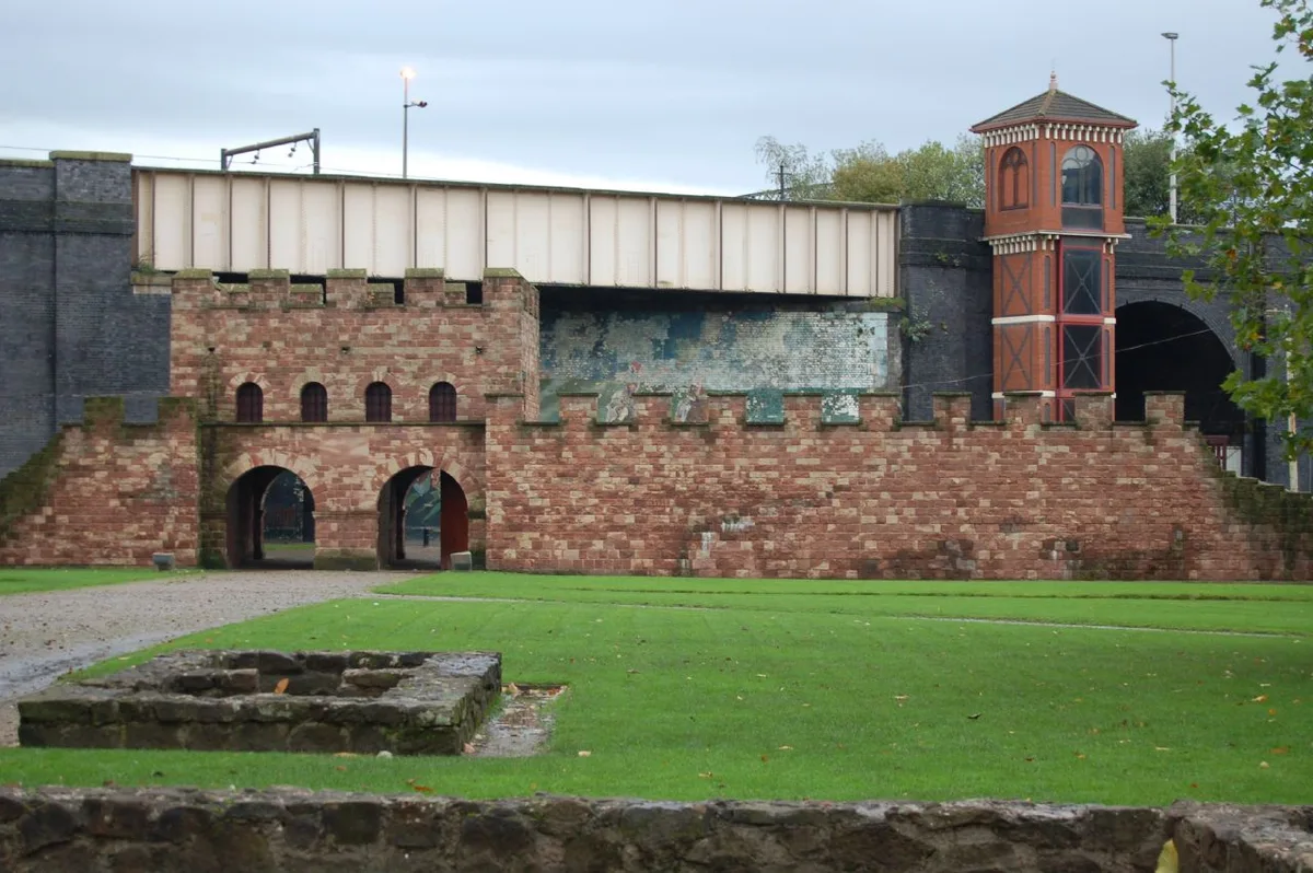
Mamucium
Mamucium — former Roman fort in the Castlefield area of Manchester in North West England.
 📷 3
📷 3Hill forts · North West England
Timperley Hall
Timperley Hall is a hill fort in the United Kingdom.
 📷 3
📷 3Hill forts · North West England
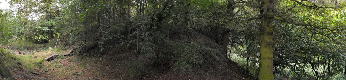
Watch Hill Castle
Watch Hill Castle — medieval castle in Bowdon, Greater Manchester, England, UK.
 📷 5
📷 5Hill forts · North West England
Buckton Castle
Buckton Castle — 12th-century castle in Mossley, Greater Manchester, England, UK.
Frequently asked questions
- Where is Coggabata?
- Coggabata is in North-West England, United Kingdom (postcode CA7 5DP), in the parish of Bowness.
- What is Coggabata?
- Coggabata is a hill fort in the United Kingdom.
- How do I get to Coggabata?
- The nearest railway station is Annan, about 9.7 km away. The nearest town is Bowness-on-Solway. Drivers can use postcode CA7 5DP.
- Is Coggabata a protected site?
- Yes — Coggabata is part of the Upper Solway Flats & Marshes SSSI Site of Special Scientific Interest and the Solway Coast National Landscape (AONB).
- Is Coggabata free to visit?
- Yes, Coggabata is free to enter.
- How do I get to Coggabata?
- Drivers can navigate to postcode CA7 5DP. It sits within the Penrith and Solway parliamentary constituency.