Canals · North West England
Carlisle Canal
In or near Bowness-on-Solway.
Carlisle Canal is a canal in the United Kingdom.

Wikimedia Commons licence
Plan your visit
- Typical visit
- 1 h–2 h
- Nearest railway station
- Annan · 6.3 km
- Free entry
- Dog-friendly
About
Carlisle Canal is a canal in the United Kingdom. Coordinates: 54.9489°, -3.1852°. This entry is part of The Great Britain Guide, a free, ad-free, open-data tourist directory.
Photo gallery
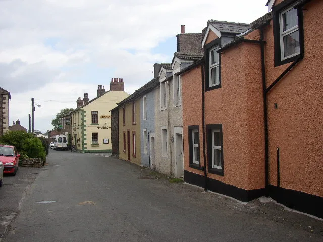
See it from the streetimagery from 2022
Imagery © Mapillary contributors, CC BY-SA 4.0
Protected designations
- Site of Special Scientific Interest: Upper Solway Flats & Marshes SSSI
- Area of Outstanding Natural Beauty: Solway Coast
- Ramsar wetland: Upper Solway Flats & Marshes
Designations sourced from Natural England open data under OGL v3.
From the Wikipedia article
The Carlisle Canal opened in 1823, linking Carlisle to the Solway Firth, to facilitate the transport of goods to and from the city. It was a short-lived venture, being replaced in 1854 by a railway which used the canal bed for most of its route.
Excerpt from Wikipedia under CC BY-SA 4.0. See the source article linked in Sources below.
Background
History
The River Eden flows through the city of Carlisle, and into the Solway Firth. There were coal mines at Maryport, a little further down the coast, and prior to 1720 places along the river were supplied with coal by boats. However, this trade ended in 1720, when duties were levied on all goods carried around the coast by sea, and it became cheaper to transport the coal by land. Three traders from Carlisle, John Hicks, Henry Orme and Thomas Pattinson, sought an act of Parliament which would waive the coastwise duties between Ellen Foot, as Maryport was then known, and Bank End, which was located on the river close to Carlisle. The act enabled them to build wharves, cranes and warehouses, and…
Architecture
The committee appointed Chapman as consulting engineer, but who held the position of resident engineer is less clear. Richard Buck had helped Chapman with the initial surveys, and it appears that his brother Henry fulfilled that role at the start of the project. Contracts to build the entire canal had been awarded by early 1820, but relationships between Chapman, Buck and the committee were not good, and the committee asked Thomas Ferrier from the Forth and Clyde Canal to oversee the works in March. Buck was not happy with this and resigned in July. but Richard Buck stayed on, effectively working for Ferrier. Chapman was not happy with this situation, and in November 1822, when most of the…
Sourced from Wikipedia under CC BY-SA 4.0.
- Coordinates
- 54.9489, -3.1852
- District
- Cumberland
- Parish
- Bowness
- Postcode
- CA7 5BX
- Parliamentary constituency
- Penrith and Solway
- Established
- 1823
- Nearest railway station
- Annan — 6.3 km
Sources
- wikidata: Q85750667 (CC0)
- wikipedia: Carlisle Canal (CC BY-SA 4.0)
Other places nearby

Port Carlisle
Villages · 0.2 km

Hadrian's Wall between Port Carlisle and Bowness-on-Solway in wall miles 78 and 79
Archaeological sites · 1.0 km

Cottage and Glendale Holiday Park
Caravan parks · 1.3 km
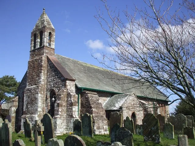
St Michael's Church
Historic churches · 1.8 km

Bowness on Solway War Memorial
Memorials & monuments · 1.9 km
Maia Roman Fort
Hill forts · 1.9 km

Bowness-on-Solway Roman Fort
Archaeological sites · 2.0 km
Maia
Archaeological sites · 2.0 km

Glasson Bridge
Historic bridges · 2.0 km

Bowness-on-Solway
Towns & cities · 2.0 km

Glasson
Villages · 2.1 km

Milecastle 77 (site of)
Archaeological sites · 2.1 km
Nearby
📷 5📷 3Archaeological sites · North West England
Hadrian's Wall between Port Carlisle and Bowness-on-Solway in wall miles 78 and 79
Hadrian's Wall between Port Carlisle and Bowness-on-Solway in wall miles 78 and 79 — archaeological site in Bowness, Cumbria, England, UK.
📷 5Caravan parks · North West England
Cottage and Glendale Holiday Park
Cottage and Glendale Holiday Park — a caravan park in scotland lowlands.
📷 3Historic churches · North West England
St Michael's Church
St Michael's Church — church in Bowness-on-Solway, Cumbria, United Kingdom.
📷 3Memorials & monuments · North West England
Bowness on Solway War Memorial
Bowness on Solway War Memorial — Grade II listed building-listed memorial in scotland-lowlands, United Kingdom.
📷 5Hill forts · North West England
Maia Roman Fort
Maia Roman Fort — Roman fort (castrum) on Hadrian's Wall.
Where to eat & stay near Carlisle Canal
Places to stay
📷 5Caravan parks · North West England
Cottage and Glendale Holiday Park
Cottage and Glendale Holiday Park — a caravan park in scotland lowlands.
 📷 5
📷 5Campsites · North West England
The Bush Inn
The Bush Inn — a campsite in scotland lowlands.
 📷 5
📷 5 📷 5
📷 5Caravan parks · North West England
Galabank Camping and Caravan Park
Galabank Camping and Caravan Park — a caravan park in scotland lowlands.
 📷 5
📷 5Caravan parks · North West England
Broom Fisheries campsite
Broom Fisheries campsite — a caravan park in scotland lowlands.
 📷 5
📷 5Caravan parks · North West England
Bruce's Cave
Bruce's Cave — a caravan park in scotland lowlands.
Places to eat & drink
 📷 7
📷 7Historic pubs · North West England
Queensberry Arms Hotel
Queensberry Arms Hotel in Scotland Lowlands, United Kingdom.
 📷 7
📷 7Historic pubs · North West England
The Greyhound Inn
The Greyhound Inn in Scotland Lowlands, United Kingdom.
 📷 5
📷 5Historic pubs · North West England
Kings Arms Walter Willsons
Kings Arms Walter Willsons in Scotland Lowlands, United Kingdom.
 📷 7
📷 7Historic pubs · North West England
The Globe Tavern
The Globe Tavern in Scotland Lowlands, United Kingdom.
 📷 5
📷 5Historic pubs · North West England
Horse And Farrier Public House
Horse And Farrier Public House in Scotland Lowlands, United Kingdom.
 📷 7
📷 7Historic pubs · Scottish Lowlands
The Farmers Inn
The Farmers Inn in Scotland Lowlands, United Kingdom.
More places in this region
 📷 5
📷 5Canals · North West England
Bridgewater Canal
Bridgewater Canal — canal in North West England.
 📷 4
📷 4Canals · North West England
Cheshire Ring
Cheshire Ring — canal ring in North West England.
 📷 3
📷 3Canals · North West England
Hulme Lock Branch Canal
Hulme Lock Branch Canal — Grade II listed canal in Manchester, Greater Manchester, England, UK.
 📷 5
📷 5Canals · North West England
Hulme Locks Branch Canal
Hulme Locks Branch Canal — canal in Manchester, England.
Frequently asked questions
- Where is Carlisle Canal?
- Carlisle Canal is in the Scottish Lowlands, United Kingdom (postcode CA7 5BX), in the parish of Bowness.
- What is Carlisle Canal?
- Carlisle Canal is a canal in the United Kingdom.
- How do I get to Carlisle Canal?
- The nearest railway station is Annan, about 6.3 km away. Drivers can use postcode CA7 5BX.
- When was Carlisle Canal built?
- Built or established in 1823.
- Is Carlisle Canal a protected site?
- Yes — Carlisle Canal is part of the Upper Solway Flats & Marshes SSSI Site of Special Scientific Interest and the Solway Coast National Landscape (AONB).
- Is Carlisle Canal free to visit?
- Yes, Carlisle Canal is free to enter.
- How do I get to Carlisle Canal?
- The nearest railway station is Annan, about 6.3 km away. Drivers can navigate to postcode CA7 5BX.