
Caravan parks · North East England
Coeburn
In or near Glanton.
Coeburn — a caravan park in scotland lowlands.

Russel Wills — CC BY-SA 2.0 via Wikimedia Commons licence

Plan your visit
- Typical visit
- 1 h–2 h
About
Coeburn is a caravan park located in scotland lowlands. Caravan park listed with verified location and OSM metadata. Touring pitches, static availability and seasonal opening vary — confirm directly with the park.
Photo gallery
Protected designations
- Site of Special Scientific Interest: Northumberland Shore SSSI
- Site of Special Scientific Interest: River Coquet and Coquet Valley Woodlands SSSI
- Area of Outstanding Natural Beauty: Northumberland Coast
Designations sourced from Natural England open data under OGL v3.
Place summary
Coeburn is a caravan park located in the Scottish Lowlands. This park offers a setting for visitors to enjoy outdoor activities and the natural landscape. Facilities typically include pitches for caravans and amenities for a comfortable stay. Ideal for those looking to explore the surrounding countryside.
AI-generated from the structured facts on this page (operator, designation, listing, era). Not a substitute for visiting.
- Coordinates
- 55.3729, -1.8630
- District
- Northumberland
- Parish
- Whittingham
- Postcode
- NE66 4SQ
- Parliamentary constituency
- North Northumberland
Sources
- osm: w239944824 (ODbL)
Other places nearby

Thrunton Wood
Castles · 1.0 km

Coe Crag
Mountains & hills · 2.1 km

Callaly Crag
Mountains & hills · 2.3 km

Rimside Moor
Mountains & hills · 2.4 km

Edlingham
Other places · 2.5 km
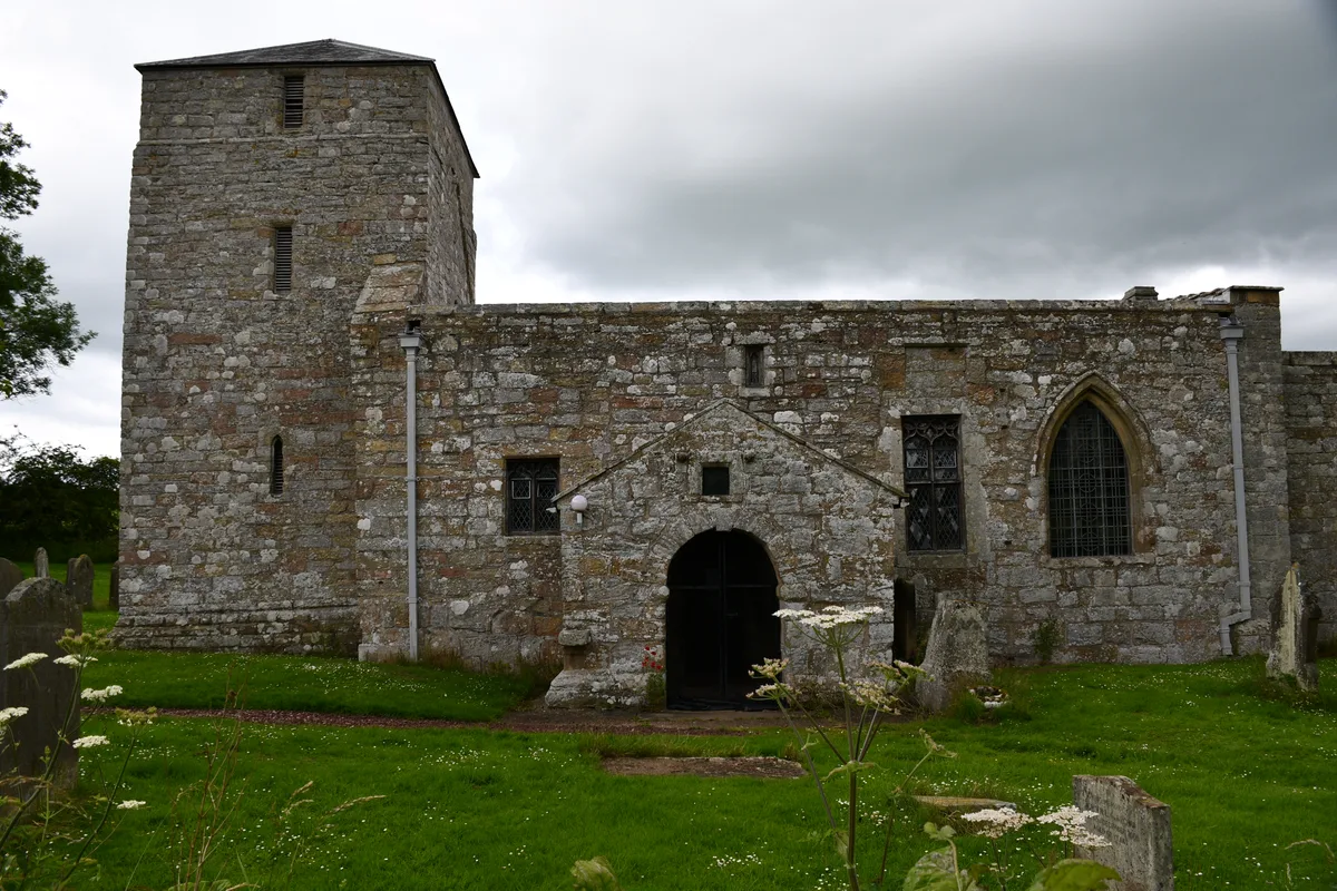
St John the Baptist, Edlingham
Historic churches · 2.7 km

Edlingham deserted village
Vineyards · 2.7 km

Old Callaly Castle Hill
Castles · 2.8 km
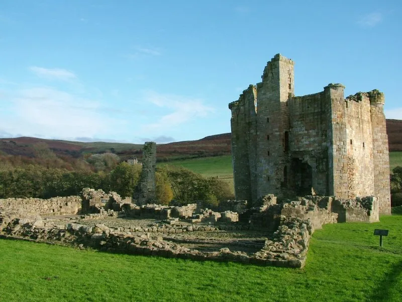
Edlingham Castle
Castles · 2.9 km

Learchild Roman fort
Forts · 2.9 km

Castle Hill Callaly
Memorials & monuments · 2.9 km
Long Crag East Top
Mountains & hills · 3.0 km
Nearby
📷 5Castles · North East England
Thrunton Wood
Thrunton Wood in England North East, United Kingdom.
📷 5Mountains & hills · North East England
Coe Crag
Coe Crag — mountain in scotland lowlands. Elevation: 308 m.
📷 5Mountains & hills · North East England
Callaly Crag
Callaly Crag — a hill or mountain in scotland lowlands.
📷 5Mountains & hills · North East England
Rimside Moor
Rimside Moor — mountain in scotland lowlands. Elevation: 216 m.
📷 5📷 3Historic churches · North East England
St John the Baptist, Edlingham
St John the Baptist, Edlingham — church in Edlingham, Northumberland, England, UK.
Where to eat & stay near Coeburn
Places to stay
 📷 5
Caravan parks · North East England
Riverside Caravan Park Rothbury
Riverside Caravan Park Rothbury — a caravan park in scotland lowlands.
 📷 7
Hotels · North East England
Newcastle House Hotel
Newcastle House Hotel — a hotel in scotland lowlands.
 📷 5
Caravan parks · North East England
Coquetdale Holiday Park
Coquetdale Holiday Park — a caravan park in scotland lowlands.
 📷 5
Caravan parks · North East England
Whitton Glebe Caravan Park
Whitton Glebe Caravan Park — a caravan park in scotland lowlands.
 📷 7
B&Bs · North East England
The Granby Inn
The Granby Inn — a bed-and-breakfast in scotland lowlands.
 📷 5
Caravan parks · North East England
River Breamish - Caravan Club site
River Breamish - Caravan Club site — a caravan park in scotland lowlands.
Places to eat & drink
 📷 7
Historic pubs · North East England
Bridge Of Aln Hotel
Bridge Of Aln Hotel in Scotland Lowlands, United Kingdom.
 📷 7
Historic pubs · North East England
Plough Inn With Outbuilding To North
Plough Inn With Outbuilding To North in Scotland Lowlands, United Kingdom.
 📷 7
Historic pubs · North East England
Crown Public House
Crown Public House in Scotland Lowlands, United Kingdom.
 📷 7
Historic pubs · North East England
Black Swan Public House
Black Swan Public House in Scotland Lowlands, United Kingdom.
 📷 5
 📷 7
More places in this region
 📷 5
Caravan parks · North East England
White Water Park Caravan Club Site
White Water Park Caravan Club Site — a caravan park in england north east.
 📷 5
Caravan parks · North East England
Wild Rose Caravan Site
Wild Rose Caravan Site — a caravan park in england north east.
 📷 5
Caravan parks · North East England
Honeypot Lane Caravan Site
Honeypot Lane Caravan Site — a caravan park in england north east.
 📷 5
Caravan parks · North East England
Teesdale Barnard Castle Caravan & Motorhome Club Campsite
Teesdale Barnard Castle Caravan & Motorhome Club Campsite — a caravan park in england north east.
Frequently asked questions
- Where is Coeburn?
- Coeburn is in North-East England, United Kingdom (postcode NE66 4SQ), in the parish of Whittingham.
- What is Coeburn?
- Coeburn — a caravan park in scotland lowlands.
- How do I get to Coeburn?
- The nearest town is Glanton. Drivers can use postcode NE66 4SQ.
- Is Coeburn a protected site?
- Yes — Coeburn is part of the Northumberland Shore SSSI Site of Special Scientific Interest and the River Coquet and Coquet Valley Woodlands SSSI Site of Special Scientific Interest.
- How do I get to Coeburn?
- Drivers can navigate to postcode NE66 4SQ. It sits within the North Northumberland parliamentary constituency.