
Historic churches · Scottish Lowlands
Churchyard and Gatepiers, Torthorwald Parish Church
In or near Locharbriggs.
Churchyard and Gatepiers, Torthorwald Parish Church — category B listed building-listed church in scotland-lowlands, United Kingdom.

Billy McCrorie — CC BY-SA 2.0 via Wikimedia Commons licence

Plan your visit
- Typical visit
- 30 min–1 h
- Nearest railway station
- Dumfries · 6.1 km
- Free entry
Getting there & planning your visit
To visit the Churchyard and Gatepiers at Torthorwald Parish Church, the nearest railway station is Dumfries, located 6.1 km away. The postcode for the church is DG1 3GD, which can be used for sat-nav coordinates (latitude 55.0891, longitude -3.5122). Entry is free.
About
Churchyard and Gatepiers, Torthorwald Parish Church is a category B listed building-listed church in scotland-lowlands, United Kingdom, registered on the Historic Environment Scotland register (entry LB17153). Listed status protects buildings and structures of special architectural or historic interest. See the linked Wikipedia article for further details.
Photo gallery
Heritage listing
Category B Date Added 03/08/1971 Local Authority Dumfries And Galloway Planning Authority Dumfries And Galloway Parish Torthorwald NGR NY 03577 78233 Coordinates 303577, 578233 — Dated 1782. T-plan church built on slope. Rubble-built with droved ashlar base course; whitewashed; red ashlar margins and gabled vestry - latter added 1898 centrally to tall 4-bay west elevation. Door on each short wall below oculus; forestair to vestry; 1967 unfortunate lean-to (dated) to east. Windows small-paned, round-headed, keystoned, and blocked at imposts. Stumpy wallhead stack over vestry. Slate roof, piended/except at east; ball-finialed birdcage belfry (supports rebuilt in brick) over latter gable. Simple interior, renovated and re-seated 1898, with pulpit central on west wall. Rubble built wall encloses churchyard; some interesting 17-19th century headstones and monuments. 2 rusticated red ashlar square gatepiers, corniced, with pyramidal caps; gates and gate-piers bear bronze plaques, memorials to Dr John G Paton, 1824-1907, missionary to the New Hebrides. — Ecclesiastical building in use as such. Late mediaeval monumental slab incorporated in vestry. Flooring and ceiling not executed until 1819.
From Historic Environment Scotland under OGL v3.
Place summary
The Churchyard and Gatepiers of Torthorwald Parish Church are located in the Scottish Lowlands, postcode DG1. This site is designated as a category B listed building, highlighting its architectural and historical significance.
AI-generated from the structured facts on this page (operator, designation, listing, era). Not a substitute for visiting.
- Coordinates
- 55.0891, -3.5122
- District
- Dumfries and Galloway
- Postcode
- DG1 3GD
- Parliamentary constituency
- Dumfriesshire, Clydesdale and Tweeddale
- Nearest railway station
- Dumfries — 6.1 km
Sources
- wikidata: Q17794863 (CC0)
Other places nearby
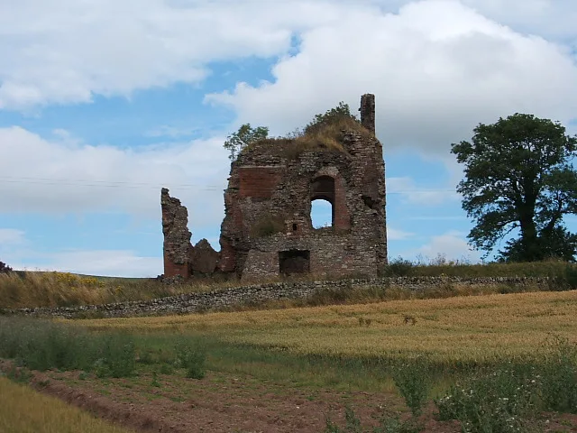
Torthorwald Castle
Castles · 0.1 km

Torthorwald
Villages · 0.2 km

Camp Hill, Tinlaw
Vineyards · 0.8 km
Tinlaw
Mountains & hills · 0.8 km

Gars Hill, West Roucan
Vineyards · 1.1 km

Redhills
Vineyards · 1.5 km
Bellridding Hill
Mountains & hills · 1.9 km

Beacon Hill
Mountains & hills · 2.2 km
Beacon Hill
Mountains & hills · 2.2 km
Collin
Villages · 2.4 km

John D. Laurie Memorial Plaque
Memorials & monuments · 2.4 km

Rockhall Mote
Archaeological sites · 2.4 km
Nearby
📷 4Castles · Scottish Lowlands
Torthorwald Castle
Torthorwald Castle — complex castle ruins in Dumfries and Galloway, Scotland, UK.
📷 5📷 5Vineyards · Scottish Lowlands
Camp Hill, Tinlaw
Camp Hill, Tinlaw — a UK vineyard in scotland lowlands, producing English or Welsh wine from cool-climate grape varieties.
📷 5📷 5Vineyards · Scottish Lowlands
Gars Hill, West Roucan
Gars Hill, West Roucan — a UK vineyard in scotland lowlands, producing English or Welsh wine from cool-climate grape varieties.
📷 5Vineyards · Scottish Lowlands
Redhills
Redhills — a UK vineyard in scotland lowlands, producing English or Welsh wine from cool-climate grape varieties.
Where to eat & stay near Churchyard and Gatepiers, Torthorwald Parish Church
Places to stay
 📷 5
📷 5Caravan parks · Scottish Lowlands
Dumfries Caravan Park
Dumfries Caravan Park — a caravan park in scotland lowlands.
Caravan parks · Scottish Lowlands
Fir Tree Wood CL
Fir Tree Wood CL — a caravan park in scotland lowlands.
 📷 5
📷 5Campsites · Scottish Lowlands
Kirk Loch Campsite
Kirk Loch Campsite — a campsite in scotland lowlands.
 📷 5
📷 5Caravan parks · Scottish Lowlands
Partridge Cottage CAMC CL
Partridge Cottage CAMC CL — a caravan park in scotland lowlands.
 📷 3
📷 3Hotels · Scottish Lowlands
Comlongon Castle (Hotel)
Comlongon Castle (Hotel) — a hotel in scotland lowlands.
 📷 7
📷 7Hotels · Scottish Lowlands
Kings Arms Hotel
Kings Arms Hotel — a hotel in scotland lowlands.
Places to eat & drink
 📷 5
📷 5Historic pubs · Scottish Lowlands
Bruce Arms Public House, 3 Castle Street, Lochmaben
Bruce Arms Public House, 3 Castle Street, Lochmaben in Scotland Lowlands, United Kingdom.
 📷 5
📷 5Historic pubs · Scottish Lowlands
73-77 English Street, Dumfries
73-77 English Street, Dumfries in Scotland Lowlands, United Kingdom.
 📷 7
📷 7Historic pubs · Scottish Lowlands
Rob Roy Public House, 63-65 Queensberry Street, Dumfries
Rob Roy Public House, 63-65 Queensberry Street, Dumfries in Scotland Lowlands, United Kingdom.
 📷 5
📷 5Historic pubs · Scottish Lowlands
The Globe Inn, 56 High Street, Dumfries
The Globe Inn, 56 High Street, Dumfries in Scotland Lowlands, United Kingdom.
 📷 5
📷 5Historic pubs · Scottish Lowlands
Queen O' The South Public House, 8-10 Nith Place, Dumfries
Queen O' The South Public House, 8-10 Nith Place, Dumfries in Scotland Lowlands, United Kingdom.
 📷 5
📷 5Historic pubs · Scottish Lowlands
75 Friars Vennel, Dumfries
75 Friars Vennel, Dumfries in Scotland Lowlands, United Kingdom.
More places in this region
 📷 4
📷 4Historic churches · Scottish Lowlands
Bassendean
Bassendean in England North East, United Kingdom.
 📷 4
📷 4Historic churches · Scottish Lowlands
St Andrew's College, Drygrange
St Andrew's College, Drygrange in England North East, United Kingdom.
 📷 4
📷 4Historic churches · Scottish Lowlands
St John The Evangelist's Episcopal Church
St John The Evangelist's Episcopal Church in England North East, United Kingdom.
 📷 5
📷 5Frequently asked questions
- Where is Churchyard and Gatepiers, Torthorwald Parish Church?
- Churchyard and Gatepiers, Torthorwald Parish Church is in the Scottish Lowlands, United Kingdom (postcode DG1 3GD).
- What is Churchyard and Gatepiers, Torthorwald Parish Church?
- Churchyard and Gatepiers, Torthorwald Parish Church — category B listed building-listed church in scotland-lowlands, United Kingdom.
- How do I get to Churchyard and Gatepiers, Torthorwald Parish Church?
- The nearest railway station is Dumfries, about 6.1 km away. The nearest town is Locharbriggs. Drivers can use postcode DG1 3GD.
- Is Churchyard and Gatepiers, Torthorwald Parish Church a listed building?
- Churchyard and Gatepiers, Torthorwald Parish Church is officially recognised as category B listed building listed.
- Is Churchyard and Gatepiers, Torthorwald Parish Church free to visit?
- Yes, Churchyard and Gatepiers, Torthorwald Parish Church is free to enter.
- How do I get to Churchyard and Gatepiers, Torthorwald Parish Church?
- The nearest railway station is Dumfries, about 6.1 km away. Drivers can navigate to postcode DG1 3GD.