
Historic churches · North West England
Church of St Mary in the Baum, Rochdale
In or near Wardle.
The Church of St Mary in the Baum or Church of St Mary-in-the-Baum is a church in the town of Rochdale, Greater Manchester, England. Commissioned in 1738, and opened in 1742 as a chapel of ease, the c

Alexander P Kapp — CC BY-SA 2.0 via Wikimedia Commons licence

Plan your visit
- Typical visit
- 30 min–1 h
- Nearest railway station
- Rochdale · 1.0 km
- Free entry
Getting there & planning your visit
To visit the Church of St Mary in the Baum, Rochdale, the nearest railway station is Rochdale, located 1 km away. The postcode for your sat-nav is OL16 1AP, and entry to the church is free.
About
The Church of St Mary in the Baum or Church of St Mary-in-the-Baum is a church in the town of Rochdale, Greater Manchester, England. Commissioned in 1738, and opened in 1742 as a chapel of ease, the chapel was extended in the 19th century. In the very early 20th century the church authorities determined to construct a new building and they commissioned Ninian Comper to undertake the task. Comper designed a completely new church to an unusual plan, due to the constriction of the urban site. He incorporated elements of the original chapel into the new design. St Mary's remains an active parish church in the Anglican Diocese of Manchester. It is a Grade I listed building.
Photo gallery
Protected designations
- Site of Special Scientific Interest: Rochdale Canal SSSI
- Site of Special Scientific Interest: South Pennine Moors SSSI
Designations sourced from Natural England open data under OGL v3.
From the Wikipedia article
The Church of St Mary in the Baum or Church of St Mary-in-the-Baum is a church in the town of Rochdale, Greater Manchester, England. Commissioned in 1738, and opened in 1742 as a chapel of ease, the chapel was extended in the 19th century. In the very early 20th century the church authorities determined to construct a new building and they commissioned Ninian Comper to undertake the task. Comper designed a completely new church to an unusual plan, due to the constriction of the urban site. He incorporated elements of the original chapel into the new design. St Mary's remains an active parish church in the Anglican Diocese of Manchester. It is a Grade I listed building.
Excerpt from Wikipedia under CC BY-SA 4.0. See the source article linked in Sources below.
Background
History
The first church on the present site was a chapel of ease opened in 1742. The name supposedly derives from the fields of Melissa plant which grew on the site. The land and much of the funding was supplied by Samuel Chetham, of Turton Tower and Castleton Hall and High Sheriff of Lancashire in 1738. The church was extended in the 19th century but by the 20th was in a state of disrepair. The parish authorities determined that repairing the structure would be more expensive than the construction of a new building and commissioned Ninian Comper to design a new church. Respecting the parishioners’ affection for the original chapel, Comper incorporated elements from it into the new structure…
Architecture
The site of the church was restricted, to which Comper responded with an unusual floor plan. The nave and chancel are both placed on the south side, to take advantage of the light, while two aisles run along the north side. The architectural style is also rare; the brief required Comper to respect and reflect the design of the original chapel. The body of the church is his trademark Perpendicular Gothic, while the exterior aisle wall is Neoclassical. The church is built of red brick, with ashlar dressings. Also by Comper are two Christ Pantocrators, images of a beardless adult Jesus unusual in Christian iconography. The church is a Grade I listed building.
Sourced from Wikipedia under CC BY-SA 4.0.
- Coordinates
- 53.6188, -2.1585
- District
- Rochdale
- Parish
- Rochdale, unparished area
- Postcode
- OL16 1AP
- Parliamentary constituency
- Rochdale
- Established
- 1909
- Nearest railway station
- Rochdale — 1 km
- Official site
- rochdaleparishchurches.org.uk
Sources
- wikipedia: Church of St Mary in the Baum, Rochdale (CC BY-SA 4.0)
Other places nearby

The Baum
Historic pubs · 0.1 km
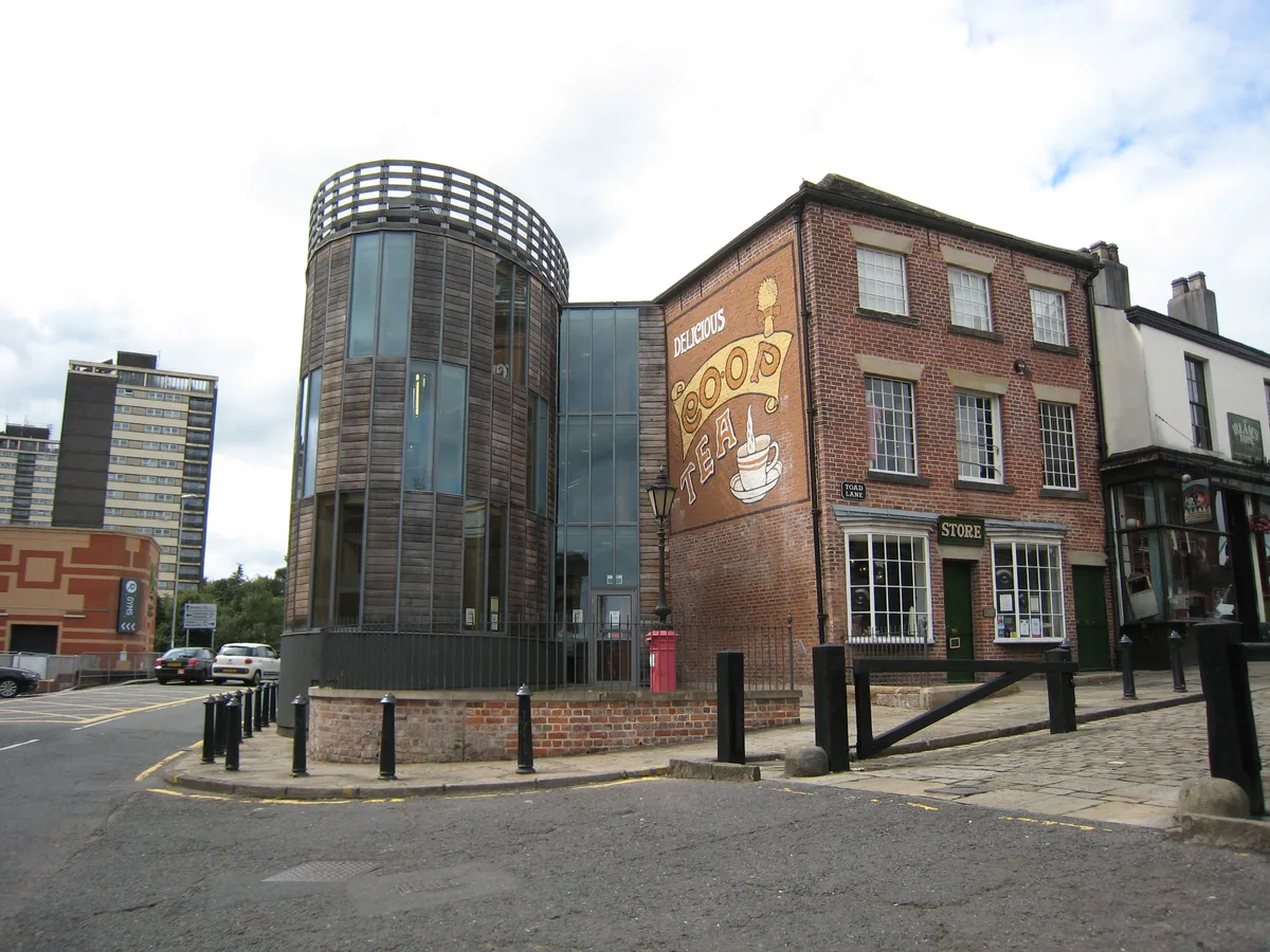
Rochdale Pioneers Museum
Galleries · 0.1 km

Reed Hotel
Historic pubs · 0.1 km

Co-op van
Public art & sculpture · 0.1 km

The Regal Moon
Theatres · 0.2 km

Reel Cinema Rochdale
Cinemas · 0.2 km

Circus and Hippodrome
Theatres · 0.2 km

Rochdale Bridge
Historic bridges · 0.2 km

Metropolitan Borough of Rochdale
Castles · 0.3 km

Rochdale War Memorial
Memorials & monuments · 0.3 km

Hope Chapel And Parsons House Parson's House
Chapels · 0.3 km

Empire Music Hall
Theatres · 0.3 km
Nearby
📷 7Historic pubs · North West England
The Baum
The Baum in England North West, United Kingdom.
📷 5Galleries · North West England
Rochdale Pioneers Museum
Rochdale Pioneers Museum — collection (museum), Heritage centre in Toad Lane, Rochdale.
📷 5📷 3Public art & sculpture · North West England
Co-op van
Co-op van — a public art in england-north-west, United Kingdom.
📷 3Theatres · North West England
The Regal Moon
The Regal Moon in England North West, United Kingdom.
📷 5Cinemas · North West England
Reel Cinema Rochdale
Reel Cinema Rochdale — a cinema in england north west.
Where to eat & stay near Church of St Mary in the Baum, Rochdale
Places to stay
 📷 5
📷 5Hotels · North West England
Broadfield Park Hotel
Broadfield Park Hotel — a hotel in england north west.
 📷 5
📷 5Caravan parks · North West England
Roch Vale Caravan Park
Roch Vale Caravan Park — a caravan park in england north west.
 📷 5
📷 5Hotels · North West England
Norton Grange Hotel
Norton Grange Hotel — a hotel in england north west.
 📷 5
📷 5Caravan parks · North West England
Gelder Clough
Gelder Clough — a caravan park in england north west.
 📷 5
📷 5Caravan parks · North West England
Hollingworth Lake Caravan park
Hollingworth Lake Caravan park — a caravan park in england north west.
 📷 5
📷 5Campsites · North West England
Ashworth Valley Scout Camp Site
Ashworth Valley Scout Camp Site — a campsite in england north west.
Places to eat & drink
📷 7Historic pubs · North West England
The Baum
The Baum in England North West, United Kingdom.
📷 5 📷 5
📷 5 📷 5
📷 5Historic pubs · North West England
Ye Olde Boars Head Public House
Ye Olde Boars Head Public House in England North West, United Kingdom.
 📷 7
📷 7 📷 5
📷 5More places in this region
 📷 3
📷 3Historic churches · North West England
All Saints Chapel, Somerford
All Saints Chapel, Somerford — church in Cheshire East, Cheshire, England, UK.
 📷 3
📷 3Historic churches · North West England
All Saints Church, Church Lawton
All Saints Church, Church Lawton — Grade II* listed church in Church Lawton, Cheshire East, Cheshire, England, UK.
 📷 3
📷 3Historic churches · North West England
All Saints Church, Scholar Green
All Saints Church, Scholar Green — church in Cheshire East, Cheshire, England, UK.
 📷 3
📷 3Historic churches · North West England
All Saints Church, Siddington
All Saints Church, Siddington — church in Cheshire East, Cheshire, England, UK.
Frequently asked questions
- Where is Church of St Mary in the Baum, Rochdale?
- Church of St Mary in the Baum, Rochdale is in North-West England, United Kingdom (postcode OL16 1AP), in the parish of Rochdale, unparished area.
- What is Church of St Mary in the Baum, Rochdale?
- The Church of St Mary in the Baum or Church of St Mary-in-the-Baum is a church in the town of Rochdale, Greater Manchester, England. Commissioned in 1738, and opened in 1742 as a chapel of ease, the c
- How do I get to Church of St Mary in the Baum, Rochdale?
- The nearest railway station is Rochdale, about 1.0 km away. Drivers can use postcode OL16 1AP.
- When was Church of St Mary in the Baum, Rochdale built?
- Built or established in 1909.
- Is Church of St Mary in the Baum, Rochdale a protected site?
- Yes — Church of St Mary in the Baum, Rochdale is part of the Rochdale Canal SSSI Site of Special Scientific Interest and the South Pennine Moors SSSI Site of Special Scientific Interest.
- Is Church of St Mary in the Baum, Rochdale free to visit?
- Yes, Church of St Mary in the Baum, Rochdale is free to enter.
- How do I get to Church of St Mary in the Baum, Rochdale?
- The nearest railway station is Rochdale, about 1.0 km away. Drivers can navigate to postcode OL16 1AP.