
Historic churches · South East England
Church of St Mary, Adderbury
In or near Adderbury.
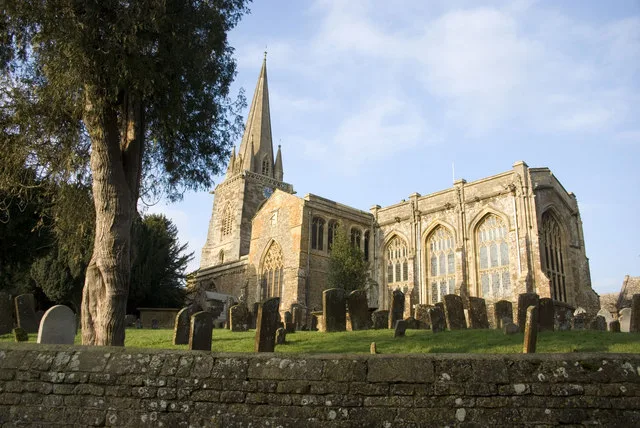
Church of St Mary, Adderbury — a Grade I-listed church in england-west-midlands, United Kingdom.

nick macneill — CC BY-SA 2.0 via Wikimedia Commons licence

Plan your visit
- Typical visit
- 30 min–1 h
- Nearest railway station
- King's Sutton · 2.4 km
- Free entry
Getting there & planning your visit
To visit the Church of St Mary in Adderbury, the nearest railway station is King's Sutton, located 2.4 km away. Entry to the church is free, and the postcode for sat-nav is OX17 3LP.
About
Church of St Mary, Adderbury is a Grade I-listed building in england-west-midlands, United Kingdom. Grade I status is conferred by Historic England (or Cadw, Historic Environment Scotland or NIEA equivalents) on buildings of exceptional national interest. See the linked Wikipedia article for full historical and architectural details.
Photo gallery
Heritage listing
The Parish Church of Saint Mary the Virgin, Adderbury (also referred to as St Mary's Church) is a Church of England parish church in the village of Adderbury, Oxfordshire, England. It is a Grade I listed building.
From the Historic England List Entry under OGL v3.
From the Wikipedia article
The Parish Church of Saint Mary the Virgin, Adderbury (also referred to as St Mary's Church) is a Church of England parish church in the village of Adderbury, Oxfordshire, England. It is a Grade I listed building.
Excerpt from Wikipedia under CC BY-SA 4.0. See the source article linked in Sources below.
Background
History
The church was likely founded before the Norman Conquest, as the village was named after the 10th century St Eadburga, and the bishops of Winchester claimed in the 13th century that the village had been granted to them by Athelstan in 1014-15, though this cannot have happened as Athelstan was dead by then. In the Middle Ages, Adderbury served as the mother church to a wide area, including Milton, Bodicote and Barford St John, and was consequently rebuilt on a grand scale to be one of the largest churches in Oxfordshire. Its wealthy benefice caused a long-running dispute between the bishops, the crown and the papacy until in 1381 Bishop William of Wykeham settled the matter by granting it to…
Architecture
The church is a medieval cruciform stone building with a west tower and spire. The earliest parts are the 13th century transepts, with Geometrical traceried windows. The nave arcades are of a similar date, though altered later. The tower also has gargoyles at the top of each of its diagonal corner buttresses. In 1408-18, New College added a grand chancel and vestry, designed by Richard Winchcombe, who also designed the Divinity School at Oxford, as well as other works for New College. Unusually, the building records survive, showing that the work cost £399 5s 4d. The 148-foot-tall stone spire, though often dated to the 14th century, was also probably an addition of the 15th century, as can…
Sourced from Wikipedia under CC BY-SA 4.0.
- Coordinates
- 52.0148, -1.3153
- County
- Oxfordshire
- District
- Cherwell
- Parish
- Adderbury
- Postcode
- OX17 3LP
- Parliamentary constituency
- Banbury
- Established
- 1250
- Nearest railway station
- King's Sutton — 2.4 km
Sources
- wikidata: Q17528118 (CC0)
- wikipedia: St Mary's Church, Adderbury (CC BY-SA 4.0)
Other places nearby
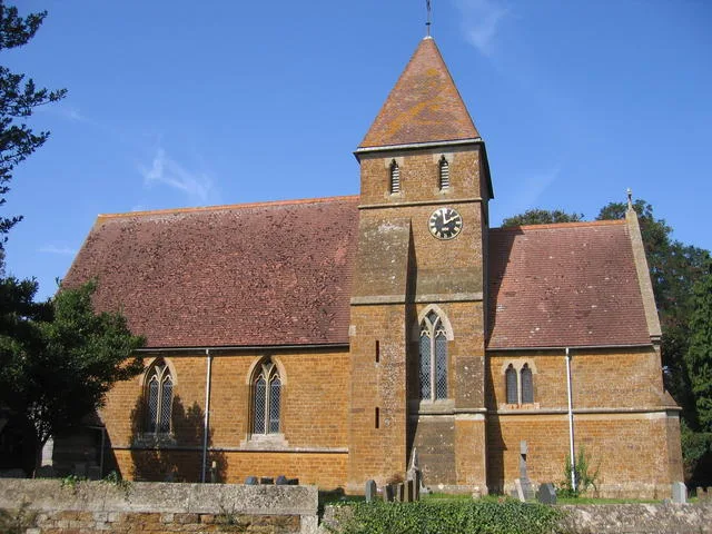
Adderbury
Towns & cities · 0.2 km

Duchess Bridge And Flanking Walls
Historic bridges · 0.4 km
_(geograph_2935627).jpg?width=1200)
Adderbury Lakes
Forests & woodlands · 0.7 km

Bo Peep Caravan Park
Caravan parks · 1.1 km

Bo Peep Caravan Park
Campsites · 1.1 km
Milton
Towns & cities · 2.0 km

Tilting Bridge Approximately 250 Metres South Of King's Sutton Lock Oxford Canal
Historic bridges · 2.1 km

Tilting Bridge Approximately 700 Metres South Of King's Sutton Lock Oxford Canal
Historic bridges · 2.2 km

Bridge At Kings Sutton Lock Oxford Canal
Historic bridges · 2.2 km

Tilting Bridge Approximately 1.1 Kilometres North Of Nell Bridge Lock (Not Included) Oxford Canal
Historic bridges · 2.2 km

Kings Sutton Lock Oxford Canal
Canal locks · 2.2 km

Twyford Road Canal Bridge Oxford Canal
Historic bridges · 2.2 km
Nearby
Flagship📷 3Towns & cities · South East England
Adderbury
Adderbury — village and civil parish in Cherwell district, Oxfordshire, England.
📷 3Historic bridges · South East England
Duchess Bridge And Flanking Walls
Duchess Bridge And Flanking Walls — Grade II listed building-listed bridge in england-west-midlands, United Kingdom.
📷 3Forests & woodlands · South East England
Adderbury Lakes
Adderbury Lakes is a forest or woodland in the United Kingdom.
📷 5Caravan parks · South East England
Bo Peep Caravan Park
Bo Peep Caravan Park — a caravan park in england west midlands.
📷 5Campsites · South East England
Bo Peep Caravan Park
Bo Peep Caravan Park — a campsite in england west midlands.
Flagship📷 3Towns & cities · South East England
Milton
Milton — village and civil parish in Cherwell district, Oxfordshire, England.
Where to eat & stay near Church of St Mary, Adderbury
Places to stay
📷 5Caravan parks · South East England
Bo Peep Caravan Park
Bo Peep Caravan Park — a caravan park in england west midlands.
📷 5Campsites · South East England
Bo Peep Caravan Park
Bo Peep Caravan Park — a campsite in england west midlands.
 📷 5
📷 5Campsites · South East England
The Pig Place
The Pig Place — a campsite in england west midlands.
 📷 5
📷 5Campsites · South East England
Cheyney Manor House Campsite
Cheyney Manor House Campsite — a campsite in england west midlands.
 📷 5
📷 5B&Bs · South East England
Easington House
Easington House — a bed-and-breakfast in england west midlands.
 📷 7
📷 7Hotels · South East England
Cartwright Hotel
Cartwright Hotel — a hotel in england west midlands.
Places to eat & drink
 📷 5
📷 5Historic pubs · South East England
Baker's Arms Public House
Baker's Arms Public House in England West Midlands, United Kingdom.
 📷 7
📷 7Historic pubs · South East England
Crown And Tuns Public House
Crown And Tuns Public House in England South East, United Kingdom.
 📷 5
📷 5Historic pubs · South East England
Elephant And Castle Public House
Elephant And Castle Public House in England West Midlands, United Kingdom.
 📷 7
📷 7Historic pubs · South East England
Duke Of Cumberlands Head Public House
Duke Of Cumberlands Head Public House in England South East, United Kingdom.
 📷 6
📷 6Historic pubs · South East England
The Jolly Weaver Public House
The Jolly Weaver Public House in England West Midlands, United Kingdom.
 📷 5
📷 5Historic pubs · South East England
Wheatsheaf Inn
Wheatsheaf Inn in England West Midlands, United Kingdom.
More places in this region
 📷 5
📷 5Historic churches · South East England
All Saints Church, Frindsbury
All Saints Church, Frindsbury — church in Medway, UK.
 📷 5
📷 5Historic churches · South East England
All Saints Church, Maidstone
All Saints Church, Maidstone — parish church associated with the Archbishop's Palace, Maidstone, Kent, England, UK.
 📷 5
📷 5Historic churches · South East England
All Saints Church, West Farleigh
All Saints Church, West Farleigh — Grade I listed church in West Farleigh, Maidstone, Kent, England, UK.
 📷 5
📷 5Historic churches · South East England
All Souls' Church, Sutton Green
All Souls' Church, Sutton Green — church in Guildford, England.
Frequently asked questions
- Where is Church of St Mary, Adderbury?
- Church of St Mary, Adderbury is in Oxfordshire, the West Midlands, United Kingdom (postcode OX17 3LP), in the parish of Adderbury.
- What is Church of St Mary, Adderbury?
- Church of St Mary, Adderbury — a Grade I-listed church in england-west-midlands, United Kingdom.
- How do I get to Church of St Mary, Adderbury?
- The nearest railway station is King's Sutton, about 2.4 km away. Drivers can use postcode OX17 3LP.
- When was Church of St Mary, Adderbury built?
- Built or established in 1250.
- Is Church of St Mary, Adderbury a listed building?
- Church of St Mary, Adderbury is officially recognised as Grade I listed.
- Is Church of St Mary, Adderbury free to visit?
- Yes, Church of St Mary, Adderbury is free to enter.
- How do I get to Church of St Mary, Adderbury?
- The nearest railway station is King's Sutton, about 2.4 km away. Drivers can navigate to postcode OX17 3LP.