
Historic churches · South Wales
Church of St Andrew, Banwell
In or near Winscombe.
Church of St Andrew, Banwell — church in Banwell, Somerset, England, UK.

Wikimedia Commons contributors — see linked file page for photographer and licence licence

Plan your visit
- Typical visit
- 30 min–1 h
- Nearest railway station
- Puxton Park · 3.8 km
- Free entry
- Family-friendly
Getting there & planning your visit
The Church of St Andrew in Banwell is located at postcode BS29 6EA. The nearest railway station is Puxton Park, which is 3.8 km away. Entry to the church is free.
About
Church of St Andrew, Banwell is a historic church in the United Kingdom. Records date its origin to 1450. Heritage designation: Grade I listed building. Affiliated with Anglicanism. Wikidata describes it as: "church in Banwell, Somerset, England, UK". Coordinates: 51.3281°, -2.8633°.
Photo gallery
Heritage listing
The mainly 15th-century parish Church of St Andrew in Banwell, Somerset, England, is a Grade I listed building. The body of the church has a nave with a clerestory, north and south aisles and a rather short chancel, considering the proportions of the rest of the church. The font dates from the 12th century and there is a carved stone pulpit from the 15th century and a carved rood screen built and set up in 1552, which escaped the Reformation. The 100 ft (30 m) high tower, which dates from around 1417, contains ten bells dates from the 18th to 20th century and the clock is dated 1884. Bells dating from 1734 and 1742 were made by Thomas Bilbie, of the Bilbie family. On the western face of the tower is a representation of the Annunciation.
From the Historic England List Entry under OGL v3.
Protected designations
- Site of Special Scientific Interest: Severn Estuary SSSI
- National Nature Reserve: MENDIP
- Area of Outstanding Natural Beauty: Mendip Hills
- Ramsar wetland: Severn Estuary
Designations sourced from Natural England open data under OGL v3.
From the Wikipedia article
The mainly 15th-century parish Church of St Andrew in Banwell, Somerset, England, is a Grade I listed building. The body of the church has a nave with a clerestory, north and south aisles and a rather short chancel, considering the proportions of the rest of the church. The font dates from the 12th century and there is a carved stone pulpit from the 15th century and a carved rood screen built and set up in 1552, which escaped the Reformation. The 100 ft (30 m) high tower, which dates from around 1417, contains ten bells dates from the 18th to 20th century and the clock is dated 1884. Bells dating from 1734 and 1742 were made by Thomas Bilbie, of the Bilbie family. On the western face of the tower is a representation of the Annunciation. In the Virgin Mary's niche there is a lily pot as a symbol of purity, and a lily leaf motif is also to be found in the font and pulpit. The churchyard contains the war grave of a Hampshire Regiment soldier of World War I.
Excerpt from Wikipedia under CC BY-SA 4.0. See the source article linked in Sources below.
- Coordinates
- 51.3281, -2.8633
- District
- North Somerset
- Parish
- Banwell
- Postcode
- BS29 6EA
- Parliamentary constituency
- Wells and Mendip Hills
- Established
- 1450
- Nearest railway station
- Puxton Park — 3.8 km
Sources
- wikidata: Q5117350 (CC0)
- wikipedia: St Andrew's Church, Banwell (CC BY-SA 4.0)
- commons: Banwellchurch.jpg (CC BY-SA 4.0)
Other places nearby

The Cart Wash
Natural landmarks · 0.1 km

Old Bell Inn
Historic pubs · 0.1 km
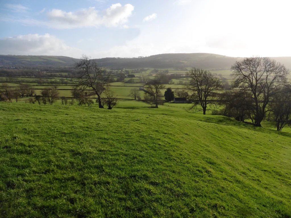
Roman settlement and associated industrial remains and field system north-east of Winthill Farm
Archaeological sites · 0.7 km

Banwell Ochre Caves
Caves · 0.8 km
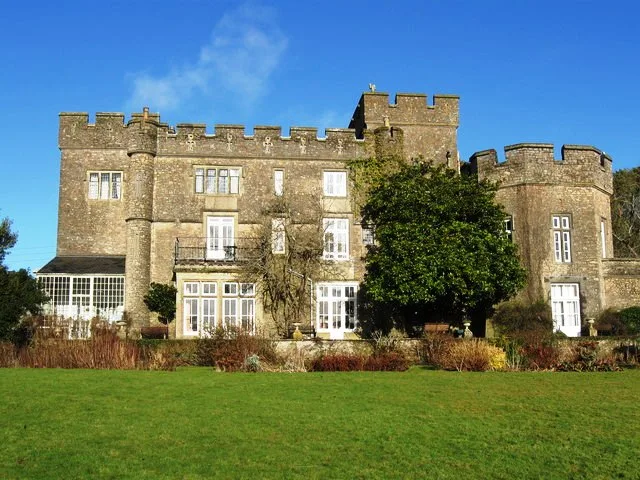
Banwell Castle
Castles · 0.8 km
Banwell Camp
Vineyards · 1.0 km

Banwell Plain
Mountains & hills · 1.0 km

Banwell Hill
Mountains & hills · 1.2 km

Stonebridge Farm Campsite
Campsites · 1.3 km

Standing stone 150m south-east of Yarberry Farm
Windmills · 1.6 km

Court Farm Country Park
Zoos & aquariums · 1.6 km

Summer Lane Parkhomes
Caravan parks · 1.7 km
Nearby
📷 3Natural landmarks · South Wales
The Cart Wash
The Cart Wash — a other in wales-south, United Kingdom.
📷 5📷 3Archaeological sites · South Wales
Roman settlement and associated industrial remains and field system north-east of Winthill Farm
Roman settlement and associated industrial remains and field system north-east of Winthill Farm — archaeological site in Banwell, North Somerset, England, UK.
📷 5Caves · South Wales
Banwell Ochre Caves
Banwell Ochre Caves — a cave broad in wales-south, United Kingdom.
📷 3Castles · South Wales
Banwell Castle
Banwell Castle — castle in Banwell, Somerset, England, UK.
📷 5Vineyards · South Wales
Banwell Camp
Banwell Camp — a UK vineyard in wales south, producing English or Welsh wine from cool-climate grape varieties.
Where to eat & stay near Church of St Andrew, Banwell
Places to stay
📷 4Campsites · South Wales
Stonebridge Farm Campsite
Stonebridge Farm Campsite — a campsite in wales south.
📷 5Caravan parks · South Wales
Summer Lane Parkhomes
Summer Lane Parkhomes — a caravan park in wales south.
 📷 5
📷 5Caravan parks · South Wales
Myrtle Farm Touring Park
Myrtle Farm Touring Park — a caravan park in wales south.
 📷 5
📷 5 📷 5
📷 5Campsites · South Wales
Netherdale Caravan & Camping Site
Netherdale Caravan & Camping Site — a campsite in wales south.
 📷 3
📷 3Caravan parks · South Wales
West End Farm Caravan Park
West End Farm Caravan Park — a caravan park in wales south.
Places to eat & drink
📷 5 📷 5
📷 5 📷 5
📷 5Restaurants · South Wales
Muffins Tea Room & Brasserie
Muffins Tea Room & Brasserie — a restaurant in wales south.
 📷 5
📷 5Restaurants · South Wales
The Pavilion
The Pavilion — a restaurant in wales south.
 📷 7
📷 7 📷 5
📷 5Other places from this era
 📷 5
📷 5Historic churches · London
All Hallows Staining
All Hallows Staining — church in City of London, UK.
 📷 5
📷 5Historic churches · London
All Hallows' Church, Tottenham
All Hallows' Church, Tottenham — church in Tottenham, London.
 📷 5
📷 5Historic churches · London
All Saints Church, Kingston upon Thames
All Saints Church, Kingston upon Thames — church in Kingston upon Thames, London.
 📷 5
📷 5Historic churches · London
All Saints' Church, Edmonton
All Saints' Church, Edmonton — church in Edmonton, London.
More places in this region
 📷 3
📷 3Historic churches · South Wales
All Saints Church, Wraxall
All Saints Church, Wraxall — church in Wraxall, North Somerset, England, UK.
 📷 4
📷 4Historic churches · South Wales
All Saints' Church
All Saints' Church — church in Oystermouth, Swansea, Wales.
 📷 3
📷 3Historic churches · South Wales
Bethania Presbyterian Church
Bethania Presbyterian Church — Calvinistic Methodist chapel in Aberdare.
 📷 3
📷 3Historic churches · South Wales
Bethel, Abernant
Bethel, Abernant — church in Rhondda Cynon Taf, UK.
Frequently asked questions
- Where is Church of St Andrew, Banwell?
- Church of St Andrew, Banwell is in South Wales, United Kingdom (postcode BS29 6EA), in the parish of Banwell.
- What is Church of St Andrew, Banwell?
- Church of St Andrew, Banwell — church in Banwell, Somerset, England, UK.
- How do I get to Church of St Andrew, Banwell?
- The nearest railway station is Puxton Park, about 3.8 km away. The nearest town is Winscombe. Drivers can use postcode BS29 6EA.
- When was Church of St Andrew, Banwell built?
- Built or established in 1450.
- Is Church of St Andrew, Banwell a listed building?
- Church of St Andrew, Banwell is officially recognised as Grade I listed building listed.
- Is Church of St Andrew, Banwell a protected site?
- Yes — Church of St Andrew, Banwell is part of the Severn Estuary SSSI Site of Special Scientific Interest and the MENDIP National Nature Reserve.
- Is Church of St Andrew, Banwell free to visit?
- Yes, Church of St Andrew, Banwell is free to enter.
- How do I get to Church of St Andrew, Banwell?
- The nearest railway station is Puxton Park, about 3.8 km away. Drivers can navigate to postcode BS29 6EA.