
Historic churches · South West England
Church of Saint Germoe
In or near St Hilary.
Church of Saint Germoe — Grade I listed building-listed church in england-south-west, United Kingdom.

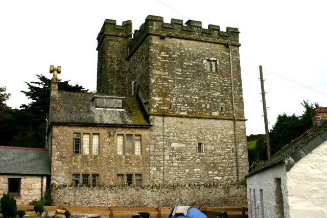
Adrian Dust — CC BY-SA 2.0 via Wikimedia Commons licence

Plan your visit
- Typical visit
- 30 min–1 h
- Nearest railway station
- Prospidnick Halt · 6.2 km
- Free entry
Getting there & planning your visit
To visit the Church of Saint Germoe, the nearest railway station is Prospidnick Halt, located 6.2 km away. The postcode for sat-nav is TR20 9QX, and entry to the church is free.
About
Church of Saint Germoe is a Grade I listed building-listed church in england-south-west, United Kingdom, registered on the National Heritage List for England (NHLE entry 1142197). Listed status protects buildings and structures of special architectural or historic interest. See the linked Wikipedia article for further details.
Photo gallery
Heritage listing
Details SW 52 NE, 6/210 GERMOE, CHURCHTOWN, Germoe, Church of Saint Germoe 10.7.57 GV I Parish church. Possibly pre-Norman and C12 fonts, parts of south wall possibly C12, chancel, south transept and porch probably C13 or C14, remodelled and extended in the C15 with west tower north aisle and north transept. Some re-roofing in 1860, restored 1891. Granite ashlar tower, otherwise granite rubble with granite dressings for windows, doorways and copings. Scantle slate roofs with coped gable ends, Gothic style C19 bellcote over the rood position, large embattled stone lateral stack over the west wall of the north transept/vestry. PLAN: probably originally nave and chancel, becoming cruciform in the C13 or C14 with north and south transepts and a south porch. In the C15 the north wall and transept demolished and north aisle, north transept (vestry) and west tower added. Several periods of C19 repair including much re-roofing circa 1860 and a restoration of 1891 probably included new gable copings to the east, west and north gables and a new chancel east window. Roofs repaired and reslated circa 1950-1952. Complete C15 3-stage unbuttressed west tower with strings dividing diminishing stages; embattled parapet with crocketted corner pinnacles. Complex moulded 4- centred west doorway with square hoodmould with carved oak leaf label stops, 3-light traceried window over; blind second stage and 3-light traceried window with lowered or pierced slate lights to the upper stage. Under the parapet are two carved gargoyles to each side and the panelled pinnacles rise from carved angel corbels. North aisle: original C15 Perpendicular windows those to gable ends with tracery, each window within a 4-centred arch; all 3-light windows except the 4-light east window. North wall has one window
From the Historic England List Entry under OGL v3.
Protected designations
- Area of Outstanding Natural Beauty: Cornwall
Designations sourced from Natural England open data under OGL v3.
Place summary
The Church of Saint Germoe is a Grade I listed building located in South-West England. Its architectural significance and historical value contribute to its prominent status within the region.
AI-generated from the structured facts on this page (operator, designation, listing, era). Not a substitute for visiting.
- Coordinates
- 50.1157, -5.3789
- District
- Cornwall
- Parish
- Germoe
- Postcode
- TR20 9QX
- Parliamentary constituency
- St Ives
- Established
- 1150
- Nearest railway station
- Prospidnick Halt — 6.2 km
Sources
- wikidata: Q17529220 (CC0)
Other places nearby
Germoe
Castles · 0.1 km

Wheal Grey
Historic houses · 1.0 km
Pengersick Castle
Stately homes · 1.1 km

Balwest
Historic churches · 1.1 km

Praa Sands Holiday Park
Caravan parks · 1.2 km

The Old Farm
Campsites · 1.3 km

Trem
Campsites · 1.4 km

Higher Pentreath
Campsites · 1.5 km

Pencaire
Archaeological sites · 1.5 km
Germoe War Memorial
Memorials & monuments · 1.5 km
War Memorial near Castle Pencair Fort
Memorials & monuments · 1.5 km

RAAF Sunderland Flying Boat
Memorials & monuments · 1.5 km
Nearby
📷 5Castles · South West England
Germoe
Germoe (Cornish: Germogh) is a village and civil parish in Cornwall, England, United Kingdom. Germoe village, the parish's main settlement and church town, is about five miles (8.0 km) west of Helston
📷 3Historic houses · South West England
Wheal Grey
Wheal Grey — a historic house in england-south-west, United Kingdom.
📷 5Stately homes · South West England
Pengersick Castle
Pengersick Castle — Grade I listed manor house in Breage, United Kingdom.
📷 5Historic churches · South West England
Balwest
Balwest (Cornish: Bal West, meaning Western mine) is a hamlet in the civil parish of Germoe in west Cornwall, England, in the United Kingdom. The hamlet is on the southern edge of a former mining area
📷 5Caravan parks · South West England
Praa Sands Holiday Park
Praa Sands Holiday Park — a caravan park in england south west.
📷 5Where to eat & stay near Church of Saint Germoe
Places to stay
📷 5Caravan parks · South West England
Praa Sands Holiday Park
Praa Sands Holiday Park — a caravan park in england south west.
📷 5📷 5📷 5Campsites · South West England
Higher Pentreath
Higher Pentreath — a campsite in england south west.
 📷 5
📷 5Campsites · South West England
Keneggy Cove Holiday Park
Keneggy Cove Holiday Park — a campsite in england south west.
 📷 3
📷 3Campsites · South West England
Dropped Anchor Camping Site
Dropped Anchor Camping Site — a campsite in england south west.
Places to eat & drink
 📷 5
📷 5 📷 5
📷 5Historic pubs · South West England
Fitzsimmons Arms Public House
Fitzsimmons Arms Public House in England South West, United Kingdom.
 📷 7
📷 7Historic pubs · South West England
The Pendarves Arms
The Pendarves Arms in England South West, United Kingdom.
 📷 5
📷 5Historic pubs · South West England
The Bucket of Blood
The Bucket of Blood in England South West, United Kingdom.
 📷 7
📷 7Restaurants · South West England
The Old Lifeboat House Bistro
The Old Lifeboat House Bistro — a restaurant in england south west. Cuisine: seafood.
 📷 5
📷 5Historic pubs · South West England
First And Last Inn
First And Last Inn in England South West, United Kingdom.
More places in this region
 📷 5
📷 5Historic churches · South West England
Abbey Church of St Gregory the Great, Downside Abbey
Abbey Church of St Gregory the Great, Downside Abbey — church in Stratton-on-the-Fosse, Somerset, England, UK.
 📷 5
📷 5Historic churches · South West England
All Saints Church
All Saints Church — Grade I listed church in Woolley, Somerset, England, UK.
 📷 5
📷 5Historic churches · South West England
All Saints Church, Hampreston
All Saints Church, Hampreston — church in Hampreston, Dorset, England, UK.
 📷 5
📷 5Historic churches · South West England
All Saints Church, Nether Cerne
All Saints Church, Nether Cerne — church in Nether Cerne, Dorset, England, UK.
Frequently asked questions
- Where is Church of Saint Germoe?
- Church of Saint Germoe is in South-West England, United Kingdom (postcode TR20 9QX), in the parish of Germoe.
- What is Church of Saint Germoe?
- Church of Saint Germoe — Grade I listed building-listed church in england-south-west, United Kingdom.
- How do I get to Church of Saint Germoe?
- The nearest railway station is Prospidnick Halt, about 6.2 km away. Drivers can use postcode TR20 9QX.
- When was Church of Saint Germoe built?
- Built or established in 1150.
- Is Church of Saint Germoe a listed building?
- Church of Saint Germoe is officially recognised as Grade I listed building listed.
- Is Church of Saint Germoe a protected site?
- Yes — Church of Saint Germoe is part of the Cornwall National Landscape (AONB).
- Is Church of Saint Germoe free to visit?
- Yes, Church of Saint Germoe is free to enter.
- How do I get to Church of Saint Germoe?
- The nearest railway station is Prospidnick Halt, about 6.2 km away. Drivers can navigate to postcode TR20 9QX.