
Forts · North East England
Castra Vindolanda
In or near Bardon Mill.
Castra Vindolanda — Historic fort, dating to 4C.

Wikimedia Commons contributors — see linked file page for photographer and licence licence

Plan your visit
- Typical visit
- 45 min–1.5 h
- Nearest railway station
- Bardon Mill · 2.1 km
- Free entry
Getting there & planning your visit
To visit Castra Vindolanda, the nearest railway station is Bardon Mill, located 2.1 km away. The postcode for sat-nav is NE47 7JN. Entry details are not provided, so please check in advance for accessibility information.
About
Castra Vindolanda is a historic fort or fortified site in the United Kingdom. Records date its origin to AD 85. Wikidata describes it as: "Historic fort, dating to 4C.". Coordinates: 54.9914°, -2.3603°.
Photo gallery
Official information
Vindolanda is a significant archaeological site featuring the remains of a Roman fort and museum. Visitors can explore the site, learn about Roman history, and see various artifacts, including the famous writing tablets.
Protected designations
- Site of Special Scientific Interest: River Eden and Tributaries SSSI
- Site of Special Scientific Interest: Roman Wall Escarpments SSSI
Designations sourced from Natural England open data under OGL v3.
From the Wikipedia article
Vindolanda was a Roman auxiliary fort (castrum) just south of Hadrian's Wall in northern England, which it pre-dated. Archaeological excavations of the site show it was under Roman occupation from roughly 85 AD to 370 AD. Located near the modern village of Bardon Mill in Northumberland, it guarded the Stanegate, the Roman road from the River Tyne to the Solway Firth. It is noted for the Vindolanda tablets, a set of wooden leaf-tablets that were, at the time of their discovery, the oldest surviving handwritten documents in Britain.
Excerpt from Wikipedia under CC BY-SA 4.0. See the source article linked in Sources below.
Background
History
The site is a hill on the Stanegate road, with steep slopes on the north, east, and south sides. It originally had a deep dip running north-south through the centre of the hill, which was gradually filled up by successive layers of occupation. There is currently no evidence for settlement on the fortress site before the Roman period, but there was an iron-age hillfort at , 1.3 km to the northeast (which served as a quarry and signal station in the Roman period). Two pre-Roman farmsteads have been found in the area and two standing stones called the Mare and Foal, about 5 km to the west, are the remnants of a stone circle, which might have been the local religious centre. The name…
Architecture
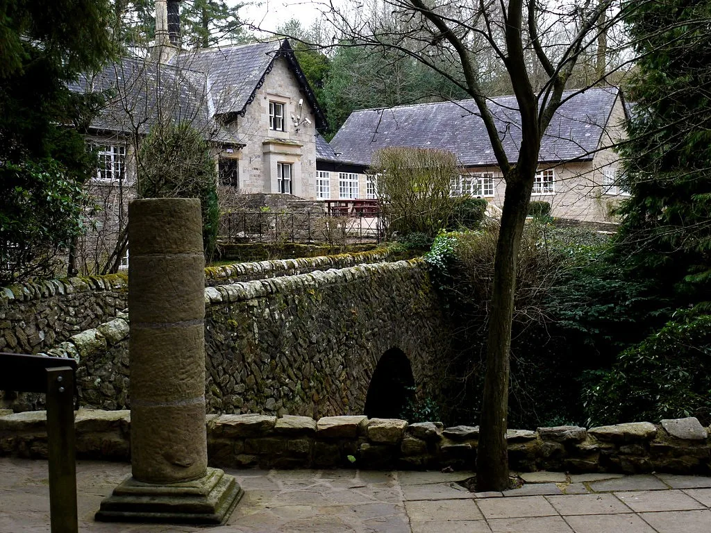
The Vindolanda site museum, also known as Chesterholm Museum, conserves and displays finds from the site. The museum is set in gardens, which include full-sized reconstructions of a Roman temple, a Roman shop, a Roman house and Northumbrian croft, all with audio presentations. Exhibits include Roman boots, shoes, armour, jewellery and coins, infrared photographs of the writing tablets and, from 2011, a small selection of the tablets themselves, on loan from the British Museum. 2011 saw the reopening of the museum at Vindolanda, and also the Roman Army Museum at Magnae Carvetiorum (Carvoran), refurbished with a grant from the Heritage Lottery Fund. A full-size replica of two sections of…
Description
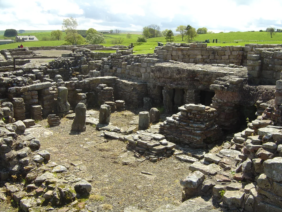
The site consists of a series of fortresses built one on top of the other, which have been divided by archaeologists into nine periods. The first five periods are successive forts built of wood and turf with different footprints (Periods I–V). They are buried as much as 4 m deep in the anoxic waterlogged soil and are covered by the remains of later periods, which makes excavation difficult, but has also led to the preservation of large amounts of organic matter. The fifth fort was converted to stone in period VIa, replaced with a new stone fort (the Severan complex) in Period VIb, and replaced with a second stone fort (Periods VII-IX), which accounts for most of the remains visible on the…
Sourced from Wikipedia under CC BY-SA 4.0.
- Coordinates
- 54.9914, -2.3603
- District
- Northumberland
- Parish
- Bardon Mill
- Postcode
- NE47 7JN
- Parliamentary constituency
- Hexham
- Phone
- 01434 344 277
- Nearest railway station
- Bardon Mill — 2.1 km
- Official site
- www.vindolanda.com
Sources
- osm: n10089459650 (ODbL)
- wikipedia: Vindolanda (CC BY-SA 4.0)
- commons: Vindolanda bathhouse - 2007-05-19.jpg (CC BY-SA 4.0)
Other places nearby

Granary & Stores
Historic houses · 0.0 km
Vindolanda
Hill forts · 0.1 km

dolichenum at Vindolanda
Follies · 0.1 km

Vindolanda Fort
Forts · 0.1 km

Spring
Historic houses · 0.2 km
Chesterholm Museum - Vindolanda
Science centres · 0.2 km

Vindolanda Museum
Museums · 0.2 km

Workshops
Historic houses · 0.2 km

Water tank
Historic houses · 0.2 km
Roman temple tomb 2 at Vindolanda
Follies · 0.2 km
Roman temple tomb 1 at Vindolanda
Follies · 0.2 km

Long Stone
Archaeological sites · 0.8 km
Nearby
📷 3Historic houses · North East England
Granary & Stores
Granary & Stores — a historic house in scotland-lowlands, United Kingdom.
📷 5Hill forts · North East England
Vindolanda
Vindolanda — Roman fort and archaeological site on Stanegate, England.
📷 5Follies · North East England
dolichenum at Vindolanda
dolichenum at Vindolanda — a temple folly in scotland-lowlands, United Kingdom.
📷 3Forts · North East England
Vindolanda Fort
Vindolanda Fort — a other in scotland-lowlands, United Kingdom.
📷 3Historic houses · North East England
Spring
Spring — a historic house in scotland-lowlands, United Kingdom.
📷 3Science centres · North East England
Chesterholm Museum - Vindolanda
Chesterholm Museum - Vindolanda — museum at Vindolanda Roman Fort, Northumberland, England, UK.
Where to eat & stay near Castra Vindolanda
Places to stay
 📷 5
📷 5 📷 5
📷 5Campsites · North East England
Winshields Farm Campsite
Winshields Farm Campsite — a campsite in scotland lowlands.
 📷 5
📷 5Campsites · North East England
Hadrian's Wall Campsite
Hadrian's Wall Campsite — a campsite in scotland lowlands.
 📷 5
📷 5Caravan parks · North East England
Seldom Seen Caravan Park
Seldom Seen Caravan Park — a caravan park in scotland lowlands.
 📷 5
📷 5B&Bs · North East England
Old Repeater Station
Old Repeater Station — a bed-and-breakfast in scotland lowlands.
 📷 5
📷 5Caravan parks · North East England
Herding Hill Farm Camping
Herding Hill Farm Camping — a caravan park in scotland lowlands.
Places to eat & drink
 📷 7
📷 7Historic pubs · North East England
Anchor Hotel
Anchor Hotel in Scotland Lowlands, United Kingdom.
 📷 5
📷 5 📷 5
📷 5 📷 6
📷 6 📷 4
📷 4 📷 4
📷 4Historic pubs · North West England
Hallbankgate
Hallbankgate in England North East, United Kingdom.
More forts in this region
 📷 4
📷 4 📷 4
📷 4 📷 4
📷 4Forts · North East England
Richmond Barracks, North Yorkshire
Richmond Barracks, North Yorkshire in England North East, United Kingdom.
 📷 3
📷 3Forts · North East England
Albemarle Barracks, England
Albemarle Barracks, England in England North East, United Kingdom.
Frequently asked questions
- Where is Castra Vindolanda?
- Castra Vindolanda is in the Scottish Lowlands, United Kingdom (postcode NE47 7JN), in the parish of Bardon Mill.
- What is Castra Vindolanda?
- Castra Vindolanda — Historic fort, dating to 4C.
- How do I get to Castra Vindolanda?
- The nearest railway station is Bardon Mill, about 2.1 km away. Drivers can use postcode NE47 7JN.
- When was Castra Vindolanda built?
- Dates from the Roman period.
- Is Castra Vindolanda a protected site?
- Yes — Castra Vindolanda is part of the River Eden and Tributaries SSSI Site of Special Scientific Interest and the Roman Wall Escarpments SSSI Site of Special Scientific Interest.
- How do I get to Castra Vindolanda?
- The nearest railway station is Bardon Mill, about 2.1 km away. Drivers can navigate to postcode NE47 7JN.