
Natural landmarks · Scottish Lowlands
Carse Loch
In or near Ae.
Carse Loch — lake in Dumfries and Galloway, Scotland, UK, outflows east to Mains Burn.

Wikimedia Commons licence
Plan your visit
- Typical visit
- 1 h–2 h
- Nearest railway station
- Dumfries · 10.0 km
- Free entry
- Dog-friendly
About
Carse Loch is a named natural landmark in the United Kingdom. Wikidata describes it as: "lake in Dumfries and Galloway, Scotland, UK, outflows east to Mains Burn". Coordinates: 55.1447°, -3.6974°.
Photo gallery
From the Wikipedia article
Carse Loch is situated (NX 926 849) in a low-lying area, surrounded by woodland, close to the A76 at Friar's Carse, in Dumfries and Galloway, Parish of Dunscore. It was once used as a monastic fish pond and the friars are said to have hidden their treasures on the crannog in times of danger. The loch is located about 7 miles from Dumfries and 2 miles from Auldgirth.
Excerpt from Wikipedia under CC BY-SA 4.0. See the source article linked in Sources below.
Background
History
In 1465 a charter was granted by Cardinal Antonius of Rome for the Cistercian order of monks from Melrose to build a monastery on the site of the old British fort and druidical circle at Friar's Carse. Only a monastic farm or grange may have actually been established at the site of the present day hotel of Friars Carse rather than a friary The loch was once used as a fish pond by the friars of the monastic grange. William Crawford's map of 1804 shows a Grange Mill and Grange Loch with a single island. Roy's map of 1747 shows a 'Grange Loch' with a mill nearby and a single island. The 1855 OS map shows a substantial loch with a single island and the nearby Carse Mill corn mill with a lade…
Description
A small island in a loch near Friars' Carse was identified as a being the remains of a lake dwelling or crannog, and in 1878 was measured as being circa 80 ft by 70 ft. Some of the timbers were morticed and bore traces of clay flooring and central paving. Medieval pottery was found and additionally a dug-out canoe or logboat with a paddle, carrying an inserted sternboard, was found in the mud near the crannog As stated, the friars are said to have hidden their treasures on the crannog with its pillar or piles during times of war, raids from England, etc. The nearby Debatable lands were also frequently in turmoil. An axe hammer was found on the old crannog that was located in the loch. Carse…
Sourced from Wikipedia under CC BY-SA 4.0.
- Coordinates
- 55.1447, -3.6974
- District
- Dumfries and Galloway
- Postcode
- DG2 0SA
- Parliamentary constituency
- Dumfriesshire, Clydesdale and Tweeddale
- Nearest railway station
- Dumfries — 10 km
Sources
- wikidata: Q5046860 (CC0)
- wikipedia: Carse Loch (CC BY-SA 4.0)
Other places nearby

Temple Wood
Vineyards · 0.5 km

Friars Carse Country House Hotel
Hotels · 0.7 km
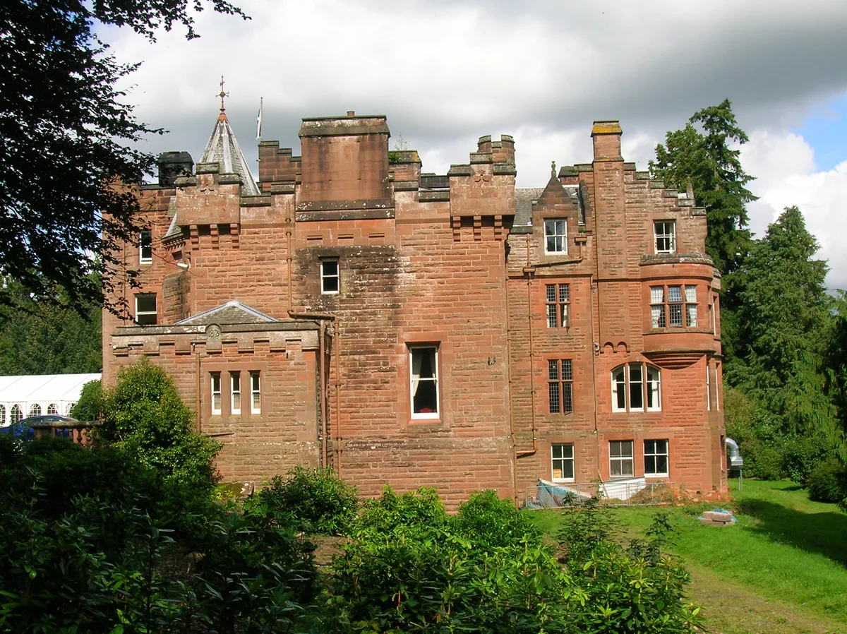
Friars Carse
Castles · 0.7 km
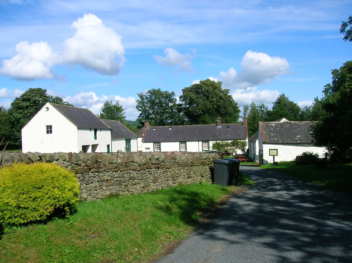
Ellisland Farm
Museums · 1.4 km

Belt Knowe
Mountains & hills · 1.5 km

Dunscore Old Kirk
Historic churches · 1.6 km

The Belt
Vineyards · 1.7 km

Lagg’s Tomb
Vineyards · 1.8 km

Auldgirth Bridge
Historic bridges · 1.8 km

Auldgirth Inn
Historic pubs · 2.0 km

Dalswinton
Castles · 2.0 km

Dalswinton Church
Historic churches · 2.3 km
Nearby
📷 5Vineyards · Scottish Lowlands
Temple Wood
Temple Wood — a UK vineyard in scotland lowlands, producing English or Welsh wine from cool-climate grape varieties.
📷 5Hotels · Scottish Lowlands
Friars Carse Country House Hotel
Friars Carse Country House Hotel — a hotel in scotland lowlands.
📷 5Castles · Scottish Lowlands
Friars Carse
Friars Carse — castle in Dumfries and Galloway, Scotland, UK.
📷 3Museums · Scottish Lowlands
Ellisland Farm
Ellisland Farm — museum in Dumfries and Galloway, Scotland, UK.
📷 5Mountains & hills · Scottish Lowlands
Belt Knowe
Belt Knowe — a hill or mountain in scotland lowlands.
📷 3Historic churches · Scottish Lowlands
Dunscore Old Kirk
Dunscore Old Kirk — church building in Dumfries and Galloway, Scotland, UK, now demolished.
Where to eat & stay near Carse Loch
Places to stay
📷 5Hotels · Scottish Lowlands
Friars Carse Country House Hotel
Friars Carse Country House Hotel — a hotel in scotland lowlands.
 📷 5
📷 5Campsites · Scottish Lowlands
Oakbank Farm Campsite
Oakbank Farm Campsite — a campsite in scotland lowlands.
 📷 5
📷 5Caravan parks · Scottish Lowlands
Partridge Cottage CAMC CL
Partridge Cottage CAMC CL — a caravan park in scotland lowlands.
 📷 3
📷 3Campsites · Scottish Lowlands
Barnsoul Caravan Park
Barnsoul Caravan Park — a campsite in scotland lowlands.
 📷 5
📷 5Caravan parks · Scottish Lowlands
Dumfries Caravan Park
Dumfries Caravan Park — a caravan park in scotland lowlands.
 📷 5
📷 5Caravan parks · Scottish Lowlands
Penpont Caravan Site
Penpont Caravan Site — a caravan park in scotland lowlands.
Places to eat & drink
📷 7 📷 5
📷 5Historic pubs · Scottish Lowlands
75 Friars Vennel, Dumfries
75 Friars Vennel, Dumfries in Scotland Lowlands, United Kingdom.
 📷 7
📷 7Historic pubs · Scottish Lowlands
Rob Roy Public House, 63-65 Queensberry Street, Dumfries
Rob Roy Public House, 63-65 Queensberry Street, Dumfries in Scotland Lowlands, United Kingdom.
 📷 5
📷 5Historic pubs · Scottish Lowlands
73-77 English Street, Dumfries
73-77 English Street, Dumfries in Scotland Lowlands, United Kingdom.
 📷 5
📷 5Historic pubs · Scottish Lowlands
The Globe Inn, 56 High Street, Dumfries
The Globe Inn, 56 High Street, Dumfries in Scotland Lowlands, United Kingdom.
 📷 5
📷 5Historic pubs · Scottish Lowlands
Queen O' The South Public House, 8-10 Nith Place, Dumfries
Queen O' The South Public House, 8-10 Nith Place, Dumfries in Scotland Lowlands, United Kingdom.
More natural landmarks in this region
 📷 5
📷 5Natural landmarks · Scottish Lowlands
Birkenside
Birkenside in England North East, United Kingdom.
 📷 4
📷 4Natural landmarks · Scottish Lowlands
River Teviot
River Teviot in England North East, United Kingdom.
 📷 5
📷 5Natural landmarks · Scottish Lowlands
River Leader
River Leader in England North East, United Kingdom.
 📷 4
📷 4Natural landmarks · Scottish Lowlands
Makerstoun
Makerstoun in England North East, United Kingdom.
Frequently asked questions
- Where is Carse Loch?
- Carse Loch is in the Scottish Lowlands, United Kingdom (postcode DG2 0SA).
- What is Carse Loch?
- Carse Loch — lake in Dumfries and Galloway, Scotland, UK, outflows east to Mains Burn.
- How do I get to Carse Loch?
- The nearest railway station is Dumfries, about 10.0 km away. Drivers can use postcode DG2 0SA.
- Is Carse Loch free to visit?
- Yes, Carse Loch is free to enter.
- How do I get to Carse Loch?
- Drivers can navigate to postcode DG2 0SA. It sits within the Dumfriesshire, Clydesdale and Tweeddale parliamentary constituency.