Mountains & hills · North East England
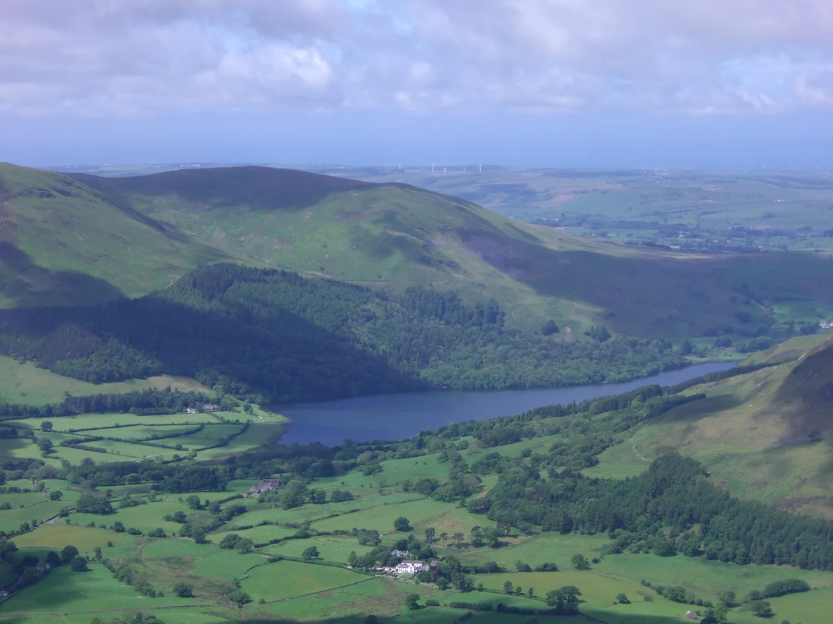
Carling Knott
Carling Knott — a hill or mountain in england north east.

Chris Holifield — CC BY-SA 2.0 via Wikimedia Commons licence
Plan your visit
- Typical visit
- 3 h–8 h
- Best time of year
- Late spring – early autumn (May–Oct)
About
A British hill or mountain, named on Ordnance Survey maps and walked by hill-baggers. Carling Knott is a named hill or mountain in england north east, recorded in the GeoNames UK gazetteer. British landmarks of this type are typically marked on Ordnance Survey maps and recorded in the national gazetteer for cartographic and navigational reference. Coordinates and feature classification are sourced from the GeoNames open dataset.
Photo gallery
Place summary
Carling Knott is a mountain located in North-East England. It offers expansive views of the surrounding landscape, making it a notable feature in the area. The mountain attracts walkers and outdoor enthusiasts seeking varied terrain and natural beauty. The region is characterised by its rugged charm and is suitable for various levels of hiking experience.
AI-generated from the structured facts on this page (operator, designation, listing, era). Not a substitute for visiting.
- Coordinates
- 54.5703, -3.3671
Sources
- manual: geonames-12616374 (CC BY 4.0)
Other places nearby
Loading nearby places…
Nearby
📷 5Mountains & hills · North East England
Carling Knott
Carling Knott — mountain in england north east. Elevation: 544 m.
 📷 3
📷 3Natural landmarks · North East England
Burnbank Fell
Burnbank Fell — mountain in United Kingdom.
 📷 5
📷 5Mountains & hills · North East England
Blake Fell
Blake Fell — Named summit at 572.6 m.
 📷 3
📷 3Mountains & hills · North East England
Burnbank Fell
Burnbank Fell — Named summit at 475 m.
 📷 5
📷 5Natural landmarks · North East England
Blake Fell
Blake Fell — mountain in United Kingdom.
 📷 5
📷 5Mountains & hills · North East England
Sharp Knott
Sharp Knott — mountain in england north east. Elevation: 482 m.
Where to eat & stay near Carling Knott
Places to stay
 📷 5
📷 5Hostels · North East England
Swallow Barn
Swallow Barn — a hostel in england north east.
 📷 5
📷 5Caravan parks · North East England
Inglenook Caravan Park
Inglenook Caravan Park — a caravan park in england north east.
 📷 5
📷 5Hostels · North East England
Scouts - Ennerdale Campsite
Scouts - Ennerdale Campsite — a hostel in england north east.
 📷 5
📷 5Caravan parks · Scottish Lowlands
Whinfell Caravan Park
Whinfell Caravan Park — a caravan park in scotland lowlands.
 📷 5
📷 5Campsites · Scottish Lowlands
Whinfell Hall Farm Campsite
Whinfell Hall Farm Campsite — a campsite in scotland lowlands.
 📷 5
📷 5Campsites · North East England
Syke Farm Campsite
Syke Farm Campsite — a campsite in england north east.
Places to eat & drink
 📷 5
📷 5Historic pubs · Scottish Lowlands
The Pheasant Inn
The Pheasant Inn in Scotland Lowlands, United Kingdom.
 📷 5
📷 5Cafés · North East England
Grange Bridge Cottage
Grange Bridge Cottage — a café in england north east.
 📷 5
📷 5Historic pubs · North West England
Fox and Grapes
Fox and Grapes in England North West, United Kingdom.
 📷 5
📷 5Cafés · Scottish Lowlands
YHA Cafe
YHA Cafe — a café in scotland lowlands.
 📷 5
📷 5Historic pubs · North West England
The Travellers Rest
The Travellers Rest in England North West, United Kingdom.
More mountains in this region
 📷 3
📷 3Mountains & hills · North East England
Angletarn Pikes
Angletarn Pikes — Named summit at 566 m.
 📷 3
📷 3Mountains & hills · North East England
Angletarn Pikes South Top
Angletarn Pikes South Top — Named summit at 563.6 m.
 📷 3
📷 3Mountains & hills · North East England
Ard Crags
Ard Crags — Named summit at 581 m.
 📷 3
📷 3Mountains & hills · North East England
Arnison Crag
Arnison Crag — Named summit at 433 m.
Frequently asked questions
- Where is Carling Knott?
- Carling Knott is in North-East England, United Kingdom.
- What is Carling Knott?
- Carling Knott — a hill or mountain in england north east.
- How do I get to Carling Knott?
- Its coordinates are 54.5703°, -3.3671°.