Mountains & hills · North East England
Blake Fell
Blake Fell — Named summit at 572.6 m.

Wikimedia Commons contributors — see linked file page for photographer and licence licence
Plan your visit
- Typical visit
- 3 h–8 h
- Best time of year
- Late spring – early autumn (May–Oct)
- Free entry
- Dog-friendly
About
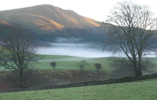
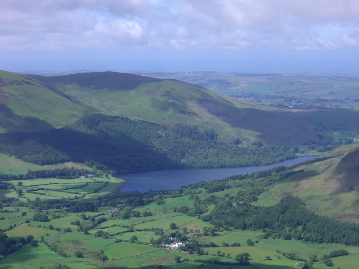
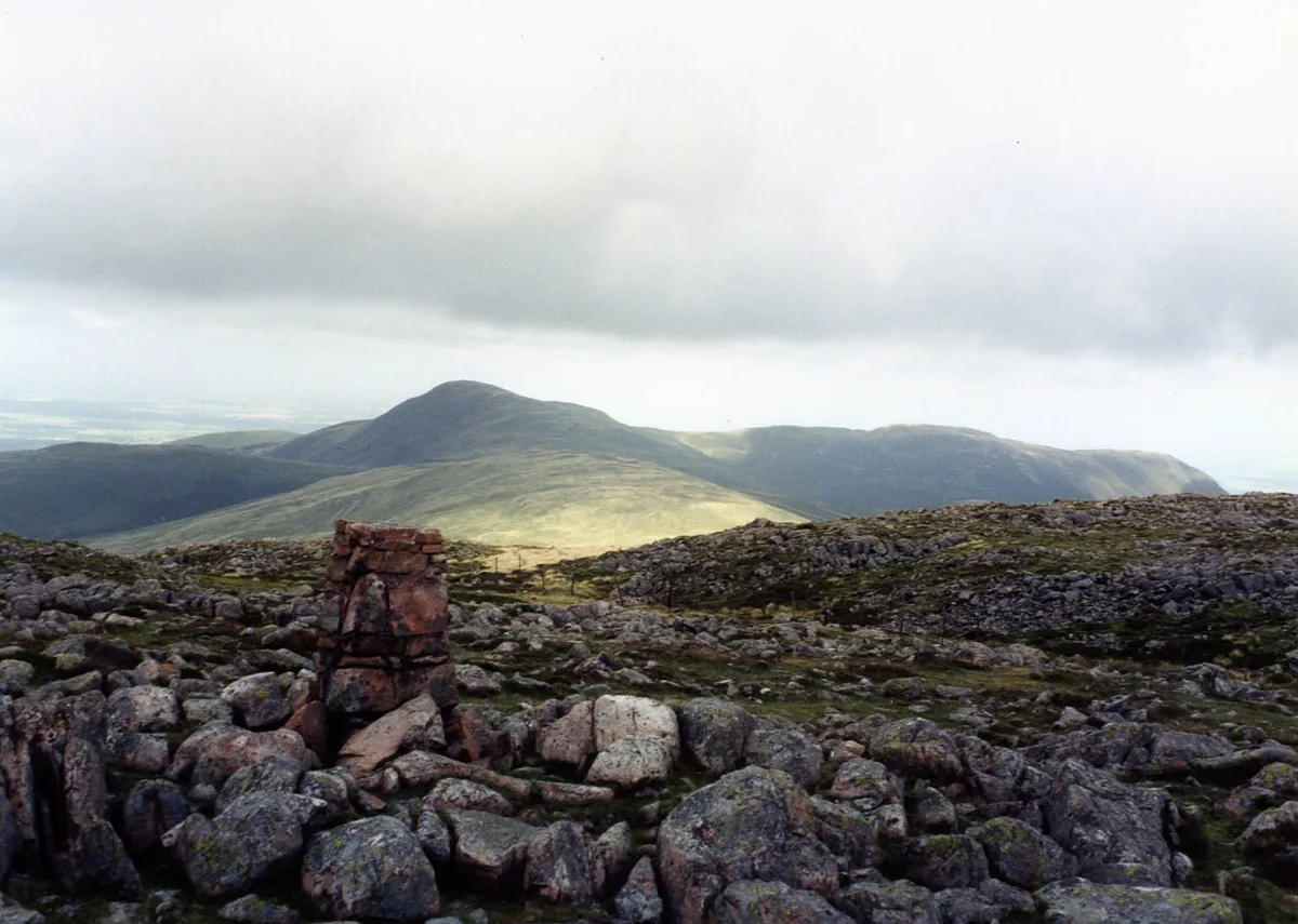
Blake Fell is a named summit in the United Kingdom. Wikidata describes it as: "Named summit at 572.6 m.". Coordinates: 54.5646°, -3.3772°.
Photo gallery
Protected designations
- Site of Special Scientific Interest: River Derwent and Tributaries SSSI
Designations sourced from Natural England open data under OGL v3.
From the Wikipedia article
Blake Fell is a hill in the Western part of the English Lake District. It is the highest point of the Loweswater Fells, an area of low grassy hills with steep sides overlooking the lake of Loweswater. The fell also overlooks the village of Loweswater, from which it can be climbed. An alternative route is from the Cogra Moss reservoir on its western slopes. Because the Loweswater Fells are a separate geographical unit, Blake Fell is a Marilyn. It is located in the Parish of Lamplugh.
Excerpt from Wikipedia under CC BY-SA 4.0. See the source article linked in Sources below.
- Coordinates
- 54.5646, -3.3772
- Address
- Cumbria, England
Sources
- osm: n4843793523 (ODbL)
- wikipedia: Blake Fell (CC BY-SA 4.0)
- commons: Blake Fell.jpg (CC BY-SA 4.0)
Other places nearby
Loading nearby places…
Nearby
 📷 5
📷 5Natural landmarks · North East England
Blake Fell
Blake Fell — mountain in United Kingdom.
 📷 3
📷 3Natural landmarks · North East England
Burnbank Fell
Burnbank Fell — mountain in United Kingdom.
 📷 3
📷 3Mountains & hills · North East England
Burnbank Fell
Burnbank Fell — Named summit at 475 m.
 📷 3
📷 3Mountains & hills · North East England
Gavel Fell (summit)
Gavel Fell (summit) — Named summit at 524.3 m.
 📷 3
📷 3Natural landmarks · North East England
Gavel Fell
Gavel Fell — mountain in United Kingdom.
 📷 5
📷 5Reservoirs & lochs · North East England
Cogra Moss
Cogra Moss — reservoir in Cumbria, England, UK.
More mountains in this region
 📷 3
📷 3Mountains & hills · North East England
Angletarn Pikes
Angletarn Pikes — Named summit at 566 m.
 📷 3
📷 3Mountains & hills · North East England
Angletarn Pikes South Top
Angletarn Pikes South Top — Named summit at 563.6 m.
 📷 3
📷 3Mountains & hills · North East England
Ard Crags
Ard Crags — Named summit at 581 m.
 📷 3
📷 3Mountains & hills · North East England
Arnison Crag
Arnison Crag — Named summit at 433 m.
Frequently asked questions
- Where is Blake Fell?
- Blake Fell is in North-East England, United Kingdom.
- Is Blake Fell a protected site?
- Yes — Blake Fell is part of the River Derwent and Tributaries SSSI Site of Special Scientific Interest.
- Is Blake Fell free to visit?
- Yes, Blake Fell is free to enter.