
Castles · South West England
Cannington Camp
In or near Otterhampton.
Cannington Camp — hillfort in Somerset, England, UK.

Wikimedia Commons licence
Plan your visit
- Typical visit
- 1.5 h–3 h
- Nearest railway station
- Bridgwater · 7.0 km
- Family-friendly
- Limited wheelchair access
Getting there & planning your visit
Cannington Camp is located in Somerset, with the nearest railway station being Bridgwater, approximately 7 km away. The postcode for sat-nav is TA5 2QF. Accessibility is limited for wheelchair users.
About
Cannington Camp is a castle in the United Kingdom — fortified architecture from the medieval, Tudor, or Victorian-revival period. Heritage designation: scheduled monument. Wikidata describes it as: "hillfort in Somerset, England, UK". Coordinates: 51.1586°, -3.0785°.
Photo gallery
Heritage listing
Cannington Camp is a Bronze Age and Iron Age hill fort near Cannington, Somerset, England. It is a Scheduled Ancient Monument. The small hill rises to 80 metres (260 ft) above low-lying land about 1.5 kilometres (0.93 mi) west of the tidal estuary of the River Parrett, near the ancient port and ford at Combwich. The hill fort is roughly square in shape, with a single rampart (univallate) enclosing 5 ha (12 acres), and the main entrance to the south-east. The north side of the hill has been destroyed by quarrying during the 19th and 20th centuries. Minor excavations were carried out in 1905, 1913 (Bezell), and 1963 (Rahtz). Flint tools, scrapers and flakes have been found on or near the hill, indicating Mesolithic occupation. Bronze Age finds include an axe head and a knife.
From the Historic England List Entry under OGL v3.
Protected designations
- National Nature Reserve: SOMERSET WETLANDS
- Area of Outstanding Natural Beauty: Quantock Hills
Designations sourced from Natural England open data under OGL v3.
From the Wikipedia article
Cannington Camp is a Bronze Age and Iron Age hill fort near Cannington, Somerset, England. It is a Scheduled Ancient Monument. The small hill rises to 80 metres (260 ft) above low-lying land about 1.5 kilometres (0.93 mi) west of the tidal estuary of the River Parrett, near the ancient port and ford at Combwich. The hill fort is roughly square in shape, with a single rampart (univallate) enclosing 5 ha (12 acres), and the main entrance to the south-east. The north side of the hill has been destroyed by quarrying during the 19th and 20th centuries. Minor excavations were carried out in 1905, 1913 (Bezell), and 1963 (Rahtz). Flint tools, scrapers and flakes have been found on or near the hill, indicating Mesolithic occupation. Bronze Age finds include an axe head and a knife. The area destroyed by quarrying was a late Roman and Saxon cemetery, with several hundred E-W (Christian) graves, and various grave goods such as coins and pottery from the period 350-800 AD. It is possibly the site of Cynwit Castle (or Cynuit, Cynwith, Cynwits, etc.) and the Battle of Cynwit between Saxons and Vikings in 878 AD (see map). It may also be the location of an earlier battle in 845 AD, when the Saxons were led by Eanwulf and Ealstan, Bishop of Sherborne.
Excerpt from Wikipedia under CC BY-SA 4.0. See the source article linked in Sources below.
Background
History
Hill forts developed in the Late Bronze and Early Iron Age, roughly the start of the first millennium BC. The reason for their emergence in Britain, and their purpose, has been a subject of debate. It has been argued that they could have been military sites constructed in response to invasion from continental Europe, sites built by invaders, or a military reaction to social tensions caused by an increasing population and consequent pressure on agriculture. The dominant view since the 1960s has been that the increasing use of iron led to social changes in Britain. Deposits of iron ore were located in different places from the tin and copper ore necessary to make bronze, and as a result…
Sourced from Wikipedia under CC BY-SA 4.0.
- Coordinates
- 51.1586, -3.0785
- District
- Somerset
- Parish
- Cannington
- Postcode
- TA5 2QF
- Parliamentary constituency
- Bridgwater
- Nearest railway station
- Bridgwater — 7 km
Sources
- wikidata: Q5032713 (CC0)
- wikipedia: Cannington Camp (CC BY-SA 4.0)
Other places nearby
Castle Hill
Mountains & hills · 0.0 km

Horn Hill
Mountains & hills · 0.1 km

Cannington War Memorial
Memorials & monuments · 1.3 km

The Walled Gardens of Cannington
Gardens · 1.4 km

Cannington Court
Historic houses · 1.4 km
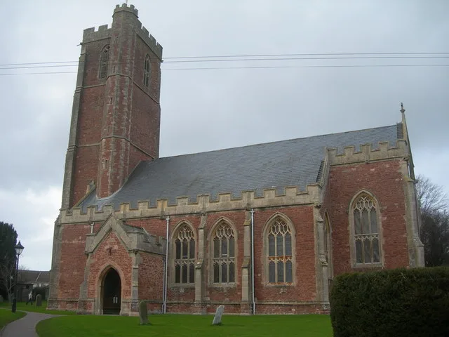
Church of St Mary, Cannington
Historic churches · 1.5 km

Road Bridge Over River At Ngr St 2548 4177
Historic bridges · 1.5 km

Memorial Globe
Public art & sculpture · 1.7 km
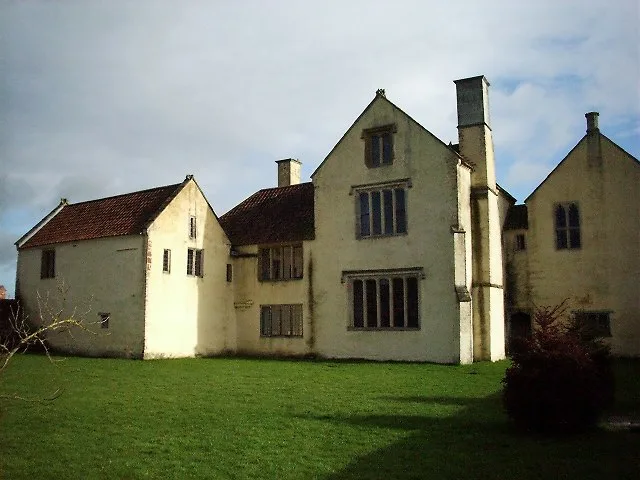
Gurney Manor
Stately homes · 1.9 km

Blackmoor Farmhouse, Cannington
Farms (open to visitors) · 1.9 km

Combwich Buoy
Memorials & monuments · 2.3 km
John Biffen
Memorials & monuments · 2.3 km
Nearby
📷 5Mountains & hills · South West England
Horn Hill
Horn Hill — a hill or mountain in england south west.
📷 3Memorials & monuments · South West England
Cannington War Memorial
Cannington War Memorial — Grade II listed building-listed memorial in england-south-west, United Kingdom.
📷 3Gardens · South West England
The Walled Gardens of Cannington
The Walled Gardens of Cannington — a garden in South West England, United Kingdom.
📷 4Historic houses · South West England
Cannington Court
Cannington Court — a Grade I-listed historic house in england-south-west, United Kingdom.
📷 5Historic churches · South West England
Church of St Mary, Cannington
Church of St Mary, Cannington — church in Cannington, Somerset, England, UK.
Where to eat & stay near Cannington Camp
Places to stay
 📷 5
📷 5Caravan parks · South West England
Mill Farm Caravan & Camping Park
Mill Farm Caravan & Camping Park — a caravan park in england south west.
 📷 5
📷 5Caravan parks · South West England
Farringdon Hill Caravan Park
Farringdon Hill Caravan Park — a caravan park in england south west.
 📷 5
📷 5 📷 5📷 5
Campsites · South West England
Secret Valley
Secret Valley — a campsite in england south west.
📷 5Campsites · South West England
Secret Valley Bell Tents
Secret Valley Bell Tents — a campsite in england south west.
Places to eat & drink
 📷 5
📷 5 📷 7
📷 7Historic pubs · South West England
Quantock Gateway Hotel
Quantock Gateway Hotel in England South West, United Kingdom.
 📷 5
📷 5Restaurants · South West England
English Raj Tandoori Restaurant
English Raj Tandoori Restaurant — a restaurant in england south west. Cuisine: indian. 5-star.
 📷 6
📷 6Historic pubs · South West England
Cobblestones Public House
Cobblestones Public House in England South West, United Kingdom.
 📷 5
📷 5Historic pubs · South West England
The Carew Arms And Attached Outbuilding
The Carew Arms And Attached Outbuilding in England South West, United Kingdom.
 📷 3
📷 3Historic pubs · South West England
The Farmers Arms
The Farmers Arms — Historic pub — listed building or notable heritage status.
More castles in this region
 Flagship📷 10
Castles · South West England
Old Wardour Castle
Old Wardour Castle — Grade I listed castle in Wardour, Wiltshire, England, UK.
 📷 5
📷 5Castles · South West England
Ballands Castle
Ballands Castle — former castle in Somerset, England, UK.
 📷 5
📷 5Castles · South West England
Brownsea Castle
Brownsea Castle — grade II listed Device Fort in Purbeck, United Kingdom.
 📷 5
📷 5Frequently asked questions
- Where is Cannington Camp?
- Cannington Camp is in South-West England, United Kingdom (postcode TA5 2QF), in the parish of Cannington.
- What is Cannington Camp?
- Cannington Camp — hillfort in Somerset, England, UK.
- How do I get to Cannington Camp?
- The nearest railway station is Bridgwater, about 7.0 km away. The nearest town is Otterhampton. Drivers can use postcode TA5 2QF.
- Who owns Cannington Camp?
- Cannington Camp is owned by | designation1 =Scheduled Ancient Monument.
- Is Cannington Camp a listed building?
- Cannington Camp is officially recognised as scheduled monument listed.
- Is Cannington Camp a protected site?
- Yes — Cannington Camp is part of the SOMERSET WETLANDS National Nature Reserve and the Quantock Hills National Landscape (AONB).
- Does Cannington Camp charge admission?
- Cannington Camp typically charges admission. Check the official site for current ticket prices and opening hours.
- How do I get to Cannington Camp?
- The nearest railway station is Bridgwater, about 7.0 km away. Drivers can navigate to postcode TA5 2QF.