
Forests & woodlands · North West England
Campfield Marsh Nature Reserve
In or near Bowness-on-Solway.
Campfield Marsh Nature Reserve is a forest or woodland in the United Kingdom.

Wikimedia Commons contributors — see linked file page for photographer and licence licence

Plan your visit
- Typical visit
- 1 h–3 h
- Nearest railway station
- Annan · 5.4 km
- Free entry
- Family-friendly
- Dog-friendly
About
Campfield Marsh Nature Reserve is woodland in the Scottish Lowlands. The site is within the Solway Coast National Landscape (AONB), and is part of the SOUTH SOLWAY MOSSES National Nature Reserve. It sits within the Penrith and Solway parliamentary constituency. The nearest railway station is Annan, about 5.4 km away. Postcode area CA7.
Official information
Campfield Marsh Nature Reserve is a diverse habitat featuring peat bogs, saltmarsh, and farmland, making it a haven for various bird species. Visitors can explore trails, engage in family-friendly activities, and learn about the local ecosystem at the Solway Wetlands Centre.
Protected designations
- Site of Special Scientific Interest: Bowness Common SSSI
- Site of Special Scientific Interest: Upper Solway Flats & Marshes SSSI
- National Nature Reserve: SOUTH SOLWAY MOSSES
- Area of Outstanding Natural Beauty: Solway Coast
Designations sourced from Natural England open data under OGL v3.
Place summary
Campfield Marsh Nature Reserve is a forest located in the Scottish Lowlands, within the parish of Bowness (postcode CA7). It is designated as a Site of Special Scientific Interest (SSSI) for both Bowness Common and Upper Solway Flats & Marshes, and is also recognised as a National Nature Reserve (NNR) known as South Solway Mosses.
AI-generated from the structured facts on this page (operator, designation, listing, era). Not a substitute for visiting.
- Coordinates
- 54.9374, -3.2339
- District
- Cumberland
- Parish
- Bowness
- Postcode
- CA7 5AG
- Parliamentary constituency
- Penrith and Solway
- Nearest railway station
- Annan — 5.4 km
- Official site
- www.solwaycoastaonb.org.uk
Sources
- osm: w1118311193 (ODbL)
- commons: RSPB Campfield Marsh pond.jpg (CC BY-SA 4.0)
Other places nearby

Mile Fortlet 1
Archaeological sites · 0.9 km

Milefortlet 1
Hill forts · 1.0 km

Herd Hill
Mountains & hills · 1.2 km
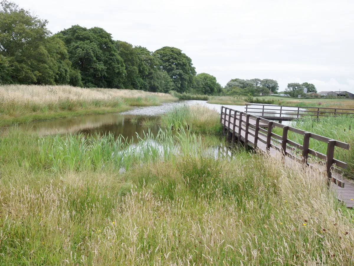
Campfield Marsh RSPB reserve
Wildlife reserves · 1.4 km

Bowness-on-Solway
Towns & cities · 1.8 km

Maia
Archaeological sites · 2.0 km

Campfield (tower 2b) and associated parallel ditches and Roman road, 350m south west of Campfield Farm part of Roman frontier defences along Cumbrian coast
Archaeological sites · 2.0 km
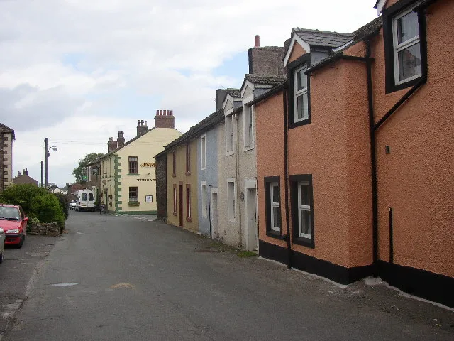
Maia Roman Fort
Hill forts · 2.0 km
Bowness on Solway War Memorial
Memorials & monuments · 2.1 km

Bowness-on-Solway Roman Fort
Archaeological sites · 2.1 km
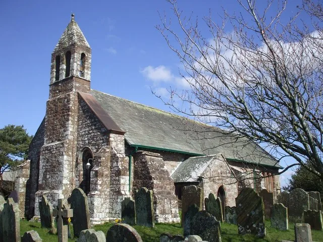
St Michael's Church
Historic churches · 2.1 km

Milefortlet 3
Hill forts · 2.5 km
Nearby
📷 3Archaeological sites · North West England
Mile Fortlet 1
Mile Fortlet 1 — a archaeological in scotland-lowlands, United Kingdom.
📷 3Hill forts · North West England
Milefortlet 1
Milefortlet 1 — milefortlet of the Roman Cumbrian Coast defences.
📷 5Mountains & hills · North West England
Herd Hill
Herd Hill — mountain in scotland lowlands. Elevation: 10 m.
📷 3Wildlife reserves · North West England
Campfield Marsh RSPB reserve
Campfield Marsh RSPB reserve — RSPB nature reserve in United Kingdom.
📷 5Towns & cities · North West England
Bowness-on-Solway
Bowness-on-Solway — village in Cumbria, United Kingdom.
📷 3Archaeological sites · North West England
Maia
Maia — a archaeological in scotland-lowlands, United Kingdom.
Where to eat & stay near Campfield Marsh Nature Reserve
Places to stay
 📷 5
📷 5Caravan parks · North West England
Cottage and Glendale Holiday Park
Cottage and Glendale Holiday Park — a caravan park in scotland lowlands.
 📷 5
📷 5Campsites · North West England
The Bush Inn
The Bush Inn — a campsite in scotland lowlands.
 📷 5
📷 5 📷 5
📷 5Caravan parks · North West England
Galabank Camping and Caravan Park
Galabank Camping and Caravan Park — a caravan park in scotland lowlands.
 📷 5
📷 5Caravan parks · North West England
Broom Fisheries campsite
Broom Fisheries campsite — a caravan park in scotland lowlands.
 📷 5
📷 5Caravan parks · North West England
Queensberry Bay Holiday Park
Queensberry Bay Holiday Park — a caravan park in scotland lowlands.
Places to eat & drink
 📷 7
📷 7Historic pubs · North West England
Queensberry Arms Hotel
Queensberry Arms Hotel in Scotland Lowlands, United Kingdom.
 📷 7
📷 7Historic pubs · North West England
The Greyhound Inn
The Greyhound Inn in Scotland Lowlands, United Kingdom.
 📷 5
📷 5Historic pubs · North West England
Kings Arms Walter Willsons
Kings Arms Walter Willsons in Scotland Lowlands, United Kingdom.
 📷 7
📷 7Historic pubs · Scottish Lowlands
The Farmers Inn
The Farmers Inn in Scotland Lowlands, United Kingdom.
 📷 5
📷 5Historic pubs · North West England
Horse And Farrier Public House
Horse And Farrier Public House in Scotland Lowlands, United Kingdom.
 📷 7
📷 7Historic pubs · North West England
The Globe Tavern
The Globe Tavern in Scotland Lowlands, United Kingdom.
More forests in this region
 📷 3
📷 3Forests & woodlands · North West England
Davyhulme Millennium Nature Reserve
Davyhulme Millennium Nature Reserve is a forest or woodland in the United Kingdom.
 📷 3
📷 3Forests & woodlands · North West England
Paddington Meadows
Paddington Meadows is a forest or woodland in the United Kingdom.
 📷 5
📷 5Forests & woodlands · North West England
Rixton Claypits Local Nature Reserve
Rixton Claypits Local Nature Reserve is a forest or woodland in the United Kingdom.
 📷 5
📷 5Forests & woodlands · North West England
Woolston Eyes Nature Reserve No. 1 Bed
Woolston Eyes Nature Reserve No. 1 Bed is a forest or woodland in the United Kingdom.
Frequently asked questions
- Where is Campfield Marsh Nature Reserve?
- Campfield Marsh Nature Reserve is in the Scottish Lowlands, United Kingdom (postcode CA7 5AG), in the parish of Bowness.
- What is Campfield Marsh Nature Reserve?
- Campfield Marsh Nature Reserve is a forest or woodland in the United Kingdom.
- How do I get to Campfield Marsh Nature Reserve?
- The nearest railway station is Annan, about 5.4 km away. Drivers can use postcode CA7 5AG.
- Is Campfield Marsh Nature Reserve a protected site?
- Yes — Campfield Marsh Nature Reserve is part of the Bowness Common SSSI Site of Special Scientific Interest and the Upper Solway Flats & Marshes SSSI Site of Special Scientific Interest.
- Is Campfield Marsh Nature Reserve free to visit?
- Yes, Campfield Marsh Nature Reserve is free to enter.
- How do I get to Campfield Marsh Nature Reserve?
- The nearest railway station is Annan, about 5.4 km away. Drivers can navigate to postcode CA7 5AG.