
Natural landmarks · Northern Ireland
Camlough Fault
In or near Killean.
Camlough Fault in Northern Ireland, United Kingdom.

Eric Jones — CC BY-SA 2.0 via Wikimedia Commons licence
_-_geograph.org.uk_-_5757465.jpg)
Plan your visit
- Typical visit
- 1 h–2 h
- Nearest railway station
- Newry · 6.9 km
- Free entry
- Dog-friendly
Getting there & planning your visit
To visit Camlough Fault, the nearest railway station is Newry, located 6.9 km away. The postcode for navigation is BT35 8RA, and entry to the site is free.
About
Camlough Fault is a place of interest in Northern Ireland, United Kingdom — drawn from open-data sources for visitor reference. See the linked Wikipedia article for the full description.
Photo gallery
360° view
Imagery © Mapillary contributors, CC BY-SA 4.0
From the Wikipedia article
Camlough Fault is a NNW–SSE–trending dextral (right-lateral) strike-slip fault in County Armagh, Northern Ireland. It forms part of a broader network of Cenozoic faults across the province. Aeromagnetic and gravity surveys show that it displaces the Palaeogene Slieve Gullion Complex ring-dyke by about 2 km. To the north-north-west it links with the Markethill Fault, although its surface trace is buried beneath Oligocene Lough Neagh Group sediments. To the east the fault steps roughly 10 km to become the Portrush Fault, and to the south-east it cuts the Carlingford Complex, where its position is marked by strong magnetic anomalies. These right-lateral movements record significant Cenozoic deformation driven by both Alpine compression and mantle plume-related extension. In the Mid-Palaeocene, movement on the Camlough Fault helped form the Lough Neagh pull-apart basin. This focused subsidence beneath the modern lake and allowed unusually thick sequences of Palaeogene basalts and overlying Oligocene clays to accumulate. Further north-east, the fault is defined by a sudden shift in Silurian strike at Thompson's Bridge (from E–W to E 40° N). Bailey & McCallien note that it shows dextral offset at the reservoir but sinistral movement at Flurrybridge, suggesting distinct block movements on either side of the fault. During the last glaciation, ice flow exploited the Camlough Fault zone to scour out the valley now occupied by the narrow ribbon lake Cam Lough, the fault acting as a line of weakness that guided glacial erosion.
Excerpt from Wikipedia under CC BY-SA 4.0. See the source article linked in Sources below.
- Coordinates
- 54.1272, -6.3793
- District
- Newry, Mourne and Down
- Postcode
- BT35 8RA
- Parliamentary constituency
- Newry and Armagh
- Nearest railway station
- Newry — 6.9 km
Sources
- wikidata: Q5026841 (CC0)
- wikipedia: Camlough Fault (CC BY-SA 4.0)
Other places nearby

Slieve Gullion Getaways
Caravan parks · 0.8 km

Meigh
Natural landmarks · 1.2 km

Clonlum South Cairn
Burial mounds & barrows · 1.4 km

Newtowncloghoge
Natural landmarks · 1.5 km

Clonlum North Cairn
Burial mounds & barrows · 1.6 km

Lisbanemore Cashel
Archaeological sites · 2.0 km
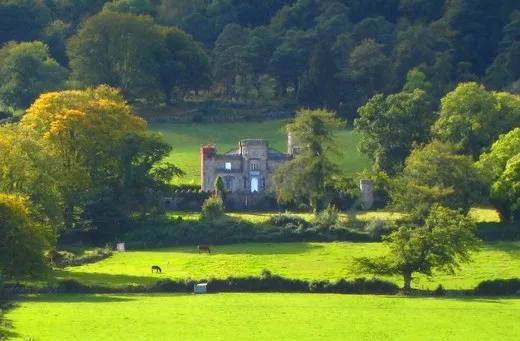
Killevy Castle
Castles · 2.1 km

Killeavy Castle
Castles · 2.1 km

Killeavy Castle
Castles · 2.1 km

Lisdoo Cashel
Archaeological sites · 2.1 km

Adavoyle railway station
Natural landmarks · 2.3 km

Killean
Towns & cities · 2.7 km
Nearby
📷 5Caravan parks · Northern Ireland
Slieve Gullion Getaways
Slieve Gullion Getaways — a caravan park in northern ireland.
📷 4📷 3Burial mounds & barrows · Northern Ireland
Clonlum South Cairn
Clonlum South Cairn — a burial mound in northern-ireland, United Kingdom.
📷 4Natural landmarks · Northern Ireland
Newtowncloghoge
Newtowncloghoge in Northern Ireland, United Kingdom.
📷 3Burial mounds & barrows · Northern Ireland
Clonlum North Cairn
Clonlum North Cairn — a burial mound in northern-ireland, United Kingdom.
📷 3Archaeological sites · Northern Ireland
Lisbanemore Cashel
Lisbanemore Cashel — a archaeological in northern-ireland, United Kingdom.
Where to eat & stay near Camlough Fault
Places to stay
📷 5Caravan parks · Northern Ireland
Slieve Gullion Getaways
Slieve Gullion Getaways — a caravan park in northern ireland.
 📷 5
📷 5Hostels · Northern Ireland
Kilbroney Youth Centre C.O.I
Kilbroney Youth Centre C.O.I — a hostel in northern ireland.
 📷 5
📷 5Caravan parks · Northern Ireland
Kilbroney Caravan Park
Kilbroney Caravan Park — a caravan park in northern ireland.
 📷 5
📷 5Caravan parks · Northern Ireland
Touring in the Trees - Kilbroney
Touring in the Trees - Kilbroney — a caravan park in northern ireland.
 📷 5
📷 5 📷 5
📷 5More natural landmarks in this region
 Flagship📷 4
Natural landmarks · Northern Ireland
Lough Erne
Lough Erne — lake in County Fermanagh, Northern Ireland, UK.
 Flagship📷 4
Natural landmarks · Northern Ireland
Lough Neagh
Lough Neagh — large lake in Northern Ireland.
 📷 3
📷 3Natural landmarks · Northern Ireland
Ballysaggart Lough
Ballysaggart Lough — lake in the United Kingdom.
 📷 5
📷 5Natural landmarks · Northern Ireland
Belmore Mountain
Belmore Mountain — mountain in the United Kingdom.
Frequently asked questions
- Where is Camlough Fault?
- Camlough Fault is in Northern Ireland, United Kingdom (postcode BT35 8RA).
- What is Camlough Fault?
- Camlough Fault in Northern Ireland, United Kingdom.
- How do I get to Camlough Fault?
- The nearest railway station is Newry, about 6.9 km away. Drivers can use postcode BT35 8RA.
- Is Camlough Fault free to visit?
- Yes, Camlough Fault is free to enter.
- How do I get to Camlough Fault?
- The nearest railway station is Newry, about 6.9 km away. Drivers can navigate to postcode BT35 8RA.