Mines & mining heritage · Mid Wales
Caio
Also known as: Caeo (pentref)
In or near Llandovery.
Caio in Wales Mid, United Kingdom.

Adrian Dust — CC BY-SA 2.0 via Wikimedia Commons licence
Plan your visit
- Typical visit
- 1 h–2 h
- Nearest railway station
- Llanwrda · 9.7 km
About
Caio is a place of interest in Wales Mid, United Kingdom — drawn from open-data sources for visitor reference. See the linked Wikipedia article for the full description.
Photo gallery
From the Wikipedia article
Caio (or Caeo) is a village in the county of Carmarthenshire, south-west Wales, sited near to the Dolaucothi Gold Mines.
Excerpt from Wikipedia under CC BY-SA 4.0. See the source article linked in Sources below.
Background
History
The parish church, consecrated to Saint Cynwyl, now stands at the centre of the village, near the Roman road that linked the Roman forts at Llandovery (Alabum) and Llanio (Bremia), and the Roman gold mines at Dolaucothi. The Roman road remained in use until the late 18th century, mainly as a cattle-road or Drover's road. The Dolaucothi Estate long held by the Johnes family is now a tourist attraction owned by the National Trust. A pounding-stone long known as Carreg Pumsaint and a possible holy well are located nearby. The oldest record of a chapel in the village is the Tynewydd Calvinistic Methodists chapel which was built around 1774. The old Ysgol Gynradd Caio stands next to the church,…
Sourced from Wikipedia under CC BY-SA 4.0.
- Coordinates
- 52.0415, -3.9328
- District
- Carmarthenshire
- Parish
- Cynwyl Gaeo
- Postcode
- SA19 8RE
- Parliamentary constituency
- Caerfyrddin
- Nearest railway station
- Llanwrda — 9.7 km
Sources
- wikidata: Q3404900 (CC0)
- wikipedia: Caio, Carmarthenshire (CC BY-SA 4.0)
Other places nearby
Parish Church Of St Cynwyl, Caeo
Historic churches · 0.0 km
Bridge Over River Annell Including attached Retaining Walls, Caeo
Historic bridges · 0.1 km

Cayo Hundred
Natural landmarks · 0.9 km
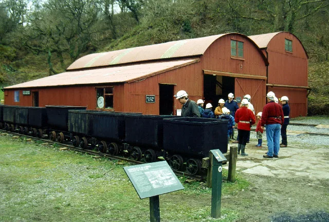
Dolaucothi Gold Mines
Hill forts · 1.2 km

Careg Pumsaint
Archaeological sites · 1.3 km

Carreg Pumsaint
Windmills · 1.3 km

Allt Ogofau
Literary houses · 1.3 km
Carreg Pumsant
Castles · 1.3 km

Maesglas
Mountains & hills · 1.3 km

Roman Gold Mines
Archaeological sites · 1.3 km

Dolaucothi Estate
Historic houses · 1.4 km

Ban Bronffin
Mountains & hills · 1.9 km
Nearby
📷 5Historic churches · Mid Wales
Parish Church Of St Cynwyl, Caeo
Parish Church Of St Cynwyl, Caeo — Grade II* listed building-listed church in wales-mid, United Kingdom.
📷 5Historic bridges · Mid Wales
Bridge Over River Annell Including attached Retaining Walls, Caeo
Bridge Over River Annell Including attached Retaining Walls, Caeo — Grade II listed building-listed bridge in wales-mid, United Kingdom.
📷 2📷 3Hill forts · Mid Wales
Dolaucothi Gold Mines
Dolaucothi Gold Mines is a hill fort in the United Kingdom.
📷 3Archaeological sites · Mid Wales
Careg Pumsaint
Careg Pumsaint — a archaeological in wales-mid, United Kingdom.
📷 5Windmills · Mid Wales
Carreg Pumsaint
Carreg Pumsaint — a post mill in wales-mid, United Kingdom.
Where to eat & stay near Caio
Places to stay
 📷 5
📷 5Caravan parks · Mid Wales
Springwater Lakes Touring Site
Springwater Lakes Touring Site — a caravan park in wales mid.
 📷 4
📷 4 📷 5
📷 5
 📷 5
📷 5Caravan parks · Mid Wales
Abermarlais Camping and Caravan
Abermarlais Camping and Caravan — a caravan park in wales south.
 📷 5
📷 5Campsites · Mid Wales
Llandovery Caravan & Camping Park
Llandovery Caravan & Camping Park — a campsite in wales south.
Places to eat & drink
 📷 5
📷 5 📷 3
📷 3 📷 3
📷 3 📷 4
📷 4 📷 4
📷 4More places in this region
 📷 4
📷 4 📷 2
📷 2 📷 4
📷 4 📷 4
📷 4Frequently asked questions
- Where is Caio?
- Caio is in Mid Wales, United Kingdom (postcode SA19 8RE), in the parish of Cynwyl Gaeo.
- What is Caio?
- Caio in Wales Mid, United Kingdom.
- How do I get to Caio?
- The nearest railway station is Llanwrda, about 9.7 km away. Drivers can use postcode SA19 8RE.
- How do I get to Caio?
- Drivers can navigate to postcode SA19 8RE. It sits within the Caerfyrddin parliamentary constituency.