
Historic bridges · North East England
Bywell Bridge
In or near Stocksfield.
Bywell Bridge in England North East, United Kingdom.

Oliver Dixon — CC BY-SA 2.0 via Wikimedia Commons licence

Plan your visit
- Typical visit
- 15 min–30 min
- Nearest railway station
- Stocksfield · 0.6 km
- Paid entry
- Dog-friendly
Getting there & planning your visit
To visit Bywell Bridge, the nearest railway station is Stocksfield, located 0.6 km away. Entry to the bridge is paid, and the postcode for sat-nav is NE43 7AF.
About
Bywell Bridge is a place of interest in England North East, United Kingdom — drawn from open-data sources for visitor reference. See the linked Wikipedia article for the full description.
Photo gallery
Heritage listing
Bywell Bridge is a 19th-century stone bridge across the River Tyne. It is a Grade II listed building.
From the Historic England List Entry under OGL v3.
Protected designations
- Area of Outstanding Natural Beauty: North Pennines
Designations sourced from Natural England open data under OGL v3.
From the Wikipedia article
Bywell Bridge is a 19th-century stone bridge across the River Tyne. It is a Grade II listed building.
Excerpt from Wikipedia under CC BY-SA 4.0. See the source article linked in Sources below.
Background
History
The bridge was opened in 1838. It was built at a cost of £15,000, which was paid by the local landowner T W Beaumont. The designer was the architect George Basevi. The bridge joins Bywell and the adjoining roads with Stocksfield. It is of ashlar masonry, with five segmental arches crossing the river, and two flood arches, without parapets, to the south. The remains of the piers of an ancient bridge, believed to be Roman, stood nearby until demolished on Beaumont's instructions when work on the present bridge began.
Sourced from Wikipedia under CC BY-SA 4.0.
- Coordinates
- 54.9523, -1.9204
- District
- Northumberland
- Parish
- Bywell
- Postcode
- NE43 7AF
- Parliamentary constituency
- Hexham
- Nearest railway station
- Stocksfield — 0.6 km
- Opening
- {{start date|1838}}
- Official site
- www.keystothepast.info
Sources
- wikidata: Q5004685 (CC0)
- wikipedia: Bywell Bridge (CC BY-SA 4.0)
Other places nearby

Bridge Over Clockey Burn 70 Metres North Of Bywell Castle Entrance
Historic bridges · 0.3 km
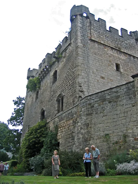
Bywell Castle
Castles · 0.3 km

Stocksfield
Towns & cities · 0.6 km
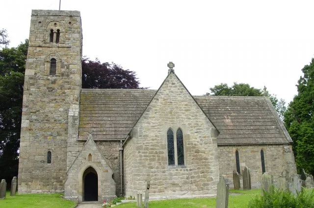
St Andrew's Church, Bywell
Historic churches · 0.6 km
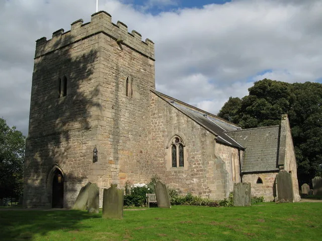
Church of St Peter
Historic churches · 0.6 km
Stocksfield railway station
Heritage railway stations · 0.7 km

Bywell Hall
Historic houses · 0.7 km

Bywell
Other places · 0.8 km

Branch End
Historic houses · 1.4 km

Stocksfield
Villages · 1.7 km

Painshawfield
Historic houses · 2.0 km

West Mickley
Other places · 2.0 km
Nearby
📷 3Historic bridges · North East England
Bridge Over Clockey Burn 70 Metres North Of Bywell Castle Entrance
Bridge Over Clockey Burn 70 Metres North Of Bywell Castle Entrance — Grade II listed building-listed bridge in scotland-lowlands, United Kingdom.
📷 3Castles · North East England
Bywell Castle
Bywell Castle — Grade I listed castle in Bywell, Northumberland, England, UK.
📷 4📷 3Historic churches · North East England
St Andrew's Church, Bywell
St Andrew's Church, Bywell — Grade I listed church in Bywell, Northumberland, England, UK.
📷 3Historic churches · North East England
Church of St Peter
Church of St Peter — church in Bywell, Northumberland, England, UK.
📷 4Heritage railway stations · North East England
Stocksfield railway station
Stocksfield railway station in England North East, United Kingdom.
Where to eat & stay near Bywell Bridge
Places to stay
 📷 5
📷 5B&Bs · North East England
Duke Of Wellington Inn
Duke Of Wellington Inn — a bed-and-breakfast in scotland lowlands.
 📷 5
📷 5Campsites · North East England
Wellhouse Farm Camping site
Wellhouse Farm Camping site — a campsite in scotland lowlands.
📷 5Caravan parks · North East England
Wellhouse Farm Caravan Park
Wellhouse Farm Caravan Park — a caravan park in scotland lowlands.
 📷 5
📷 5Campsites · North East England
High Hermitage Caravan Park
High Hermitage Caravan Park — a campsite in scotland lowlands.
📷 5Caravan parks · North East England
High Hermitage Caravan Park
High Hermitage Caravan Park — a caravan park in scotland lowlands.
 📷 5
📷 5Campsites · North East England
Dilston Scout Camp
Dilston Scout Camp — a campsite in scotland lowlands.
Places to eat & drink
 📷 4
📷 4 📷 5
📷 5Historic pubs · North East England
Wellington Inn
Wellington Inn in Scotland Lowlands, United Kingdom.
 📷 5
📷 5Historic pubs · North East England
The Crown And Anchor
The Crown And Anchor in Scotland Lowlands, United Kingdom.
 📷 7
📷 7Historic pubs · North East England
The Vicars Pele
The Vicars Pele in Scotland Lowlands, United Kingdom.
 📷 5
📷 5Historic pubs · North East England
Travellers' Rest Inn
Travellers' Rest Inn in Scotland Lowlands, United Kingdom.
 📷 5
📷 5More bridges in this region
 📷 3
📷 3Historic bridges · North East England
Bridge About 30 Metres South Of The Manor House
Bridge About 30 Metres South Of The Manor House — Grade II listed building-listed bridge in england-yorkshire, United Kingdom.
 📷 3
📷 3Historic bridges · North East England
Old Bridge Over Nor Beck, On East Side Of Road
Old Bridge Over Nor Beck, On East Side Of Road — Grade II listed building-listed bridge in england-yorkshire, United Kingdom.
 📷 3
📷 3Historic bridges · North East England
Barnard Castle Bridge
Barnard Castle Bridge is a historic bridge in the United Kingdom.
 📷 3
📷 3Historic bridges · North East England
Blandswath Bridge
Blandswath Bridge is a historic bridge in the United Kingdom.
Frequently asked questions
- Where is Bywell Bridge?
- Bywell Bridge is in North-East England, United Kingdom (postcode NE43 7AF), in the parish of Bywell.
- What is Bywell Bridge?
- Bywell Bridge in England North East, United Kingdom.
- How do I get to Bywell Bridge?
- The nearest railway station is Stocksfield, about 0.6 km away. Drivers can use postcode NE43 7AF.
- Who owns Bywell Bridge?
- Bywell Bridge is owned by | maint =.
- Is Bywell Bridge a listed building?
- Bywell Bridge is officially recognised as Grade II listed building listed.
- Is Bywell Bridge a protected site?
- Yes — Bywell Bridge is part of the North Pennines National Landscape (AONB).
- How do I get to Bywell Bridge?
- The nearest railway station is Stocksfield, about 0.6 km away. Drivers can navigate to postcode NE43 7AF.