
Historic houses · North East England
Branch End
In or near Stocksfield.
Branch End in England North East, United Kingdom.

Andrew Curtis — CC BY-SA 2.0 via Wikimedia Commons licence

Plan your visit
- Typical visit
- 1 h–2 h
- Nearest railway station
- Stocksfield · 1.1 km
- Family-friendly
- Limited wheelchair access
Getting there & planning your visit
To visit Branch End, the nearest railway station is Stocksfield, located 1.1 km away. The postcode for sat-nav is NE43 7LG. Accessibility is limited for wheelchair users.
About
Branch End is a place of interest in England North East, United Kingdom — drawn from open-data sources for visitor reference. See the linked Wikipedia article for the full description.
Photo gallery
Protected designations
- Area of Outstanding Natural Beauty: North Pennines
Designations sourced from Natural England open data under OGL v3.
From the Wikipedia article
Branch End is part of the village of Stocksfield in Northumberland, England. It is situated at the junction of the A695 Main Road with New Ridley Road. It lies 1 mile (1.6 km) east of Stocksfield Station, between Hexham and Newcastle upon Tyne. Local services include a doctors' surgery, pharmacy, petrol station with associated shop and post office, two garages, a hairdresser, newsagent, children's play area and Quaker meeting house. There is a half hourly bus service to Hexham and Newcastle with Go North East "Tyne Valley 10".
Excerpt from Wikipedia under CC BY-SA 4.0. See the source article linked in Sources below.
- Coordinates
- 54.9480, -1.9000
- District
- Northumberland
- Parish
- Stocksfield
- Postcode
- NE43 7LG
- Parliamentary constituency
- Hexham
- Nearest railway station
- Stocksfield — 1.1 km
Sources
- wikidata: Q4956354 (CC0)
- wikipedia: Branch End (CC BY-SA 4.0)
Other places nearby

West Mickley
Other places · 0.7 km

Stocksfield
Villages · 0.9 km

Painshawfield
Historic houses · 1.0 km

Stocksfield
Towns & cities · 1.0 km
Stocksfield railway station
Heritage railway stations · 1.1 km

Bywell Bridge
Historic bridges · 1.4 km

The Glenside
Theatres · 1.4 km

Cherryburn - Thomas Bewick Museum
Museums · 1.5 km
Cherryburn
Forests & woodlands · 1.5 km
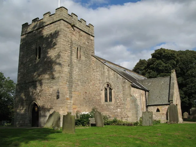
Church of St Peter
Historic churches · 1.6 km

Bridge Over Clockey Burn 70 Metres North Of Bywell Castle Entrance
Historic bridges · 1.6 km
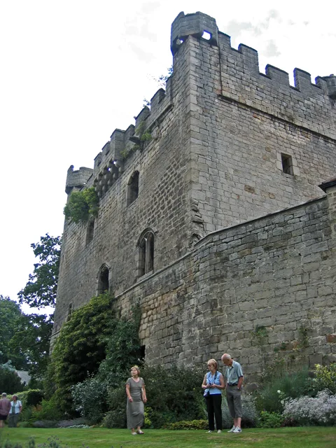
Bywell Castle
Castles · 1.6 km
Nearby
📷 3📷 5📷 4Historic houses · North East England
Painshawfield
Painshawfield in England North East, United Kingdom.
📷 4📷 4Heritage railway stations · North East England
Stocksfield railway station
Stocksfield railway station in England North East, United Kingdom.
📷 4Historic bridges · North East England
Bywell Bridge
Bywell Bridge in England North East, United Kingdom.
Where to eat & stay near Branch End
Places to stay
 📷 5
📷 5B&Bs · North East England
Duke Of Wellington Inn
Duke Of Wellington Inn — a bed-and-breakfast in scotland lowlands.
 📷 5
📷 5Campsites · North East England
High Hermitage Caravan Park
High Hermitage Caravan Park — a campsite in scotland lowlands.
📷 5Caravan parks · North East England
High Hermitage Caravan Park
High Hermitage Caravan Park — a caravan park in scotland lowlands.
 📷 5
📷 5Campsites · North East England
Wellhouse Farm Camping site
Wellhouse Farm Camping site — a campsite in scotland lowlands.
📷 5Caravan parks · North East England
Wellhouse Farm Caravan Park
Wellhouse Farm Caravan Park — a caravan park in scotland lowlands.
 📷 5
📷 5Places to eat & drink
 📷 4
📷 4 📷 5
📷 5Historic pubs · North East England
Wellington Inn
Wellington Inn in Scotland Lowlands, United Kingdom.
 📷 5
📷 5Historic pubs · North East England
The Crown And Anchor
The Crown And Anchor in Scotland Lowlands, United Kingdom.
 📷 7
📷 7Historic pubs · North East England
The Vicars Pele
The Vicars Pele in Scotland Lowlands, United Kingdom.
 📷 5
📷 5 📷 5
📷 5More historic houses in this region
 📷 3
📷 3Historic houses · North East England
Wayside cross known as Jenny Bradley 1000m north west of Bloworth Crossing on Greenhow Moor
Wayside cross known as Jenny Bradley 1000m north west of Bloworth Crossing on Greenhow Moor — a Grade II*-listed historic house in england-yorkshire, United Kingdom.
 📷 3
📷 3Historic houses · North East England
Crackpot Hall
Crackpot Hall — a historic house in england-north-west, United Kingdom.
 📷 3
📷 3Historic houses · North East England
Bunton Mine shop
Bunton Mine shop — a historic house in england-north-west, United Kingdom.
 📷 3
📷 3Historic houses · North East England
Blakethwaite Mine
Blakethwaite Mine — a historic house in england-north-west, United Kingdom.
Frequently asked questions
- Where is Branch End?
- Branch End is in North-East England, United Kingdom (postcode NE43 7LG), in the parish of Stocksfield.
- What is Branch End?
- Branch End in England North East, United Kingdom.
- How do I get to Branch End?
- The nearest railway station is Stocksfield, about 1.1 km away. Drivers can use postcode NE43 7LG.
- Is Branch End a protected site?
- Yes — Branch End is part of the North Pennines National Landscape (AONB).
- How do I get to Branch End?
- The nearest railway station is Stocksfield, about 1.1 km away. Drivers can navigate to postcode NE43 7LG.