
Natural landmarks · East of England
Butterfly World, Hertfordshire
In or near Bricket Wood.
The Butterfly World Project was a visitor attraction in the village of Chiswell Green, on the outskirts of St Albans in Hertfordshire, UK, dedicated to showcasing and promoting learning about butterfl

David Howard — CC BY-SA 2.0 via Wikimedia Commons licence

Plan your visit
- Typical visit
- 1 h–2 h
- Nearest railway station
- How Wood · 1.9 km
- Free entry
- Dog-friendly
About
The Butterfly World Project was a visitor attraction in the village of Chiswell Green, on the outskirts of St Albans in Hertfordshire, UK, dedicated to showcasing and promoting learning about butterflies. It closed permanently in 2015.
Photo gallery
Protected designations
- Area of Outstanding Natural Beauty: Chilterns
Designations sourced from Natural England open data under OGL v3.
From the Wikipedia article
The Butterfly World Project was a visitor attraction in the village of Chiswell Green, on the outskirts of St Albans in Hertfordshire, UK, dedicated to showcasing and promoting learning about butterflies. It closed permanently in 2015.
Excerpt from Wikipedia under CC BY-SA 4.0. See the source article linked in Sources below.
Background
History
The project was started by lepidopterist Clive Farrell, and was launched in 2008 at the Royal Society in London. Farrell secured a number of high-profile patrons for the scheme, including naturalists Sir David Attenborough and Professor David Bellamy, gardener and broadcaster Alan Titchmarsh, actress Emilia Fox, and barrister and politician Baroness Helena Kennedy. Construction began at the site at Chiswell Green, adjacent to the Gardens of the Rose, in 2009. Terra Firma landscape architects worked with client Clive Farrell, artist and garden designer Ivan Hicks and Chrysalis Architects on the project masterplan and detailed proposals. The Butterfly World site opened to the public in spring…
Sourced from Wikipedia under CC BY-SA 4.0.
- Coordinates
- 51.7269, -0.3686
- County
- Hertfordshire
- District
- St Albans
- Parish
- St Stephen
- Postcode
- AL2 3AL
- Parliamentary constituency
- St Albans
- Nearest railway station
- How Wood — 1.9 km
- Official site
- www.butterflyworldproject.com
Sources
- wikipedia: Butterfly World, Hertfordshire (CC BY-SA 4.0)
Other places nearby

Royal National Rose Society Gardens
Gardens · 0.2 km

Royal National Rose Society Gardens
Botanic gardens · 0.2 km

Three Hammers Public House
Historic pubs · 0.6 km

Holly Bush Public House
Historic pubs · 1.4 km

Spielplatz
Forests & woodlands · 1.4 km

Watling Street Caravan Park
Caravan parks · 1.7 km

Turning Forms
Public art & sculpture · 1.9 km

Moor Mill Quarry, West
Quarries · 2.1 km

Rose Cottage
B&Bs · 2.1 km
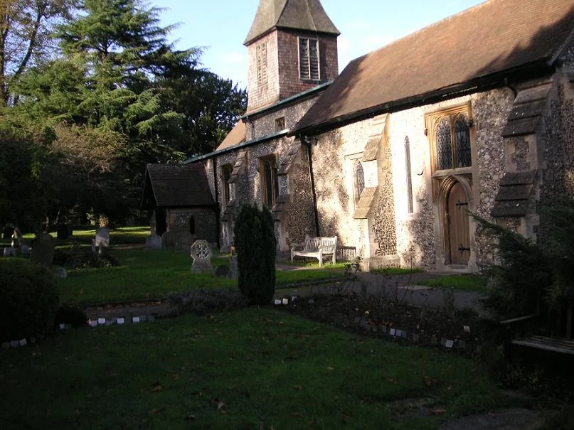
St. Stephen's Church, St. Albans
Historic churches · 2.2 km

Verlamion
Archaeological sites · 2.2 km
The Overdraught
Historic pubs · 2.2 km
Nearby
📷 4Gardens · East of England
Royal National Rose Society Gardens
The Royal National Rose Society Gardens, also known as The Gardens of The Rose, were the gardens and headquarters of The Royal National Rose Society at Bone Hill, Chiswell Green, St Albans, Hertfordsh
📷 5Botanic gardens · East of England
Royal National Rose Society Gardens
Royal National Rose Society Gardens — a botanic garden in england london.
📷 5Historic pubs · East of England
Three Hammers Public House
Three Hammers Public House in England East, United Kingdom.
📷 5Historic pubs · East of England
Holly Bush Public House
Holly Bush Public House in England East, United Kingdom.
📷 3Forests & woodlands · East of England
Spielplatz
Spielplatz (German for playground) is the longest-operating naturist resort in United Kingdom, and consists of 12 acres (4.9 ha) located in the village of Bricket Wood, in the English county of Hertfo
📷 5Caravan parks · East of England
Watling Street Caravan Park
Watling Street Caravan Park — a caravan park in england london.
Where to eat & stay near Butterfly World, Hertfordshire
Places to stay
📷 5Caravan parks · East of England
Watling Street Caravan Park
Watling Street Caravan Park — a caravan park in england london.
📷 5 📷 5
📷 5 📷 5
📷 5Hotels · East of England
The White Hart Hotel
The White Hart Hotel — a hotel in england london.
 📷 5
📷 5 📷 5
📷 5Campsites · London
Springfield Park
Springfield Park — a campsite in england london.
Places to eat & drink
📷 5Historic pubs · East of England
Three Hammers Public House
Three Hammers Public House in England East, United Kingdom.
📷 5Historic pubs · East of England
Holly Bush Public House
Holly Bush Public House in England East, United Kingdom.
📷 5 📷 5
📷 5Historic pubs · East of England
Ye Olde Fighting Cocks
Ye Olde Fighting Cocks in England East, United Kingdom.
 📷 5
📷 5 📷 5
📷 5Historic pubs · East of England
The Six Bells
The Six Bells in England East, United Kingdom.
More natural landmarks in this region
 📷 5
📷 5Natural landmarks · East of England
Orton Mere
Orton Mere — lake in Peterborough, Cambridgeshire, England, UK.
 📷 5
📷 5Natural landmarks · East of England
Magog Down
Magog Down — a other in england-london, United Kingdom.
 📷 5
📷 5Natural landmarks · East of England
Abington Pottery
Abington Pottery — a other in england-london, United Kingdom.
 📷 5
📷 5Natural landmarks · East of England
Car Dyke
Car Dyke — a other in england-london, United Kingdom.
Frequently asked questions
- Where is Butterfly World, Hertfordshire?
- Butterfly World, Hertfordshire is in Hertfordshire, East of England, United Kingdom (postcode AL2 3AL), in the parish of St Stephen.
- What is Butterfly World, Hertfordshire?
- The Butterfly World Project was a visitor attraction in the village of Chiswell Green, on the outskirts of St Albans in Hertfordshire, UK, dedicated to showcasing and promoting learning about butterfl
- How do I get to Butterfly World, Hertfordshire?
- The nearest railway station is How Wood, about 1.9 km away. Drivers can use postcode AL2 3AL.
- Is Butterfly World, Hertfordshire a protected site?
- Yes — Butterfly World, Hertfordshire is part of the Chilterns National Landscape (AONB).
- Is Butterfly World, Hertfordshire free to visit?
- Yes, Butterfly World, Hertfordshire is free to enter.
- How do I get to Butterfly World, Hertfordshire?
- The nearest railway station is How Wood, about 1.9 km away. Drivers can navigate to postcode AL2 3AL.