Museums · South East England
Burnham, Buckinghamshire
In or near Taplow.
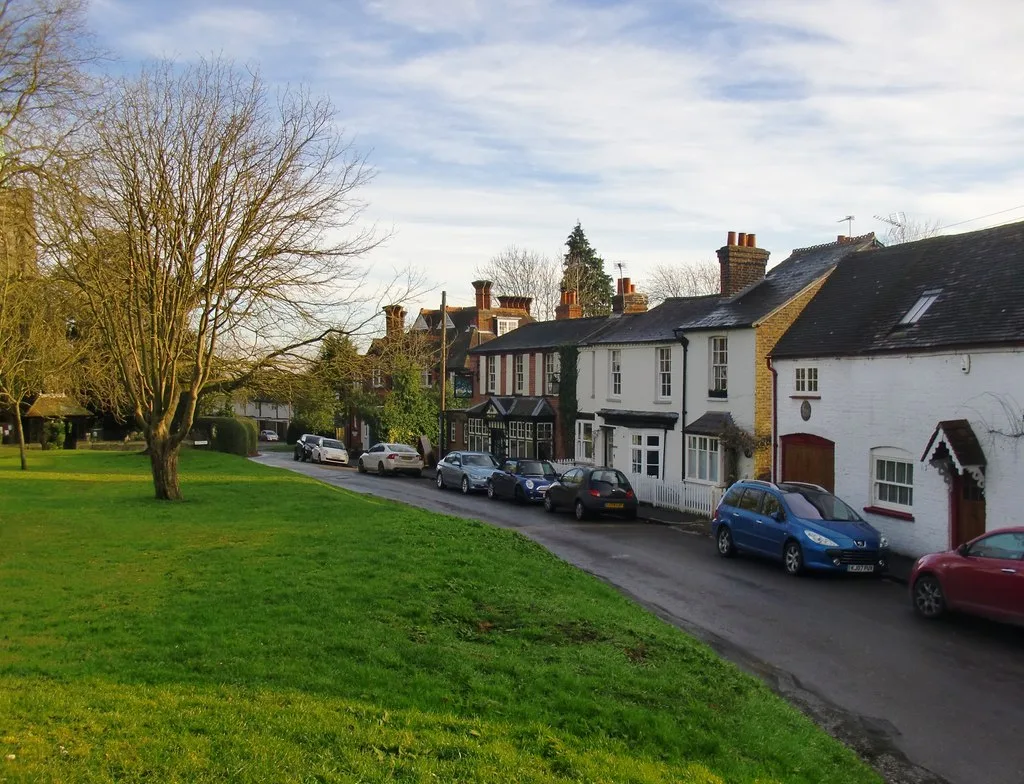
Burnham is a large village and civil parish that lies north of the River Thames in southern Buckinghamshire, between the towns of Maidenhead and Slough, about 24 miles west of Charing Cross, London. I

Kevin White — CC BY-SA 2.0 via Wikimedia Commons licence
Plan your visit
- Typical visit
- 1.5 h–3 h
- Best time of year
- Year-round
- Nearest railway station
- Burnham · 2.1 km
- Family-friendly
- Limited wheelchair access
Getting there & planning your visit
To visit the museum in Burnham, Buckinghamshire, the nearest railway station is Burnham, located 2.1 km away. The postcode for sat-nav is SL1 8FG. Please note that accessibility is limited for wheelchair users.
About
Burnham is a large village and civil parish that lies north of the River Thames in southern Buckinghamshire, between the towns of Maidenhead and Slough, about 24 miles west of Charing Cross, London. It is probably best known for the nearby Burnham Beeches woodland. The village is served by Burnham railway station on the main line between London Paddington and Reading. The M4 motorway passes through the south of the parish.
Photo gallery
Protected designations
- Area of Outstanding Natural Beauty: Chilterns
Designations sourced from Natural England open data under OGL v3.
From the Wikipedia article
Burnham is a large village and civil parish that lies north of the River Thames in southern Buckinghamshire, between the towns of Maidenhead and Slough, about 24 miles west of Charing Cross, London. It is probably best known for the nearby Burnham Beeches woodland. The village is served by Burnham railway station on the main line between London Paddington and Reading. The M4 motorway passes through the south of the parish.
Excerpt from Wikipedia under CC BY-SA 4.0. See the source article linked in Sources below.
Background
History
The toponym is derived from the Old English for "homestead on a stream". It was first recorded in the Domesday Book of 1086 as Burneham, when the manor was held by Walter FitzOther. Burnham was once a very important village. The Great West Road from London to Bath passed through the extensive parish of Burnham and as a result, in 1271, a Royal charter was granted to hold a market and an annual fair. However, when the first Maidenhead Bridge crossing the Thames opened c.1280, the road was diverted to the south of Burnham (the route of the modern A4), and Burnham fell into relative decline. The market was then transferred to Maidenhead. Today the village is nearly contiguous with west Slough,…
Sourced from Wikipedia under CC BY-SA 4.0.
- Coordinates
- 51.5400, -0.6600
- District
- Buckinghamshire
- Parish
- Burnham
- Postcode
- SL1 8FG
- Parliamentary constituency
- Beaconsfield
- Nearest railway station
- Burnham — 2.1 km
- Official site
- neighbourhood.statistics.gov.uk
Sources
- wikipedia: Burnham, Buckinghamshire (CC BY-SA 4.0)
Other places nearby

Burnham Beeches Hotel
Hotels · 0.9 km

Grovefield Hotel
Hotels · 0.9 km

Burnham War Memorial
Memorials & monuments · 0.9 km

Hitcham House
Manor houses · 1.1 km
Church of St Mary, Burnham
Historic churches · 1.2 km
Hitcham War Memorial
Memorials & monuments · 1.2 km
Nashdom
Abbeys & priories · 1.5 km

Nashdom
Cathedrals · 1.5 km
.jpg?width=1200)
Cocksherd Wood
Forests & woodlands · 1.6 km
.jpg?width=1200)
Haymill Valley
Forests & woodlands · 1.9 km
Taplow
Towns & cities · 2.1 km

Al-Madani Masjid
Historic churches · 2.1 km
Nearby
📷 5Hotels · South East England
Burnham Beeches Hotel
Burnham Beeches Hotel — a hotel in england south east.
📷 7📷 5Memorials & monuments · South East England
Burnham War Memorial
Burnham War Memorial is a memorial in the United Kingdom.
📷 5Manor houses · South East England
Hitcham House
Hitcham House — a manor in england-south-east, United Kingdom.
📷 5Historic churches · South East England
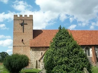
Church of St Mary, Burnham
Church of St Mary, Burnham — church in Burnham, Buckinghamshire, England, UK.
📷 5Memorials & monuments · South East England
Hitcham War Memorial
Hitcham War Memorial — Grade II listed building-listed memorial in england-south-east, United Kingdom.
Where to eat & stay near Burnham, Buckinghamshire
Places to stay
📷 5Hotels · South East England
Burnham Beeches Hotel
Burnham Beeches Hotel — a hotel in england south east.
📷 7 📷 5
📷 5Hotels · South East England
Taplow House Hotel
Taplow House Hotel — a hotel in england south east.
 📷 5
📷 5Hotels · South East England
Cliveden House
Cliveden House — a hotel in england south east.
 📷 5
📷 5Caravan parks · South East England
Amerden Caravan Park
Amerden Caravan Park — a caravan park in england south east.
 📷 5
📷 5Hotels · South East England
Bel and the Dragon
Bel and the Dragon — a hotel in england south east.
Places to eat & drink
 📷 7
📷 7Historic pubs · South East England
The Feathers Public House
The Feathers Public House in England South East, United Kingdom.
Historic pubs · South East England
The Green Man Public House
The Green Man Public House in England South East, United Kingdom.
 📷 7
📷 7Historic pubs · South East England
The Pineapple Public House
The Pineapple Public House in England South East, United Kingdom.
 📷 5
📷 5Historic pubs · South East England
The Long Barn Public House
The Long Barn Public House in England South East, United Kingdom.
 📷 5
📷 5 📷 7
📷 7Historic pubs · South East England
Green Dragon Public House
Green Dragon Public House in England South East, United Kingdom.
More museums in this region
 📷 5
📷 5Museums · South East England
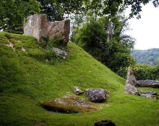
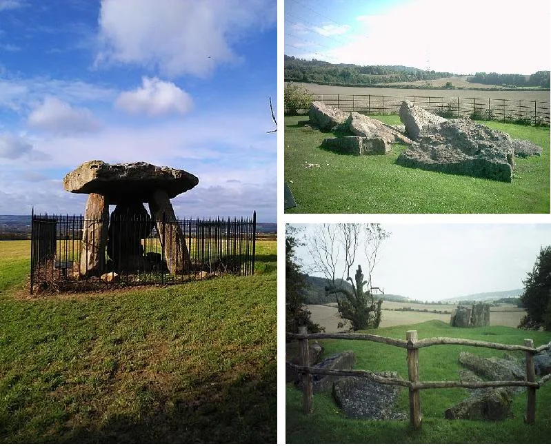
Coldrum Long Barrow
Coldrum Long Barrow — neolithic chambered long barrow near Trottiscliffe, Kent, England, UK.
 📷 5
📷 5Museums · South East England
Guildford House
Guildford House — house in Guildford, Surrey, England, UK.
 📷 5
📷 5Museums · South East England
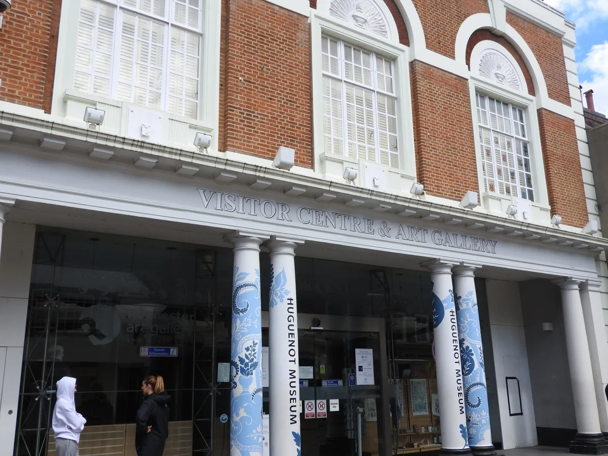
Huguenot Museum
Huguenot Museum — museum in Rochester, England, UK.
 📷 5
📷 5Museums · South East England
Medway megaliths
Medway megaliths — group of long barrows in Kent, England.
Frequently asked questions
- Where is Burnham, Buckinghamshire?
- Burnham, Buckinghamshire is in South-East England, United Kingdom (postcode SL1 8FG), in the parish of Burnham.
- What is Burnham, Buckinghamshire?
- Burnham is a large village and civil parish that lies north of the River Thames in southern Buckinghamshire, between the towns of Maidenhead and Slough, about 24 miles west of Charing Cross, London. I
- How do I get to Burnham, Buckinghamshire?
- The nearest railway station is Burnham, about 2.1 km away. Drivers can use postcode SL1 8FG.
- Is Burnham, Buckinghamshire a protected site?
- Yes — Burnham, Buckinghamshire is part of the Chilterns National Landscape (AONB).
- How do I get to Burnham, Buckinghamshire?
- The nearest railway station is Burnham, about 2.1 km away. Drivers can navigate to postcode SL1 8FG.