Forests & woodlands · East Midlands
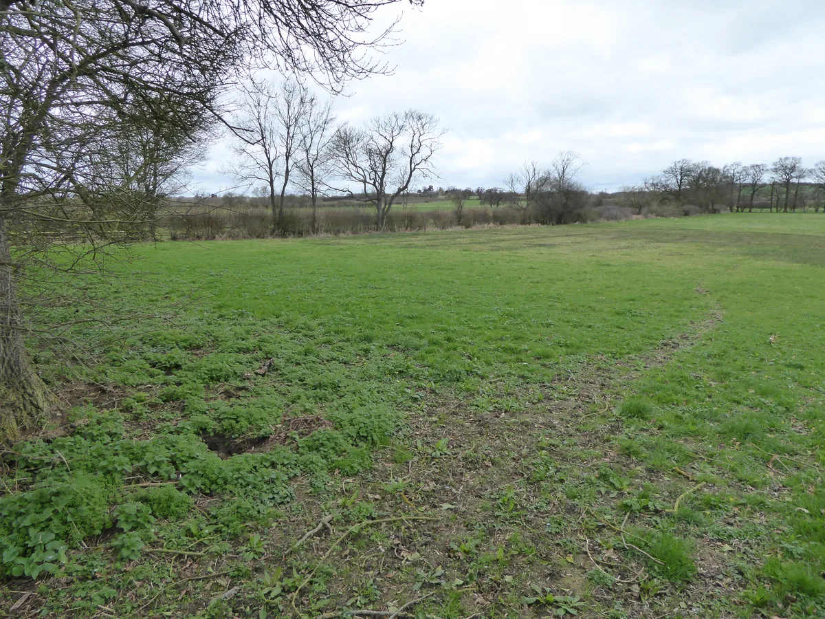
Bugbrooke Meadow
In or near Nether Heyford.
Bugbrooke Meadow is a forest or woodland in the United Kingdom.

Wikimedia Commons contributors — see linked file page for photographer and licence licence
Plan your visit
- Typical visit
- 1 h–3 h
- Nearest railway station
- Northampton · 7.7 km
- Free entry
- Family-friendly
- Dog-friendly
Getting there & planning your visit
To visit Bugbrooke Meadow, the nearest railway station is Northampton, which is 7.7 km away. The postcode for sat-nav is NN7 3QH. Entry to the meadow is free.
About
Bugbrooke Meadow is a named forest, woodland or nature reserve in the United Kingdom. Coordinates: 52.2226°, -1.0175°. This entry is part of The Great Britain Guide, a free, ad-free, open-data tourist directory.
Photo gallery
Official information
Bugbrooke Meadow is a small nature reserve located near the river Nene, known for its rich diversity of wildflowers and insects. The site features distinct wetland areas that support various plant species, including marsh orchids and marsh-marigold, making it a unique ecological habitat.
Protected designations
- Site of Special Scientific Interest: Bugbrooke Meadows SSSI
Designations sourced from Natural England open data under OGL v3.
From the Wikipedia article
Bugbrooke Meadows is a 10.1-hectare (25-acre) biological Site of Special Scientific Interest east of Nether Heyford in Northamptonshire. One of the fields with an area of 1.7 hectares is managed by the Wildlife Trust for Bedfordshire, Cambridgeshire and Northamptonshire. These meadows on the bank of the River Nene which have not been treated with fertilisers, and they often flood in winter. They are probably unique in the county, and they have very diverse damp grassland flora such as jointed rush and greater pond sedge. There are ancient hedges which are important both historically and as a habitat for wildlife. There is access to the site from the Nene Way between Kislingbury and Nether Heyford, and by a footpath from Bugbrooke.
Excerpt from Wikipedia under CC BY-SA 4.0. See the source article linked in Sources below.
- Coordinates
- 52.2226, -1.0175
- District
- West Northamptonshire
- Parish
- Bugbrooke
- Postcode
- NN7 3QH
- Parliamentary constituency
- South Northamptonshire
- Phone
- 01604 405285
- Nearest railway station
- Northampton — 7.7 km
- Opening
- Open at all times
- Official site
- www.wildlifebcn.org
Sources
- osm: w545366961 (ODbL)
- wikipedia: Bugbrooke Meadows (CC BY-SA 4.0)
- commons: Bugbrooke Meadow nature reserve 2.jpg (CC BY-SA 4.0)
Other places nearby
Bugbrooke Meadows
Wildlife reserves · 0.1 km
Nether Heyford
Towns & cities · 1.3 km

The Bakers Arms Public House
Historic pubs · 1.5 km

Roman temple at Harpole Roman villa
Follies · 1.7 km

Bridge Number 33
Historic bridges · 1.8 km

Iron Furnace
Archaeological sites · 2.0 km

Upper Heyford Top
Mountains & hills · 2.0 km
Glassthorpe
Vineyards · 2.0 km

Tramway Bridge
Historic bridges · 2.4 km

Netherheyford Mount
Mountains & hills · 2.5 km
Bugbrooke Mount
Mountains & hills · 2.5 km

Church of St Luke
Historic churches · 2.7 km
Nearby
📷 5Wildlife reserves · East Midlands
Bugbrooke Meadows
Bugbrooke Meadows — nature reserve in the United Kingdom.
Flagship📷 3Towns & cities · East Midlands
Nether Heyford
Nether Heyford — village and civil parish in Northamptonshire, United Kingdom.
📷 5Historic pubs · East Midlands
The Bakers Arms Public House
The Bakers Arms Public House in England West Midlands, United Kingdom.
📷 5Follies · East Midlands
Roman temple at Harpole Roman villa
Roman temple at Harpole Roman villa — a temple folly in england-west-midlands, United Kingdom.
📷 3Historic bridges · East Midlands
Bridge Number 33
Bridge Number 33 — Grade II listed building-listed bridge in england-west-midlands, United Kingdom.
📷 3Archaeological sites · East Midlands
Iron Furnace
Iron Furnace — a archaeological in england-west-midlands, United Kingdom.
Where to eat & stay near Bugbrooke Meadow
Places to stay
 📷 5
📷 5Caravan parks · South East England
The Limes Caravan Park
The Limes Caravan Park — a caravan park in england west midlands.
 📷 5
📷 5Caravan parks · South East England
Gayton Marina Caravan Park
Gayton Marina Caravan Park — a caravan park in england west midlands.
 📷 5
📷 5Hotels · South East England
Hilton Northampton
Hilton Northampton — a hotel in england west midlands. 4-star. Brand: Hilton Hotels & Resorts.
 📷 5
📷 5 📷 5
📷 5B&Bs · South East England
Kendal House B&B
Kendal House B&B — a bed-and-breakfast in england west midlands.
 📷 7
📷 7Hotels · South East England
The Saracen's Head
The Saracen's Head — a hotel in england west midlands.
Places to eat & drink
📷 5Historic pubs · East Midlands
The Bakers Arms Public House
The Bakers Arms Public House in England West Midlands, United Kingdom.
 📷 5
📷 5Historic pubs · South East England
Eastcote Arms Public House
Eastcote Arms Public House in England West Midlands, United Kingdom.
 📷 5
📷 5Historic pubs · East Midlands
Melbourne Arms Inn
Melbourne Arms Inn in England West Midlands, United Kingdom.
📷 5Historic pubs · East Midlands
The Squirrels Inn
The Squirrels Inn in England West Midlands, United Kingdom.
 📷 7
📷 7Historic pubs · South East England
Old Red Lion Public House
Old Red Lion Public House in England West Midlands, United Kingdom.
 📷 5
📷 5Historic pubs · East Midlands
The Fox And Hounds Public House
The Fox And Hounds Public House in England West Midlands, United Kingdom.
More forests in this region
 📷 5
📷 5Forests & woodlands · East Midlands
Castor Hanglands NNR
Castor Hanglands NNR is a forest or woodland in the United Kingdom.
 📷 5
📷 5Forests & woodlands · East Midlands
Eye Green Local Nature Reserve
Eye Green Local Nature Reserve is a forest or woodland in the United Kingdom.
 📷 5
📷 5Forests & woodlands · East Midlands
Star Pit Nature Reserve
Star Pit Nature Reserve is a forest or woodland in the United Kingdom.
 📷 5
📷 5Forests & woodlands · East Midlands
Attenborough Nature Reserve
Attenborough Nature Reserve is a forest or woodland in the United Kingdom.
Frequently asked questions
- Where is Bugbrooke Meadow?
- Bugbrooke Meadow is in the West Midlands, United Kingdom (postcode NN7 3QH), in the parish of Bugbrooke.
- What is Bugbrooke Meadow?
- Bugbrooke Meadow is a forest or woodland in the United Kingdom.
- How do I get to Bugbrooke Meadow?
- The nearest railway station is Northampton, about 7.7 km away. Drivers can use postcode NN7 3QH.
- Is Bugbrooke Meadow a protected site?
- Yes — Bugbrooke Meadow is part of the Bugbrooke Meadows SSSI Site of Special Scientific Interest.
- Is Bugbrooke Meadow free to visit?
- Yes, Bugbrooke Meadow is free to enter.
- How do I get to Bugbrooke Meadow?
- The nearest railway station is Northampton, about 7.7 km away. Drivers can navigate to postcode NN7 3QH.