
Historic bridges · East Midlands
Tramway Bridge
In or near Nether Heyford.
Tramway Bridge — a bridge in england-west-midlands, United Kingdom.

Alex McGregor — CC BY-SA 2.0 via Wikimedia Commons licence

Plan your visit
- Typical visit
- 15 min–30 min
- Nearest railway station
- Long Buckby · 9.1 km
- Free entry
- Dog-friendly
Getting there & planning your visit
To visit Tramway Bridge, the nearest railway station is Long Buckby, which is 9.1 km away. The postcode for sat-nav is NN7 4RU. Entry is free.
About
Tramway Bridge is a bridge located in england-west-midlands, United Kingdom. Sourced from OpenStreetMap (ODbL licence); see local listings for visitor information, opening hours and admission details.
Photo gallery
Heritage listing
The Tramway Bridge is a grade II listed pedestrian bridge crossing the River Avon at Stratford-upon-Avon, Warwickshire, England. The bridge was built in 1823, originally to carry a tramway track of the horse-drawn Stratford and Moreton Tramway. It was designed by John Urpeth Rastrick. It consists of eight elliptical arches, and is made from brick, with ashlar-coped parapets. The tramway had fallen into disuse by 1904, and the track was lifted in 1918. It has since then been used a public footbridge, and is an important element in the landscape around the Royal Shakespeare Theatre. The bridge gained grade II listing in 1951.
From the Historic England List Entry under OGL v3.
From the Wikipedia article
The Tramway Bridge is a grade II listed pedestrian bridge crossing the River Avon at Stratford-upon-Avon, Warwickshire, England. The bridge was built in 1823, originally to carry a tramway track of the horse-drawn Stratford and Moreton Tramway. It was designed by John Urpeth Rastrick. It consists of eight elliptical arches, and is made from brick, with ashlar-coped parapets. The tramway had fallen into disuse by 1904, and the track was lifted in 1918. It has since then been used a public footbridge, and is an important element in the landscape around the Royal Shakespeare Theatre. The bridge gained grade II listing in 1951. In 2010 the local council fitted strip lights down on the footway to simulate the historic tracks, however these were abandoned in 2020 after they repeatedly broke down. The bridge is around 100 metres (330 ft) to the west of, and downstream from the much older Clopton Bridge which dates from the 15th century. Two further relics of the old tramway are located immediately to the north of the bridge: An old toll house known as Tramway House at the northern end of the bridge which is also grade II listed. And a restored wagon of the tramway, which is located and displayed about 60 metres (200 ft) to the north of the bridge, with an information board about the history of the tramway.
Excerpt from Wikipedia under CC BY-SA 4.0. See the source article linked in Sources below.
- Coordinates
- 52.2155, -1.0513
- District
- West Northamptonshire
- Parish
- Stowe IX Churches
- Postcode
- NN7 4RU
- Parliamentary constituency
- Daventry
- Established
- 1823
- Nearest railway station
- Long Buckby — 9.1 km
Sources
- osm: node/9380518185 (ODbL)
- wikipedia: Tramway Bridge (CC BY-SA 4.0)
Other places nearby
Ruined Engine Shed
Historic houses · 0.2 km

Iron Furnace
Archaeological sites · 0.5 km

Bridge Number 33
Historic bridges · 1.0 km

Netherheyford Mount
Mountains & hills · 1.2 km
Nether Heyford
Towns & cities · 1.2 km

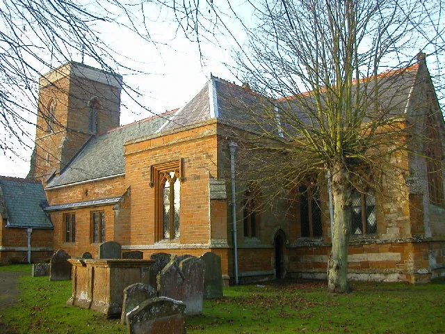
Church Stowe
Villages · 1.2 km
Bugbrooke Mount
Mountains & hills · 1.2 km

Bridge Number 27 At Sp 644 590 Grand Union Canal
Historic bridges · 1.2 km

Weedon Bec Cemetery
Cemeteries · 1.9 km

Radar Memorial
Memorials & monuments · 2.2 km

Flore Manor
Manor houses · 2.4 km
Bugbrooke Meadows
Wildlife reserves · 2.4 km
Nearby
📷 3Historic houses · East Midlands
Ruined Engine Shed
Ruined Engine Shed — a historic house in england-west-midlands, United Kingdom.
📷 3Archaeological sites · East Midlands
Iron Furnace
Iron Furnace — a archaeological in england-west-midlands, United Kingdom.
📷 3Historic bridges · East Midlands
Bridge Number 33
Bridge Number 33 — Grade II listed building-listed bridge in england-west-midlands, United Kingdom.
📷 5Mountains & hills · East Midlands
Netherheyford Mount
Netherheyford Mount — mountain in england west midlands. Elevation: 137 m.
Flagship📷 3Towns & cities · East Midlands
Nether Heyford
Nether Heyford — village and civil parish in Northamptonshire, United Kingdom.
📷 5Where to eat & stay near Tramway Bridge
Places to stay
 📷 5
📷 5Caravan parks · South East England
The Limes Caravan Park
The Limes Caravan Park — a caravan park in england west midlands.
 📷 5
📷 5Caravan parks · South East England
Gayton Marina Caravan Park
Gayton Marina Caravan Park — a caravan park in england west midlands.
 📷 5
📷 5B&Bs · South East England
Kendal House B&B
Kendal House B&B — a bed-and-breakfast in england west midlands.
 📷 5
📷 5Hotels · East Midlands
Fawsley Hall Hotel & Spa
Fawsley Hall Hotel & Spa — a hotel in england west midlands. 4-star. Brand: Handpicked Hotels.
 📷 5
📷 5B&Bs · South East England
B&B Christacorn House
B&B Christacorn House — a bed-and-breakfast in england west midlands.
 📷 5
📷 5B&Bs · East Midlands
Murcott Mill Farmhouse B&B
Murcott Mill Farmhouse B&B — a bed-and-breakfast in england west midlands.
Places to eat & drink
 📷 5
📷 5Historic pubs · East Midlands
The Bakers Arms Public House
The Bakers Arms Public House in England West Midlands, United Kingdom.
 📷 7
📷 7Historic pubs · South East England
Old Red Lion Public House
Old Red Lion Public House in England West Midlands, United Kingdom.
 📷 5
📷 5Historic pubs · South East England
Eastcote Arms Public House
Eastcote Arms Public House in England West Midlands, United Kingdom.
 📷 5
📷 5Historic pubs · East Midlands
Melbourne Arms Inn
Melbourne Arms Inn in England West Midlands, United Kingdom.
📷 5Historic pubs · East Midlands
The Squirrels Inn
The Squirrels Inn in England West Midlands, United Kingdom.
📷 5Historic pubs · South East England
The Bartholomew Arms Public House
The Bartholomew Arms Public House in England West Midlands, United Kingdom.
More bridges in this region
 📷 5
📷 5Historic bridges · East Midlands
Mill Race Bridge To Market Deeping Mill
Mill Race Bridge To Market Deeping Mill — Grade II listed building-listed bridge in england-london, United Kingdom.
 📷 5
📷 5Historic bridges · East Midlands
Bridge Over West Glen River
Bridge Over West Glen River — Grade II listed building-listed bridge in england-london, United Kingdom.
 📷 5
📷 5Historic bridges · East Midlands
Bridge And Sluices
Bridge And Sluices — Grade II listed building-listed bridge in england-london, United Kingdom.
 📷 5
📷 5Historic bridges · East Midlands
Bridge Over River Gwash
Bridge Over River Gwash — Grade II listed building-listed bridge in england-london, United Kingdom.
Frequently asked questions
- Where is Tramway Bridge?
- Tramway Bridge is in the West Midlands, United Kingdom (postcode NN7 4RU), in the parish of Stowe IX Churches.
- What is Tramway Bridge?
- Tramway Bridge — a bridge in england-west-midlands, United Kingdom.
- How do I get to Tramway Bridge?
- The nearest railway station is Long Buckby, about 9.1 km away. Drivers can use postcode NN7 4RU.
- When was Tramway Bridge built?
- Built or established in 1823.
- Is Tramway Bridge a listed building?
- Tramway Bridge is officially recognised as Grade II listed building listed.
- Is Tramway Bridge free to visit?
- Yes, Tramway Bridge is free to enter.
- How do I get to Tramway Bridge?
- Drivers can navigate to postcode NN7 4RU. It sits within the Daventry parliamentary constituency.