
National landscapes (AONB) · Mid Wales
Bucknell
Also known as: Bucknell, Swydd Amwythig
In or near Leintwardine.
Bucknell in Wales Mid, United Kingdom.

Stephen McKay — CC BY-SA 2.0 via Wikimedia Commons licence

Plan your visit
- Typical visit
- 3 h–6 h
- Nearest railway station
- Bucknell · 0.3 km
- Free entry
- Dog-friendly
Getting there & planning your visit
To visit Bucknell, the nearest railway station is Bucknell, located 0.3 km away. Entry is free, and the postcode for sat-nav is SY7 0AA.
About
Bucknell is a place of interest in Wales Mid, United Kingdom — drawn from open-data sources for visitor reference. See the linked Wikipedia article for the full description.
Photo gallery
Protected designations
- Site of Special Scientific Interest: River Teme SSSI
- Area of Outstanding Natural Beauty: Shropshire Hills
Designations sourced from Natural England open data under OGL v3.
From the Wikipedia article
Bucknell is a village and civil parish in south Shropshire, England. The village lies on the River Redlake, within 660 yards (600 m) of the River Teme and close to the border of Wales and Herefordshire. It is about 6 miles (9.7 km) east of Knighton and is set within the Shropshire Hills Area of Outstanding Natural Beauty. The name is derived from Old English and means 'Bucca's hill' or 'he-goats' hill'. The village has the "P"s identified by Country Life as essential to a successful village: a pub, a post office, a place of worship, a primary school and public transport.
Excerpt from Wikipedia under CC BY-SA 4.0. See the source article linked in Sources below.
Background
History
The settlement of Bucknell was first mentioned in the Domesday Book of 1086, as Buckehale or Buckenhill. At the time of the Domesday survey, the Shropshire and Herefordshire boundary divided the village. The Norman magnate Roger de Montgomery held the village from the King. He built many castles including Montgomery, Shrewsbury, Ludlow, Clun, Hopton and Oswestry; at the time over 90 per cent of the lordships and manors of Shropshire were held in Chief by him. His under-tenants in this area were Ralph de Mortimer, who held Bucknell (amongst his 123 manors with his chief domain in England being at Wigmore Castle), and William de Picot (also known as Picot de Say), with his chief domain at…
Architecture
The earliest of the existing buildings date back to the 17th century. The houses were built in a haphazard fashion near the river with easy access to water. The village depended on water from the river and wells until the 1920s when water was piped into the village from a spring above Chapel Lawn. The houses at the lower end of the village were very susceptible to flooding, and this hazard continued until the ford was walled up in the 1950s. Bucknell had four pubs: The Sitwell Arms, The Plough (just opposite), The Railway Tavern and The Bridge End. The latter three are all now private houses. Bucknell also had a shop and bakery in the Square and its own corn mill which was at the west end…
Description
The Old School House was built in the 16th century, this part being the part of the building next to the river to provide education for those who could pay for it. The school remained until the present one was built in 1865. The Old School House then became a shop and bakers before becoming a private dwelling. The front part of the building pre-dates the rear by around 200 years making it 13th/14th century and whilst being restored was found to have once existed as a ground floor-only property and evidence of an open fire pit and an opening in the roof to allow the smoke to escape; this pre-dates the inglenook fireplace to the rear and was believed to have been a medieval great hall.…
Sourced from Wikipedia under CC BY-SA 4.0.
- Coordinates
- 52.3600, -2.9500
- District
- Shropshire
- Parish
- Bucknell
- Postcode
- SY7 0AA
- Parliamentary constituency
- South Shropshire
- Nearest railway station
- Bucknell — 0.3 km
- Official site
- www.neighbourhood.statistics.gov.uk
Sources
- wikidata: Q2134613 (CC0)
- wikipedia: Bucknell, Shropshire (CC BY-SA 4.0)
Other places nearby

Bucknell Motte
Literary houses · 0.2 km

Bucknell railway station
Historic houses · 0.3 km

Coxall Knoll
Mountains & hills · 1.3 km

Multiple enclosure hillfort on Coxall Knoll
Memorials & monuments · 1.3 km

Bucknell Wood Hill
Mountains & hills · 1.5 km

Bridge Over River Redlake About 40 Yards South Of Coxall
Historic bridges · 1.7 km

Bedstone Court
Historic houses · 2.0 km
.jpg?width=1200)
The Hall, Brampton Bryan
Historic houses · 2.1 km
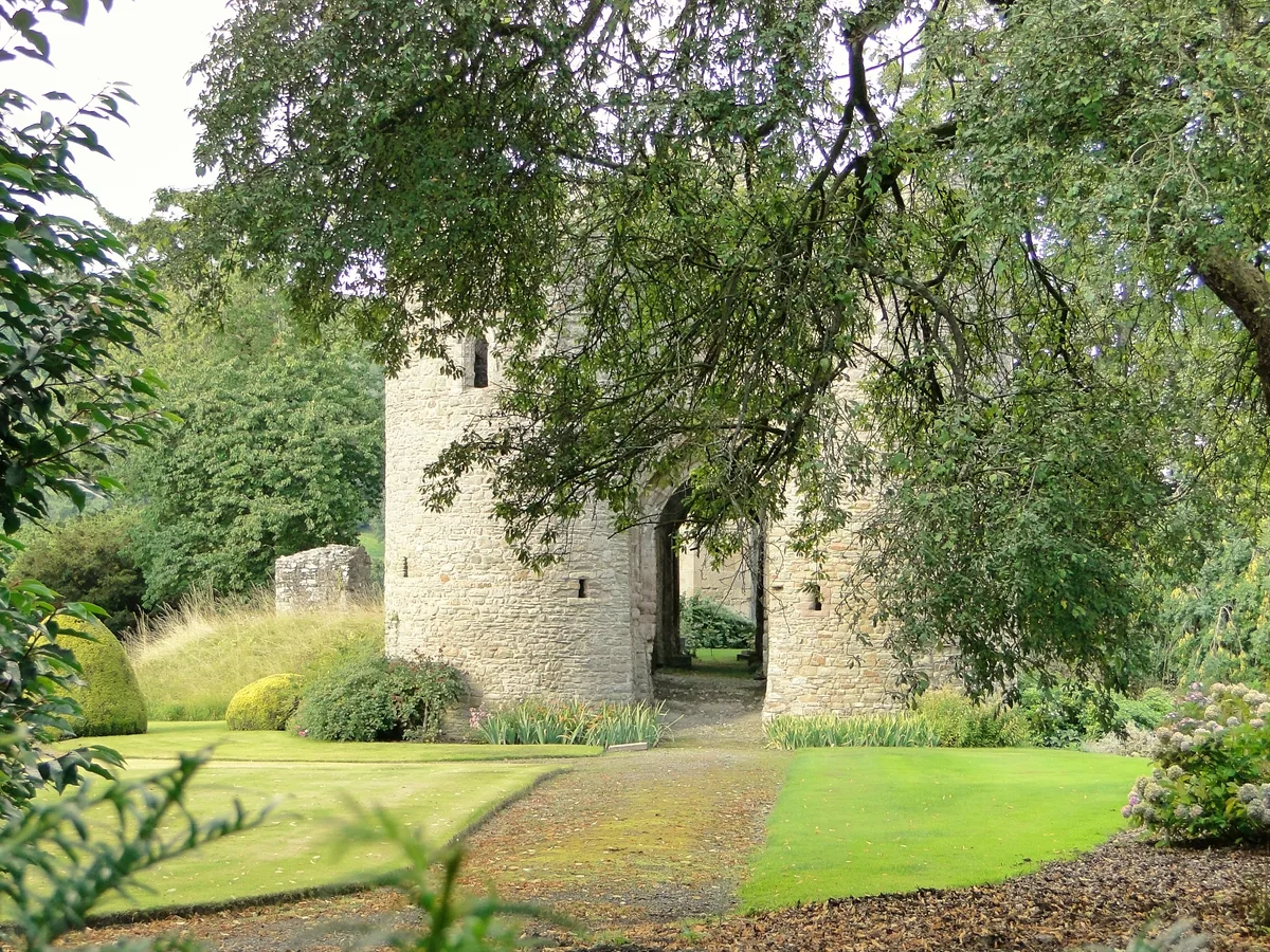
Brampton Bryan Castle
Castles · 2.1 km

Church of St Barnabas, Brampton Bryan
Historic churches · 2.2 km
Wheeler Monument About 3 Yards South Of Weathered Projection Of South Wall Of The Church Of St Barnabus
Memorials & monuments · 2.2 km

Bucknell Hill
Mountains & hills · 2.2 km
Nearby
📷 5📷 5Historic houses · Mid Wales
Bucknell railway station
Bucknell railway station in Wales Mid, United Kingdom.
📷 5📷 4Memorials & monuments · Mid Wales
Multiple enclosure hillfort on Coxall Knoll
Multiple enclosure hillfort on Coxall Knoll in Wales Mid, United Kingdom.
📷 5Mountains & hills · Mid Wales
Bucknell Wood Hill
Bucknell Wood Hill — a hill or mountain in wales mid.
📷 3Historic bridges · Mid Wales
Bridge Over River Redlake About 40 Yards South Of Coxall
Bridge Over River Redlake About 40 Yards South Of Coxall — Grade II listed building-listed bridge in wales-mid, United Kingdom.
Where to eat & stay near Bucknell
Places to stay
 📷 5
📷 5 📷 5
📷 5Caravan parks · Mid Wales
Chapel Lawn Farm Campsite
Chapel Lawn Farm Campsite — a caravan park in wales mid.
 📷 5
📷 5Campsites · Mid Wales
Panpwnton Farm
Panpwnton Farm — a campsite in wales mid.
 📷 5
📷 5 📷 5
📷 5 📷 5
📷 5Campsites · Mid Wales
Walcot Hall Caravan & Camping Park
Walcot Hall Caravan & Camping Park — a campsite in wales mid.
Places to eat & drink
 📷 5
📷 5 📷 5
📷 5 📷 4
📷 4 📷 4
📷 4 📷 7
📷 7 📷 7
📷 7Historic pubs · West Midlands
Clive Arms Public House
Clive Arms Public House in England West Midlands, United Kingdom.
More national landscapes in this region
 📷 3
📷 3 📷 5
📷 5 📷 5
📷 5 📷 3
📷 3Frequently asked questions
- Where is Bucknell?
- Bucknell is in Mid Wales, United Kingdom (postcode SY7 0AA), in the parish of Bucknell.
- What is Bucknell?
- Bucknell in Wales Mid, United Kingdom.
- How do I get to Bucknell?
- The nearest railway station is Bucknell, about 0.3 km away. The nearest town is Leintwardine. Drivers can use postcode SY7 0AA.
- Is Bucknell a protected site?
- Yes — Bucknell is part of the River Teme SSSI Site of Special Scientific Interest and the Shropshire Hills National Landscape (AONB).
- Is Bucknell free to visit?
- Yes, Bucknell is free to enter.
- How do I get to Bucknell?
- The nearest railway station is Bucknell, about 0.3 km away. Drivers can navigate to postcode SY7 0AA.