
Historic bridges · North East England
Bridge Approx 350 Yards North Of Belsay Castle
In or near Bolam.
Bridge Approx 350 Yards North Of Belsay Castle — Grade II listed building-listed bridge in scotland-lowlands, United Kingdom.

Chris Gunns — CC BY-SA 2.0 via Wikimedia Commons licence

Plan your visit
- Typical visit
- 15 min–30 min
- Free entry
- Dog-friendly
About
Bridge Approx 350 Yards North Of Belsay Castle is a Grade II listed building-listed bridge in scotland-lowlands, United Kingdom, registered on the National Heritage List for England (NHLE entry 1370666). Listed status protects buildings and structures of special architectural or historic interest. See the linked Wikipedia article for further details.
Photo gallery
Heritage listing
Details BELSAY BELSAY NZ 0878 26/15 Bridge approx 350 yards north of Belsay Castle II Bridge. Mid C18 for Sir William Middleton. Ashlar. Single segmental arch with rusticated voussoirs and projecting keystone. Band at base of parapet. Square stone end piers with pyramidal caps. Arched coping to parapet. Short approach walls, slightly ramped down on north side, end in similar piers. Listing NGR: NZ0851878861 Legacy The contents of this record have been generated from a legacy data system. Legacy System number: 238502 Legacy System: LBS
From the Historic England List Entry under OGL v3.
Protected designations
- Site of Special Scientific Interest: Northumberland Shore SSSI
Designations sourced from Natural England open data under OGL v3.
Place summary
The bridge approximately 350 yards north of Belsay Castle is located in the parish of Belsay, in the Scottish Lowlands. It is designated as a Grade II listed building, recognising its historical significance.
AI-generated from the structured facts on this page (operator, designation, listing, era). Not a substitute for visiting.
- Coordinates
- 55.1041, -1.8680
- District
- Northumberland
- Parish
- Belsay
- Postcode
- NE20 0EZ
- Parliamentary constituency
- Hexham
Sources
- wikidata: Q26651885 (CC0)
Other places nearby

Bridge Approx 440 Yds North-East Of Belsay Castle
Historic bridges · 0.2 km
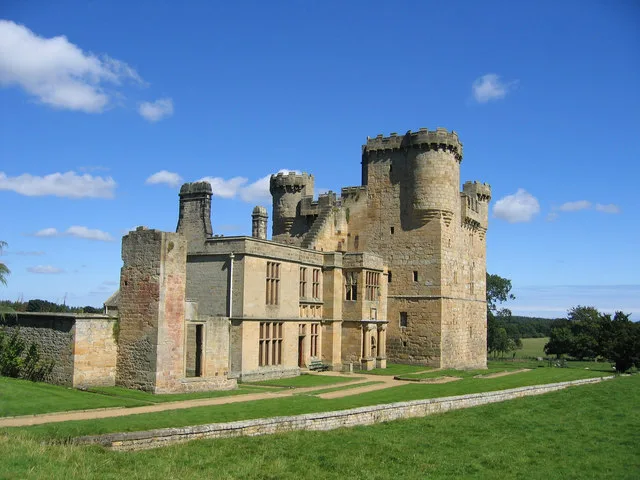
Belsay Castle
Castles · 0.2 km

Belsay Hall
Castles · 0.5 km

Bantam Hill
Vineyards · 0.6 km

Bridge And Gateway Approx 750 Yards West Of Belsay Castle
Historic bridges · 0.8 km

Harnham
Villages · 1.1 km

Belsay
Manor houses · 1.8 km

Bitchfield Tower
Historic houses · 1.9 km

Aruna Ratanagiri
Historic churches · 1.9 km

Harnham Hall
Historic houses · 2.0 km

Bridge Approx 440 Yards East Of Shortflatt Tower
Historic bridges · 2.1 km

Shortflatt Tower
Memorials & monuments · 2.2 km
Nearby
📷 3Historic bridges · North East England
Bridge Approx 440 Yds North-East Of Belsay Castle
Bridge Approx 440 Yds North-East Of Belsay Castle — Grade II listed building-listed bridge in scotland-lowlands, United Kingdom.
📷 3Castles · North East England
Belsay Castle
Belsay Castle — medieval castle ruins in Northumberland, England, UK.
📷 5Castles · North East England
Belsay Hall
Belsay Hall in England North East, United Kingdom.
📷 5Vineyards · North East England
Bantam Hill
Bantam Hill — a UK vineyard in scotland lowlands, producing English or Welsh wine from cool-climate grape varieties.
📷 3Historic bridges · North East England
Bridge And Gateway Approx 750 Yards West Of Belsay Castle
Bridge And Gateway Approx 750 Yards West Of Belsay Castle — Grade II listed building-listed bridge in scotland-lowlands, United Kingdom.
📷 5Where to eat & stay near Bridge Approx 350 Yards North Of Belsay Castle
Places to stay
 📷 5
📷 5Caravan parks · North East England
Elf Hills CL Site
Elf Hills CL Site — a caravan park in scotland lowlands.
 📷 5
📷 5Campsites · North East England
Tranwell Farm Camp Site
Tranwell Farm Camp Site — a campsite in scotland lowlands.
 📷 5
📷 5Campsites · North East England
Selby Woods Scout Campsite
Selby Woods Scout Campsite — a campsite in scotland lowlands.
 📷 5
📷 5Hotels · North East England
DoubleTree by Hilton Newcastle International Airport
DoubleTree by Hilton Newcastle International Airport — a hotel in scotland lowlands. 4-star. Brand: DoubleTree.
 📷 5
📷 5Caravan parks · North East England
Wellhouse Farm Caravan Park
Wellhouse Farm Caravan Park — a caravan park in scotland lowlands.
📷 5Campsites · North East England
Wellhouse Farm Camping site
Wellhouse Farm Camping site — a campsite in scotland lowlands.
Places to eat & drink
 📷 5
📷 5 📷 5
📷 5Historic pubs · North East England
The Seven Stars Public House
The Seven Stars Public House in Scotland Lowlands, United Kingdom.
 📷 5
📷 5Historic pubs · North East England
The Crown And Anchor
The Crown And Anchor in Scotland Lowlands, United Kingdom.
 📷 5
📷 5 📷 5
📷 5 📷 3
📷 3Historic pubs · North East England
Red House Farm
Red House Farm in England North East, United Kingdom.
More bridges in this region
 📷 3
📷 3Historic bridges · North East England
Bridge About 30 Metres South Of The Manor House
Bridge About 30 Metres South Of The Manor House — Grade II listed building-listed bridge in england-yorkshire, United Kingdom.
 📷 3
📷 3Historic bridges · North East England
Old Bridge Over Nor Beck, On East Side Of Road
Old Bridge Over Nor Beck, On East Side Of Road — Grade II listed building-listed bridge in england-yorkshire, United Kingdom.
 📷 3
📷 3Historic bridges · North East England
Barnard Castle Bridge
Barnard Castle Bridge is a historic bridge in the United Kingdom.
 📷 3
📷 3Historic bridges · North East England
Blandswath Bridge
Blandswath Bridge is a historic bridge in the United Kingdom.
Frequently asked questions
- Where is Bridge Approx 350 Yards North Of Belsay Castle?
- Bridge Approx 350 Yards North Of Belsay Castle is in the Scottish Lowlands, United Kingdom (postcode NE20 0EZ), in the parish of Belsay.
- What is Bridge Approx 350 Yards North Of Belsay Castle?
- Bridge Approx 350 Yards North Of Belsay Castle — Grade II listed building-listed bridge in scotland-lowlands, United Kingdom.
- How do I get to Bridge Approx 350 Yards North Of Belsay Castle?
- Drivers can use postcode NE20 0EZ.
- Is Bridge Approx 350 Yards North Of Belsay Castle a listed building?
- Bridge Approx 350 Yards North Of Belsay Castle is officially recognised as Grade II listed building listed.
- Is Bridge Approx 350 Yards North Of Belsay Castle a protected site?
- Yes — Bridge Approx 350 Yards North Of Belsay Castle is part of the Northumberland Shore SSSI Site of Special Scientific Interest.
- Is Bridge Approx 350 Yards North Of Belsay Castle free to visit?
- Yes, Bridge Approx 350 Yards North Of Belsay Castle is free to enter.
- How do I get to Bridge Approx 350 Yards North Of Belsay Castle?
- Drivers can navigate to postcode NE20 0EZ. It sits within the Hexham parliamentary constituency.