
Historic bridges · South West England
Bridge And Village Pump At Sw565319
In or near St Hilary.
Bridge And Village Pump At Sw565319 — Grade II listed building-listed bridge in england-south-west, United Kingdom.

Adrian Dust — CC BY-SA 2.0 via Wikimedia Commons licence
_-_geograph.org.uk_-_7799478.jpg)
Plan your visit
- Typical visit
- 15 min–30 min
- Nearest railway station
- St Erth · 4.5 km
- Free entry
- Dog-friendly
Getting there & planning your visit
The nearest railway station to the Bridge and Village Pump at Sw565319 is St Erth, located 4.5 km away. Entry to the site is free.
About
Bridge And Village Pump At Sw565319 is a Grade II listed building-listed bridge in england-south-west, United Kingdom, registered on the National Heritage List for England (NHLE entry 1143717). Listed status protects buildings and structures of special architectural or historic interest. See the linked Wikipedia article for further details.
Photo gallery
See it from the streetimagery from 2022
Imagery © Mapillary contributors, CC BY-SA 4.0
Heritage listing
Details ST HILARY RELUBBUS SW 53 SE 2/175 Bridge and Village pump at SW565319 GV II Bridge over culvert leading from spring and village pump over the spring. Circa early C19 bridge circa late C19 Bamfords universal pump. Granite rubble and dressed granite. Cast-iron pump. Low parapet on either side of the road. The north parapet has curtailed-on-plan west end with a platform of similar shape on which the iron pump is fastened. Cambered copings to the parapet. The pump is complete, with shaped handle and fluted decoration to the barrel, spout and dome. Beside the pump is an iron bucket stand with an iron grid. Listing NGR: SW5654931916 Legacy The contents of this record have been generated from a legacy data system. Legacy System number: 70079 Legacy System: LBS
From the Historic England List Entry under OGL v3.
Protected designations
- Area of Outstanding Natural Beauty: Cornwall
Designations sourced from Natural England open data under OGL v3.
Place summary
The Bridge and Village Pump at SW565319 is a Grade II listed bridge located in South-West England. It serves as both a functional crossing and a historical feature of the area.
AI-generated from the structured facts on this page (operator, designation, listing, era). Not a substitute for visiting.
- Coordinates
- 50.1372, -5.4083
- District
- Cornwall
- Parish
- St. Hilary
- Postcode
- TR20 9EL
- Parliamentary constituency
- St Ives
- Nearest railway station
- St Erth — 4.5 km
Sources
- wikidata: Q26436568 (CC0)
Other places nearby
Bridge At Sw 566319
Historic bridges · 0.1 km

Chimney (Tregembo Mine)
Historic houses · 0.7 km

Tindene Mine
Historic houses · 0.8 km
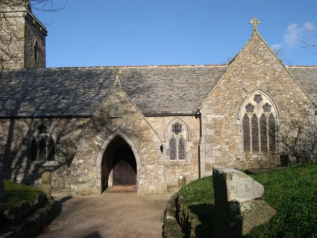
St Hilary Church, Cornwall
Historic churches · 1.6 km

St Hilary's Church, St Hilary, Cornwall
Historic churches · 1.6 km

St Hilary
Towns & cities · 1.6 km

Marazion Caravan & Motorhome club
Caravan parks · 1.7 km
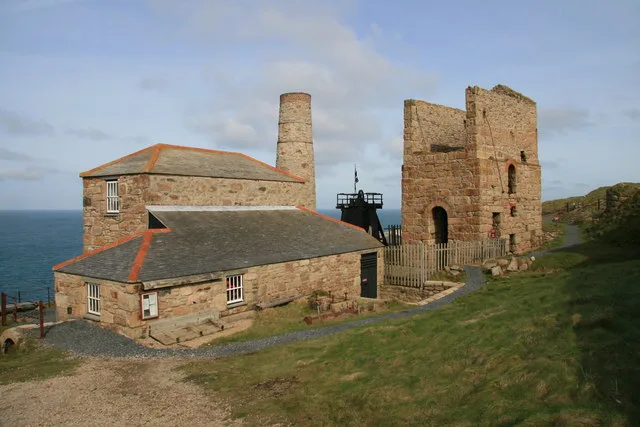
Cornwall and West Devon Mining Landscape
UNESCO World Heritage · 1.8 km

Countess Bridge At Sw 566337
Historic bridges · 1.8 km

Wheal Junket (West Godolphin Mine)
Historic houses · 1.9 km

Goldsithney
Historic churches · 2.3 km

Saint Hilary
Villages · 2.4 km
Nearby
📷 3Historic bridges · South West England
Bridge At Sw 566319
Bridge At Sw 566319 — Grade II listed building-listed bridge in england-south-west, United Kingdom.
📷 5Historic houses · South West England
Chimney (Tregembo Mine)
Chimney (Tregembo Mine) — a historic house in england-south-west, United Kingdom.
📷 3Historic houses · South West England
Tindene Mine
Tindene Mine — a historic house in england-south-west, United Kingdom.
📷 5Historic churches · South West England
St Hilary Church, Cornwall
St Hilary Church, Cornwall — church in Cornwall, England, UK.
📷 5Historic churches · South West England
St Hilary's Church, St Hilary, Cornwall
St Hilary's Church, St Hilary, Cornwall — a other in england-south-west, United Kingdom.
📷 5Where to eat & stay near Bridge And Village Pump At Sw565319
Places to stay
📷 5Caravan parks · South West England
Marazion Caravan & Motorhome club
Marazion Caravan & Motorhome club — a caravan park in england south west.
 📷 5
📷 5Campsites · South West England
Trevessa Farm Certificated Site
Trevessa Farm Certificated Site — a campsite in england south west.
 📷 5
📷 5Campsites · South West England
Keneggy Cove Holiday Park
Keneggy Cove Holiday Park — a campsite in england south west.
 📷 5
📷 5Campsites · South West England
Higher Pentreath
Higher Pentreath — a campsite in england south west.
 📷 5
📷 5 📷 5
📷 5Caravan parks · South West England
Praa Sands Holiday Park
Praa Sands Holiday Park — a caravan park in england south west.
Places to eat & drink
 📷 5
📷 5Historic pubs · South West England
The Bucket of Blood
The Bucket of Blood in England South West, United Kingdom.
 📷 7
📷 7Historic pubs · South West England
The Pendarves Arms
The Pendarves Arms in England South West, United Kingdom.
 📷 7
📷 7Restaurants · South West England
The Old Lifeboat House Bistro
The Old Lifeboat House Bistro — a restaurant in england south west. Cuisine: seafood.
 📷 5
📷 5Historic pubs · South West England
First And Last Inn
First And Last Inn in England South West, United Kingdom.
 📷 5
📷 5 📷 5
📷 5Historic pubs · South West England
The Sloop Inn
The Sloop Inn in England South West, United Kingdom.
More bridges in this region
 📷 5
📷 5Historic bridges · South West England
Avoncliff Aqueduct
Avoncliff Aqueduct is a historic bridge in the United Kingdom.
📷 5Historic bridges · South West England
Avoncliff Aqueduct
Avoncliff Aqueduct is a historic bridge in the United Kingdom.
 📷 5
📷 5Historic bridges · South West England
Bradford Viaduct
Bradford Viaduct is a historic bridge in the United Kingdom.
 📷 5
📷 5Historic bridges · South West England
Chippenham Viaduct
Chippenham Viaduct is a historic bridge in the United Kingdom.
Frequently asked questions
- Where is Bridge And Village Pump At Sw565319?
- Bridge And Village Pump At Sw565319 is in South-West England, United Kingdom (postcode TR20 9EL), in the parish of St. Hilary.
- What is Bridge And Village Pump At Sw565319?
- Bridge And Village Pump At Sw565319 — Grade II listed building-listed bridge in england-south-west, United Kingdom.
- How do I get to Bridge And Village Pump At Sw565319?
- The nearest railway station is St Erth, about 4.5 km away. The nearest town is St Hilary. Drivers can use postcode TR20 9EL.
- Is Bridge And Village Pump At Sw565319 a listed building?
- Bridge And Village Pump At Sw565319 is officially recognised as Grade II listed building listed.
- Is Bridge And Village Pump At Sw565319 a protected site?
- Yes — Bridge And Village Pump At Sw565319 is part of the Cornwall National Landscape (AONB).
- Is Bridge And Village Pump At Sw565319 free to visit?
- Yes, Bridge And Village Pump At Sw565319 is free to enter.
- How do I get to Bridge And Village Pump At Sw565319?
- The nearest railway station is St Erth, about 4.5 km away. Drivers can navigate to postcode TR20 9EL.