
Historic houses · North West England
Branthwaite Hall
In or near Greysouthen.
Branthwaite Hall — a Grade I-listed historic house in scotland-lowlands, United Kingdom.

Alex McGregor — CC BY-SA 2.0 via Wikimedia Commons licence

Plan your visit
- Typical visit
- 1 h–2 h
- Nearest railway station
- Harrington · 7.5 km
- Family-friendly
- Limited wheelchair access
Getting there & planning your visit
To visit Branthwaite Hall, the nearest railway station is Harrington, located 7.5 km away. The postcode for sat-nav is CA14 4TL. Accessibility is limited for wheelchair users.
About
Branthwaite Hall is a Grade I-listed building in scotland-lowlands, United Kingdom. Grade I status is conferred by Historic England (or Cadw, Historic Environment Scotland or NIEA equivalents) on buildings of exceptional national interest. See the linked Wikipedia article for full historical and architectural details.
Photo gallery
Protected designations
- Site of Special Scientific Interest: River Derwent and Tributaries SSSI
Designations sourced from Natural England open data under OGL v3.
From the Wikipedia article
Branthwaite Hall is pele tower in Cumbria, England, considered by historian Anthony Emery to be "one of the best-preserved early houses in Cumbria".
Excerpt from Wikipedia under CC BY-SA 4.0. See the source article linked in Sources below.
Background
History
Branthwaite Hall was built near the village of Branthwaite and the town of Cockermouth in the mid-15th century by the Skelton family, who acquired the surrounding manor from the Branthwaites by marriage. The new building was constructed from rubble stone with a single tower with a parapet and a spiral-stair turret, with an adjacent hall. The hall was 60 feet long and 42 wide (18 metres by 13 metres), but was largely remodelled in 1604; the new hall is a single space, whereas it was probably originally subdivided, and additional windows were added. Subsequent work was conducted in the 1670s to give the property a grander appearance. The Skeltons held the hall until 1757. It was designated as…
Visiting
Branthwaite Hall was restored between 1985 and 1986 by the National Coal Board, which converted the property into offices. It is considered by historian Anthony Emery to be "one of the best-preserved early houses in Cumbria".
Sourced from Wikipedia under CC BY-SA 4.0.
- Coordinates
- 54.6145, -3.4490
- District
- Cumberland
- Parish
- Dean
- Postcode
- CA14 4TL
- Parliamentary constituency
- Whitehaven and Workington
- Nearest railway station
- Harrington — 7.5 km
Sources
- wikidata: Q4957669 (CC0)
- wikipedia: Branthwaite Hall (CC BY-SA 4.0)
Other places nearby
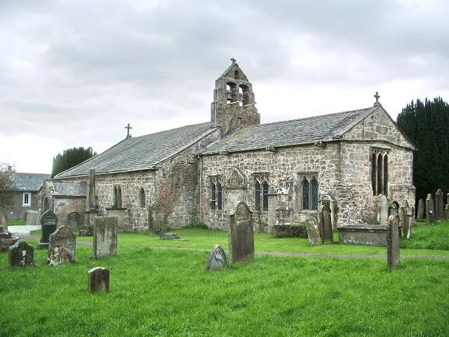
St Oswald's Church, Dean
Historic churches · 0.6 km

Dean
Villages · 1.4 km

Gatebarrow
Mountains & hills · 1.4 km

Ullock
Villages · 2.1 km

Foulknott Hill
Mountains & hills · 2.2 km

Branthwaite Edge
Mountains & hills · 2.2 km
Branthwaite Edge
Mountains & hills · 2.2 km

Mockerkin
Villages · 3.2 km

Ox Hill
Mountains & hills · 3.6 km

Crag Hills
Mountains & hills · 3.7 km
Crag Hills
Mountains & hills · 3.7 km

Pardshaw Crag
Mountains & hills · 3.7 km
Nearby
📷 5Historic churches · North West England
St Oswald's Church, Dean
St Oswald's Church, Dean — church in Dean, Cumbria, England, UK.
📷 5📷 5Mountains & hills · North West England
Gatebarrow
Gatebarrow — mountain in scotland lowlands. Elevation: 102 m.
📷 5📷 5Mountains & hills · North West England
Foulknott Hill
Foulknott Hill — mountain in scotland lowlands. Elevation: 121 m.
📷 5Mountains & hills · North West England
Branthwaite Edge
Branthwaite Edge — a hill or mountain in england north east.
Where to eat & stay near Branthwaite Hall
Places to stay
 📷 5
📷 5Caravan parks · North West England
Nepgill Park
Nepgill Park — a caravan park in scotland lowlands.
 📷 5
📷 5Caravan parks · North West England
Inglenook Caravan Park
Inglenook Caravan Park — a caravan park in england north east.
 📷 5
📷 5Caravan parks · North West England
Brigham Holiday Park
Brigham Holiday Park — a caravan park in scotland lowlands.
 📷 5
📷 5Hostels · North West England
Swallow Barn
Swallow Barn — a hostel in england north east.
 📷 5
📷 5Hotels · North West England
The Green Dragon Hotel
The Green Dragon Hotel — a hotel in scotland lowlands.
 📷 5
📷 5Caravan parks · North West England
Violet Bank holiday Home Park
Violet Bank holiday Home Park — a caravan park in scotland lowlands.
Places to eat & drink
 📷 5
📷 5Historic pubs · North West England
Fox and Grapes
Fox and Grapes in England North West, United Kingdom.
 📷 7
📷 7Historic pubs · North West England
The Pheasant Inn
The Pheasant Inn in Scotland Lowlands, United Kingdom.
 📷 5
📷 5 📷 7
📷 7Cafés · North West England
Grange Bridge Cottage
Grange Bridge Cottage — a café in england north east.
More historic houses in this region
 📷 3
📷 3Historic houses · North West England
116 Hospital Street, Nantwich
116 Hospital Street, Nantwich — substantial townhouse in Nantwich, Cheshire, England, UK.
 📷 3
📷 3Historic houses · North West England
140–142 Hospital Street, Nantwich
140–142 Hospital Street, Nantwich — grade II listed building in Nantwich, Cheshire East, Cheshire, England, UK.
 📷 3
📷 3Historic houses · North West England
46 High Street, Nantwich
46 High Street, Nantwich — house in Nantwich, Cheshire, England, UK.
 📷 3
📷 3Historic houses · North West England
64, St Ann's Road
64, St Ann's Road — Grade II* listed house in Middlewich, Cheshire East, England, UK.
Frequently asked questions
- Where is Branthwaite Hall?
- Branthwaite Hall is in North-West England, United Kingdom (postcode CA14 4TL), in the parish of Dean.
- What is Branthwaite Hall?
- Branthwaite Hall — a Grade I-listed historic house in scotland-lowlands, United Kingdom.
- How do I get to Branthwaite Hall?
- The nearest railway station is Harrington, about 7.5 km away. The nearest town is Greysouthen. Drivers can use postcode CA14 4TL.
- Who owns Branthwaite Hall?
- Branthwaite Hall is owned by | open_to_public =.
- Is Branthwaite Hall a listed building?
- Branthwaite Hall is officially recognised as Grade I listed.
- Is Branthwaite Hall a protected site?
- Yes — Branthwaite Hall is part of the River Derwent and Tributaries SSSI Site of Special Scientific Interest.
- How do I get to Branthwaite Hall?
- The nearest railway station is Harrington, about 7.5 km away. Drivers can navigate to postcode CA14 4TL.