
Archaeological sites · North East England
Bradley Hall fortified house and underground passages, moated site, pillow mound and fishponds
In or near Tow Law Town A.F.C..
Bradley Hall fortified house and underground passages, moated site, pillow mound and fishponds — archaeological site in Wolsingham, County Durham, England, UK.

Wikimedia Commons contributors — see linked file page for photographer and licence licence

Plan your visit
- Typical visit
- 45 min–1.5 h
- Nearest railway station
- Wolsingham · 3.3 km
- Free entry
- Dog-friendly
About
Bradley Hall fortified house and underground passages, moated site, pillow mound and fishponds is an archaeological site in the United Kingdom. Heritage designation: scheduled monument. Wikidata describes it as: "archaeological site in Wolsingham, County Durham, England, UK". Coordinates: 54.7207°, -1.8334°.
Photo gallery
Place summary
Bradley Hall is an archaeological site located in the Scottish Lowlands. It features a fortified house, underground passages, a moated site, a pillow mound, and fishponds. The site is designated as a scheduled monument, highlighting its historical significance.
AI-generated from the structured facts on this page (operator, designation, listing, era). Not a substitute for visiting.
- Coordinates
- 54.7207, -1.8334
- District
- County Durham
- Parish
- Wolsingham
- Postcode
- DL13 3JJ
- Parliamentary constituency
- Bishop Auckland
- Nearest railway station
- Wolsingham — 3.3 km
Sources
- wikidata: Q17664460 (CC0)
- commons: Bradley Hall - geograph.org.uk - 1313975.jpg (CC BY-SA 4.0)
Other places nearby

Bradley Burn bridge
Historic bridges · 0.2 km

Bradley Burn Farm Touring site
Caravan parks · 0.4 km

Snipe Gate Bridge
Historic bridges · 1.2 km

Harperley railway station
Historic houses · 1.6 km

Knitsley Fell
Mountains & hills · 1.8 km

Craigside
Other places · 1.9 km
Harperley Camp (WW2 POW camp)
Natural landmarks · 2.0 km
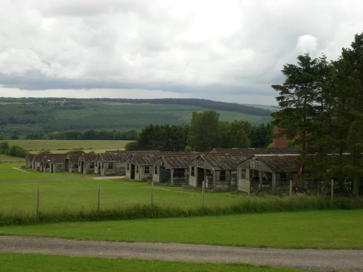
Harperley POW Camp 93
Hill forts · 2.0 km

Harperley Camp
Archaeological sites · 2.2 km

Tow Law War Memorial
Memorials & monuments · 2.7 km

Helme Park Pit
Archaeological sites · 3.0 km

The Paddock Touring Park
Caravan parks · 3.0 km
Nearby
📷 3Historic bridges · North East England
Bradley Burn bridge
Bradley Burn bridge is a historic bridge in the United Kingdom.
📷 5Caravan parks · North East England
Bradley Burn Farm Touring site
Bradley Burn Farm Touring site — a caravan park in scotland lowlands.
📷 3Historic bridges · North East England
Snipe Gate Bridge
Snipe Gate Bridge — Grade II listed building-listed bridge in scotland-lowlands, United Kingdom.
📷 4Historic houses · North East England
Harperley railway station
Harperley railway station in England North East, United Kingdom.
📷 5Mountains & hills · North East England
Knitsley Fell
Knitsley Fell — mountain in scotland lowlands. Elevation: 283.6 m.
📷 3Where to eat & stay near Bradley Hall fortified house and underground passages, moated site, pillow mound and fishponds
Places to stay
📷 5Caravan parks · North East England
Bradley Burn Farm Touring site
Bradley Burn Farm Touring site — a caravan park in scotland lowlands.
📷 5Caravan parks · North East England
The Paddock Touring Park
The Paddock Touring Park — a caravan park in scotland lowlands.
 📷 3
📷 3Campsites · North East England
High Shipley Farm Bungalow
High Shipley Farm Bungalow — a campsite in scotland lowlands.
 📷 5
📷 5Caravan parks · North East England
High Doctor Pasture Caravan Park
High Doctor Pasture Caravan Park — a caravan park in scotland lowlands.
 📷 5
📷 5Campsites · North East England
Green Acres Hamsterley
Green Acres Hamsterley — a campsite in scotland lowlands.
 📷 5
📷 5Caravan parks · North East England
Holebeck Touring Caravan Park
Holebeck Touring Caravan Park — a caravan park in scotland lowlands.
Places to eat & drink
 📷 5
📷 5Historic pubs · North East England
Black Bull Public House
Black Bull Public House in Scotland Lowlands, United Kingdom.
 📷 3
📷 3 📷 5
📷 5Historic pubs · North East England
Bay Horse Public House
Bay Horse Public House in Scotland Lowlands, United Kingdom.
 📷 5
📷 5Historic pubs · North East England
Coopers Public House
Coopers Public House in Scotland Lowlands, United Kingdom.
 📷 5
📷 5Historic pubs · North East England
5, Market Place
5, Market Place in Scotland Lowlands, United Kingdom.
📷 5Cafés · North East England
Breaking Bread Kitchen and Bakehouse
Breaking Bread Kitchen and Bakehouse — a café in scotland lowlands.
More archaeological sites in this region
 📷 5
📷 5Archaeological sites · North East England
Medieval Manorial Site of Low Dinsdale
Medieval Manorial Site of Low Dinsdale — archaeological in england yorkshire.
 📷 3
📷 3Archaeological sites · North East England
Old Smelting Mill
Old Smelting Mill — a archaeological in england-north-west, United Kingdom.
 📷 5
📷 5Archaeological sites · North East England
Roper Castle or Round Table (Roman Signal Station)
Roper Castle or Round Table (Roman Signal Station) — archaeological in england north west.
 📷 5
📷 5Archaeological sites · North East England
Nine Standards Rigg
Nine Standards Rigg — archaeological in england north west. Elevation: 662 m.
Frequently asked questions
- Where is Bradley Hall fortified house and underground passages, moated site, pillow mound and fishponds?
- Bradley Hall fortified house and underground passages, moated site, pillow mound and fishponds is in the Scottish Lowlands, United Kingdom (postcode DL13 3JJ), in the parish of Wolsingham.
- What is Bradley Hall fortified house and underground passages, moated site, pillow mound and fishponds?
- Bradley Hall fortified house and underground passages, moated site, pillow mound and fishponds — archaeological site in Wolsingham, County Durham, England, UK.
- How do I get to Bradley Hall fortified house and underground passages, moated site, pillow mound and fishponds?
- The nearest railway station is Wolsingham, about 3.3 km away. Drivers can use postcode DL13 3JJ.
- Is Bradley Hall fortified house and underground passages, moated site, pillow mound and fishponds a listed building?
- Bradley Hall fortified house and underground passages, moated site, pillow mound and fishponds is officially recognised as scheduled monument listed.
- Is Bradley Hall fortified house and underground passages, moated site, pillow mound and fishponds free to visit?
- Yes, Bradley Hall fortified house and underground passages, moated site, pillow mound and fishponds is free to enter.
- How do I get to Bradley Hall fortified house and underground passages, moated site, pillow mound and fishponds?
- The nearest railway station is Wolsingham, about 3.3 km away. Drivers can navigate to postcode DL13 3JJ.