
Forests & woodlands · South West England
Bowling Green Marsh
In or near Kenton.
Bowling Green Marsh is a forest or woodland in the United Kingdom.

Wikimedia Commons contributors — see linked file page for photographer and licence licence

Plan your visit
- Typical visit
- 1 h–3 h
- Nearest railway station
- Topsham · 1.0 km
- Free entry
- Family-friendly
- Dog-friendly
- Wheelchair accessible
Getting there & planning your visit
To visit Bowling Green Marsh, the nearest railway station is Topsham, located 1 km away. The postcode for sat-nav is EX3 0FP, and entry is free. The site is wheelchair accessible.
About
Bowling Green Marsh is a named forest, woodland or nature reserve in the United Kingdom. Coordinates: 50.6786°, -3.4550°. This entry is part of The Great Britain Guide, a free, ad-free, open-data tourist directory.
Photo gallery
Protected designations
- Site of Special Scientific Interest: Exe Estuary SSSI
- Ramsar wetland: Exe Estuary
Designations sourced from Natural England open data under OGL v3.
From the Wikipedia article
Bowling Green Marsh is a nature reserve located on the confluence of the River Exe (at the top end of its estuary) and the River Clyst, near the town of Topsham in Devon. It is managed by the RSPB. Migratory birds including Siberian brent geese, come to the marsh in the winter to feed. It is a major point of interest for birders across South West Britain, with many rare species present at any one time. Other visitors include osprey, wigeon, teal, avocet and black-tailed godwit, and many other waders. Several fish species inhabit the marsh's many pools. Otters have been sighted here, as well. There is a wheelchair-accessible bird hide on the marshes and a viewing platform, reached by steps, with views down the estuary. Occasionally, very rare vagrants, such as Barrow's goldeneye or king eider, stop at the marshes on their migration.
Excerpt from Wikipedia under CC BY-SA 4.0. See the source article linked in Sources below.
- Coordinates
- 50.6786, -3.4550
- County
- Devon
- District
- Exeter
- Parish
- Exeter, unparished area
- Postcode
- EX3 0FP
- Parliamentary constituency
- Exmouth and Exeter East
- Nearest railway station
- Topsham — 1 km
- Opening
- | website = {{URL|rspb.org.uk/reserves/guide/b/bowlinggreenmarsh}}
- Official site
- www.rspb.org.uk
Sources
- osm: r7587952 (ODbL)
- wikipedia: RSPB Bowling Green Marsh (CC BY-SA 4.0)
- commons: Bowling Green Marsh - geograph.org.uk - 264749.jpg (CC BY-SA 4.0)
Other places nearby
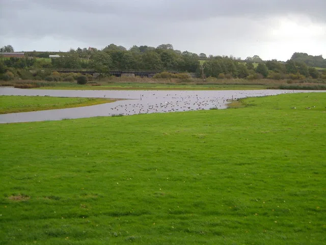
Bowling Green Marsh RSPB reserve
Wildlife reserves · 0.1 km

River Clyst
Museums · 0.2 km
_Including_The_Garage_The_Dutch_House.jpg?width=1200)
The Dutch House
Historic houses · 0.5 km

Wall and Piers of No 40
Holy wells · 0.5 km

34 The Strand
Historic houses · 0.5 km

28 The Strand
Historic houses · 0.5 km

27 The Strand
Historic houses · 0.5 km

Wall and Gates of No 27
Holy wells · 0.5 km

Wall and Gates of No 26
Holy wells · 0.6 km
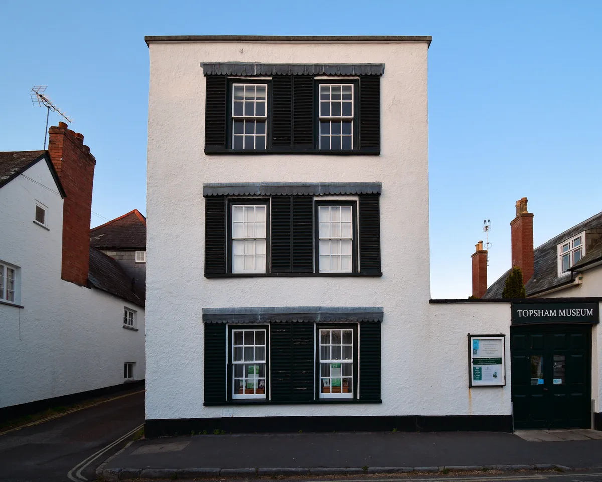
Topsham Museum
Museums · 0.6 km

Shell House
Historic houses · 0.6 km

Route 2 Cafe Bar
Cafés · 0.7 km
Nearby
📷 5Wildlife reserves · South West England
Bowling Green Marsh RSPB reserve
Bowling Green Marsh RSPB reserve — RSPB nature reserve in the United Kingdom.
📷 5Museums · South West England
River Clyst
River Clyst — a museum in england-south-west, United Kingdom.
📷 3Historic houses · South West England
The Dutch House
The Dutch House — house in Topsham, Devon, England, UK.
📷 3Holy wells · South West England
Wall and Piers of No 40
Wall and Piers of No 40 — wall in Topsham, Devon, England, UK.
📷 5Historic houses · South West England
34 The Strand
34 The Strand — house in Exeter, Devon, England, UK.
📷 5Historic houses · South West England
28 The Strand
28 The Strand — house in Exeter, Devon, England, UK.
Where to eat & stay near Bowling Green Marsh
Places to stay
 📷 5
📷 5 📷 5
📷 5Caravan parks · South West England
Courtbrook Farm CL
Courtbrook Farm CL — a caravan park in england south west.
 📷 5
📷 5Hostels · South West England
Rydon Bed & Breakfast
Rydon Bed & Breakfast — a hostel in england south west.
 📷 5
📷 5B&Bs · South West England
The Blue Ball
The Blue Ball — a bed-and-breakfast in england south west.
 📷 5
📷 5 📷 5
📷 5Places to eat & drink
📷 7Cafés · South West England
Route 2 Cafe Bar
Route 2 Cafe Bar — a café in england south west.
 📷 7
📷 7 📷 7
📷 7Historic pubs · South West England
Passage House Inn
Passage House Inn in England South West, United Kingdom.
 📷 5
📷 5Restaurants · South West England
Denley's Essence of India
Denley's Essence of India — a restaurant in england south west. Cuisine: indian.
 📷 5
📷 5Restaurants · South West England
The Swan's Nest
The Swan's Nest — a restaurant in england south west.
 📷 7
📷 7Restaurants · South West England
Beefeater
Beefeater — a restaurant in england south west. Cuisine: british. Brand: Beefeater.
More forests in this region
 📷 5
📷 5Forests & woodlands · South West England
Avebury Stone Circle
Avebury Stone Circle is a forest or woodland in the United Kingdom.
 📷 5
📷 5Forests & woodlands · South West England
Bowerchalke Downs SSSI
Bowerchalke Downs SSSI is a forest or woodland in the United Kingdom.
 📷 5
📷 5Forests & woodlands · South West England
Broadcroft Quarry Butterfly Reserve
Broadcroft Quarry Butterfly Reserve is a forest or woodland in the United Kingdom.
 📷 5
📷 5Forests & woodlands · South West England
Chickengrove Bottom SSSI
Chickengrove Bottom SSSI is a forest or woodland in the United Kingdom.
Frequently asked questions
- Where is Bowling Green Marsh?
- Bowling Green Marsh is in Devon, South-West England, United Kingdom (postcode EX3 0FP), in the parish of Exeter, unparished area.
- What is Bowling Green Marsh?
- Bowling Green Marsh is a forest or woodland in the United Kingdom.
- How do I get to Bowling Green Marsh?
- The nearest railway station is Topsham, about 1.0 km away. Drivers can use postcode EX3 0FP.
- Who owns Bowling Green Marsh?
- Bowling Green Marsh is owned by RSPB.
- Is Bowling Green Marsh a protected site?
- Yes — Bowling Green Marsh is part of the Exe Estuary SSSI Site of Special Scientific Interest and the Exe Estuary Ramsar wetland.
- Is Bowling Green Marsh free to visit?
- Yes, Bowling Green Marsh is free to enter.
- How do I get to Bowling Green Marsh?
- The nearest railway station is Topsham, about 1.0 km away. Drivers can navigate to postcode EX3 0FP.