
Museums · North West England
Borough of Pendle
In or near Foulridge.
Pendle is a local government district with borough status in Lancashire, England. The council is based in Nelson, the borough's largest town. The borough also includes the towns of Barnoldswick, Brier

Colin Pyle — CC BY-SA 2.0 via Wikimedia Commons licence

Plan your visit
- Typical visit
- 1.5 h–3 h
- Best time of year
- Year-round
- Nearest railway station
- Colne · 2.0 km
- Family-friendly
- Limited wheelchair access
Getting there & planning your visit
To visit the Borough of Pendle, the nearest railway station is Colne, located 2 km away. The postcode for navigation is BB8 7AU. Please note that wheelchair accessibility is limited.
About
Pendle is a local government district with borough status in Lancashire, England. The council is based in Nelson, the borough's largest town. The borough also includes the towns of Barnoldswick, Brierfield, Colne and Earby along with the surrounding villages and rural areas. Part of the borough lies within the Forest of Bowland Area of Outstanding Natural Beauty. The neighbouring districts are Burnley, Ribble Valley, North Yorkshire, Bradford and Calderdale.
Photo gallery
Protected designations
- Site of Special Scientific Interest: South Pennine Moors SSSI
Designations sourced from Natural England open data under OGL v3.
From the Wikipedia article
Pendle is a local government district with borough status in Lancashire, England. The council is based in Nelson, the borough's largest town. The borough also includes the towns of Barnoldswick, Brierfield, Colne and Earby along with the surrounding villages and rural areas. Part of the borough lies within the Forest of Bowland Area of Outstanding Natural Beauty. The neighbouring districts are Burnley, Ribble Valley, North Yorkshire, Bradford and Calderdale.
Excerpt from Wikipedia under CC BY-SA 4.0. See the source article linked in Sources below.
Background
History
The modern local government district of Pendle was created on 1 April 1974 under the Local Government Act 1972. It covered the whole area of seven former districts and parts of another two, all of which were abolished at the same time: The Barnoldswick, Earby and Skipton elements were in the West Riding of Yorkshire prior to 1974. The term West Craven is often used for the area transferred from Yorkshire to Lancashire in 1974. The new district was named Pendle after the hill, forest and river. The district was awarded borough status on 15 September 1976, allowing the chair of the council to take the title of mayor.
Sourced from Wikipedia under CC BY-SA 4.0.
- Coordinates
- 53.8690, -2.1640
- County
- Lancashire
- District
- Pendle
- Parish
- Colne
- Postcode
- BB8 7AU
- Parliamentary constituency
- Pendle and Clitheroe
- Nearest railway station
- Colne — 2 km
Sources
- wikipedia: Borough of Pendle (CC BY-SA 4.0)
Other places nearby

Foulridge
Towns & cities · 0.3 km

Foulridge War Memorial
Memorials & monuments · 0.7 km

Foulridge
Villages · 0.8 km

Pendle Hippodrome Theatre
Theatres · 1.3 km

Alhambra Picture Theatre
Theatres · 1.4 km
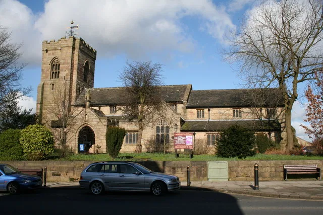
St Bartholomew's Church, Colne
Historic churches · 1.4 km

Pendle Hippodrome
Theatres · 1.4 km

Owl Carving
Public art & sculpture · 1.5 km

The Muni
Theatres · 1.6 km

The Muni
Open-air theatres · 1.6 km

Colne War Memorial
Memorials & monuments · 1.7 km
Wallace Hartley
Memorials & monuments · 1.7 km
Nearby
📷 3Towns & cities · North West England
Foulridge
Foulridge — village and civil parish in Lancashire, England.
📷 3Memorials & monuments · North West England
Foulridge War Memorial
Foulridge War Memorial — Grade II listed building-listed memorial in england-north-west, United Kingdom.
📷 5📷 4Theatres · North West England
Pendle Hippodrome Theatre
Pendle Hippodrome Theatre in England North West, United Kingdom.
📷 3Theatres · North West England
Alhambra Picture Theatre
Alhambra Picture Theatre in England North West, United Kingdom.
📷 3Historic churches · North West England
St Bartholomew's Church, Colne
St Bartholomew's Church, Colne — Grade I listed church in Colne, Pendle, Lancashire, England, UK.
Where to eat & stay near Borough of Pendle
Places to stay
 📷 5
📷 5Campsites · North West England
Lower Greenhill Holiday Park
Lower Greenhill Holiday Park — a campsite in england north west.
 📷 5
📷 5Hostels · North West England
Earby Holiday Hostel
Earby Holiday Hostel — a hostel in england north west.
📷 5Hostels · North West England
Earby Friends of Nature House
Earby Friends of Nature House — a hostel in england north west.
 📷 5
📷 5Campsites · North West England
Bridge Holme Caravan Site
Bridge Holme Caravan Site — a campsite in england north west.
 📷 5
📷 5Campsites · Yorkshire & the Humber
Winter House Farm Campsite
Winter House Farm Campsite — a campsite in england north west.
 📷 5
📷 5Caravan parks · North West England
Holgates Ribble Valley
Holgates Ribble Valley — a caravan park in england north west.
Places to eat & drink
 📷 5
📷 5Historic pubs · North West England
Cross Gaits Inn
Cross Gaits Inn in England North West, United Kingdom.
 📷 5
📷 5 📷 5
📷 5Restaurants · North West England
Fence Gate Inn
Fence Gate Inn — a restaurant in england north west.
📷 5 📷 5
📷 5Historic pubs · North West England
Duke Of York Hotel
Duke Of York Hotel in England North West, United Kingdom.
 📷 5
📷 5More museums in this region
 📷 3
📷 3Museums · North West England
Cube Gallery
Cube Gallery — former architecture museum in Manchester, England.
 📷 3
📷 3Museums · North West England
Cuckooland Museum
Cuckooland Museum — horological museum in England, UK.
 📷 4
📷 4Museums · North West England
Elizabeth Gaskell's House
Elizabeth Gaskell's House — museum in Manchester.
 📷 3
📷 3Museums · North West England
Englesea Brook Chapel and Museum of Primitive Methodism
Englesea Brook Chapel and Museum of Primitive Methodism — Primitive Methodist chapel and museum, United Kingdom.
Frequently asked questions
- Where is Borough of Pendle?
- Borough of Pendle is in Lancashire, North-West England, United Kingdom (postcode BB8 7AU), in the parish of Colne.
- What is Borough of Pendle?
- Pendle is a local government district with borough status in Lancashire, England. The council is based in Nelson, the borough's largest town. The borough also includes the towns of Barnoldswick, Brier
- How do I get to Borough of Pendle?
- The nearest railway station is Colne, about 2.0 km away. Drivers can use postcode BB8 7AU.
- Is Borough of Pendle a protected site?
- Yes — Borough of Pendle is part of the South Pennine Moors SSSI Site of Special Scientific Interest.
- How do I get to Borough of Pendle?
- The nearest railway station is Colne, about 2.0 km away. Drivers can navigate to postcode BB8 7AU.