Mountains & hills · North West England
Blake Rigg
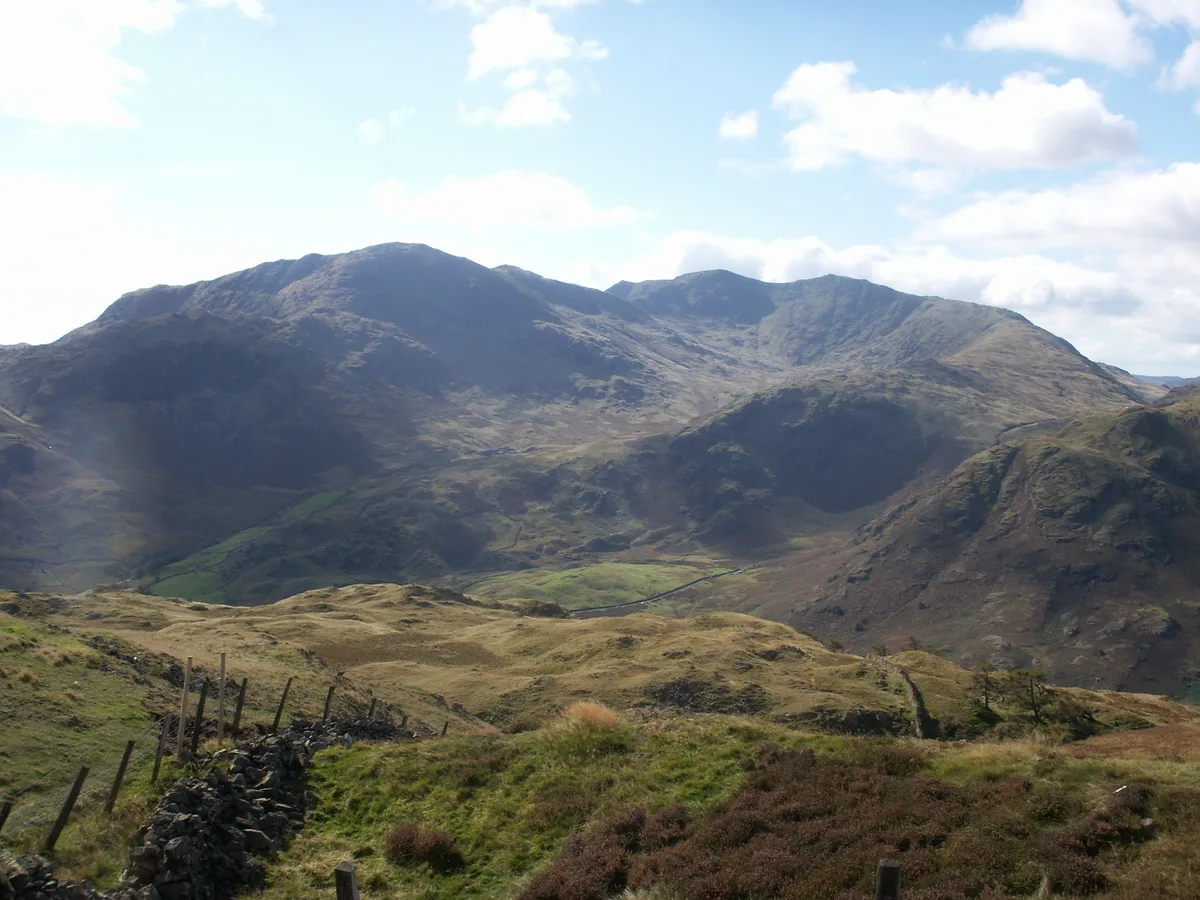
Blake Rigg — mountain in england north west. Elevation: 423 m.

Ian Greig — CC BY-SA 2.0 via Wikimedia Commons licence
Plan your visit
- Typical visit
- 3 h–8 h
- Best time of year
- Late spring – early autumn (May–Oct)
About
Blake Rigg is a mountain located in england north west. Elevation: 423 m. A named British peak recorded in OpenStreetMap. Peaks are typically named on Ordnance Survey 1:50k mapping.
Photo gallery
Place summary
Blake Rigg is a mountain located in North-West England. It is part of the Lake District National Park, known for its rugged terrain and scenic views. The area attracts walkers and climbers, offering various routes suitable for different skill levels. Visitors can expect a natural landscape characterised by rocky outcrops and rich biodiversity.
AI-generated from the structured facts on this page (operator, designation, listing, era). Not a substitute for visiting.
- Coordinates
- 54.4010, -3.0782
Sources
- osm: n4952407982 (ODbL)
Other places nearby
Loading nearby places…
Nearby
 📷 5
📷 5Waterfalls · North West England
Tilberthwaite Gill Waterfall
Tilberthwaite Gill Waterfall — waterfall in england north west.
 📷 3
📷 3Public art & sculpture · North West England
Tilberthwaite Touchstone Fold
Tilberthwaite Touchstone Fold — a public art in england-north-west, United Kingdom.
 📷 5
📷 5Vineyards · North West England
Tilberthwaite
Tilberthwaite — a UK vineyard in england north west, producing English or Welsh wine from cool-climate grape varieties.
 📷 5
📷 5Mountains & hills · North West England
Great Intake - Low Fell
Great Intake - Low Fell — a hill or mountain in england north west.
 📷 3
📷 3Mountains & hills · North West England
Wetherlam
Wetherlam — Named summit at 763 m.
 📷 3
📷 3Natural landmarks · North West England
Wetherlam
Wetherlam — mountain in Cumbria, United Kingdom.
Where to eat & stay near Blake Rigg
Places to stay
 📷 5
📷 5Hostels · North West England
Yorkshire Mountaineering Club Hut
Yorkshire Mountaineering Club Hut — a hostel in england north west.
 📷 5
📷 5Hostels · North West England
YHA Coppermines
YHA Coppermines — a hostel in england north west.
 📷 5
📷 5Hostels · North West England
Coniston Holly How YHA
Coniston Holly How YHA — a hostel in england north west.
 📷 5
📷 5Hotels · North West England
HF Holidays Monk Coniston
HF Holidays Monk Coniston — a hotel in england north west.
 📷 5
📷 5Caravan parks · North West England
Beckthwaite
Beckthwaite — a caravan park in england north west.
 📷 5
📷 5Hotels · North West England
The Coniston Inn
The Coniston Inn — a hotel in england north west.
Places to eat & drink
 📷 5
📷 5Restaurants · North West England
The Terrace Coffee House and Restaurant
The Terrace Coffee House and Restaurant — a restaurant in england north west. Cuisine: sandwich;lunch.
 📷 5
📷 5Historic pubs · North West England
Sun Cottage Sun Inn Public House
Sun Cottage Sun Inn Public House in England North West, United Kingdom.
 📷 5
📷 5Historic pubs · North West England
Church House Public House
Church House Public House in England North West, United Kingdom.
 📷 5
📷 5Historic pubs · North West England
Golden Rule Hotel
Golden Rule Hotel in England North West, United Kingdom.
 📷 5
📷 5Historic pubs · North West England
The Travellers Rest
The Travellers Rest in England North West, United Kingdom.
 📷 5
📷 5Historic pubs · North West England
Holbeck Ghyll
Holbeck Ghyll in England North West, United Kingdom.
More mountains in this region
 📷 3
📷 3Mountains & hills · North West England
Allen Crags
Allen Crags — Named summit at 785 m.
 📷 3
📷 3Mountains & hills · North West England
Alum Pot
Alum Pot — Open shaft pothole in North Yorkshire.
 📷 3
📷 3Mountains & hills · North West England
Arnside Knott
Arnside Knott — Named summit at 159 m.
 📷 3
📷 3Mountains & hills · North West England
Aye Gill Pike
Aye Gill Pike — Named summit at 556.3 m.
Frequently asked questions
- Where is Blake Rigg?
- Blake Rigg is in North-West England, United Kingdom.
- What is Blake Rigg?
- Blake Rigg — mountain in england north west. Elevation: 423 m.
- How do I get to Blake Rigg?
- Its coordinates are 54.4010°, -3.0782°.