
Memorials & monuments · East of England
Black Cat Roundabout
In or near Chawston.
Black Cat Roundabout — Monument, dating to 2004-01.

Wikimedia Commons contributors — see linked file page for photographer and licence licence

Plan your visit
- Typical visit
- 15 min–45 min
- Nearest railway station
- St Neots · 6.6 km
- Free entry
- Dog-friendly
Getting there & planning your visit
To visit the Black Cat Roundabout, the nearest railway station is St Neots, which is 6.6 km away. Entry is free.
About
Black Cat Roundabout is a public memorial or monument in the United Kingdom. Wikidata describes it as: "Monument, dating to 2004-01.". Coordinates: 52.1846°, -0.3053°.
Photo gallery
From the Wikipedia article
Black Cat roundabout (also Black Cat junction) forms the junction between the A1 and A421 (formerly A428) in Bedfordshire, England, just south of St Neots. It has been reconstructed twice since 2000 and, as of 2024, a third reconstruction is underway to completely replace it with a free-flowing junction, and becoming the Black Cat junction. It takes its name from the garage and car repair workshop which opened in the 1920s at the junction called the Black Cat Garage. The garage was later converted to a nightclub and then a restaurant, before becoming derelict for many years. In the 1980s a covered petrol station and hotel was opened on the site. All the buildings in this northwest quadrant of the junction were demolished during the 2024 upgrade. The roundabout can regularly be heard being referred to on traffic reports because of the major traffic jams that it causes on the A1.
Excerpt from Wikipedia under CC BY-SA 4.0. See the source article linked in Sources below.
Background
History
In January 2004, a (two-dimensional) metal sculpture of a black cat was installed on the roundabout, based on the original Black Cat Garage emblem and produced by local fabricators including Watson & Brookman. The installation is widely described as a locally driven initiative rather than a formal highways project. During reconstruction works associated with the Great Barford bypass between 2005 and 2006, the original sculpture was removed and relocated. A larger replacement sculpture was installed following the completion of the works in 2006. This version was stolen in June 2007. A further replacement sculpture was installed in August 2008. In April 2009, the previously stolen sculpture…
Sourced from Wikipedia under CC BY-SA 4.0.
- Coordinates
- 52.1846, -0.3053
- District
- Bedford
- Parish
- Roxton
- Postcode
- MK44 3DY
- Parliamentary constituency
- North Bedfordshire
- Nearest railway station
- St Neots — 6.6 km
Sources
- osm: n3708232771 (ODbL)
- wikipedia: Black Cat roundabout (CC BY-SA 4.0)
- commons: Black Cat Roundabout - geograph.org.uk - 1355737.jpg (CC BY-SA 4.0)
Other places nearby

Tempsford Bridge
Historic bridges · 0.9 km

Parish Church of Saint Mary Magdalen
Historic churches · 1.1 km

Chawston
Towns & cities · 1.1 km

Church Farm House
B&Bs · 1.1 km

Roundhill Barrow
Burial mounds & barrows · 1.1 km

Congregational Chapel
Chapels · 1.2 km

Wyboston
Towns & cities · 1.2 km
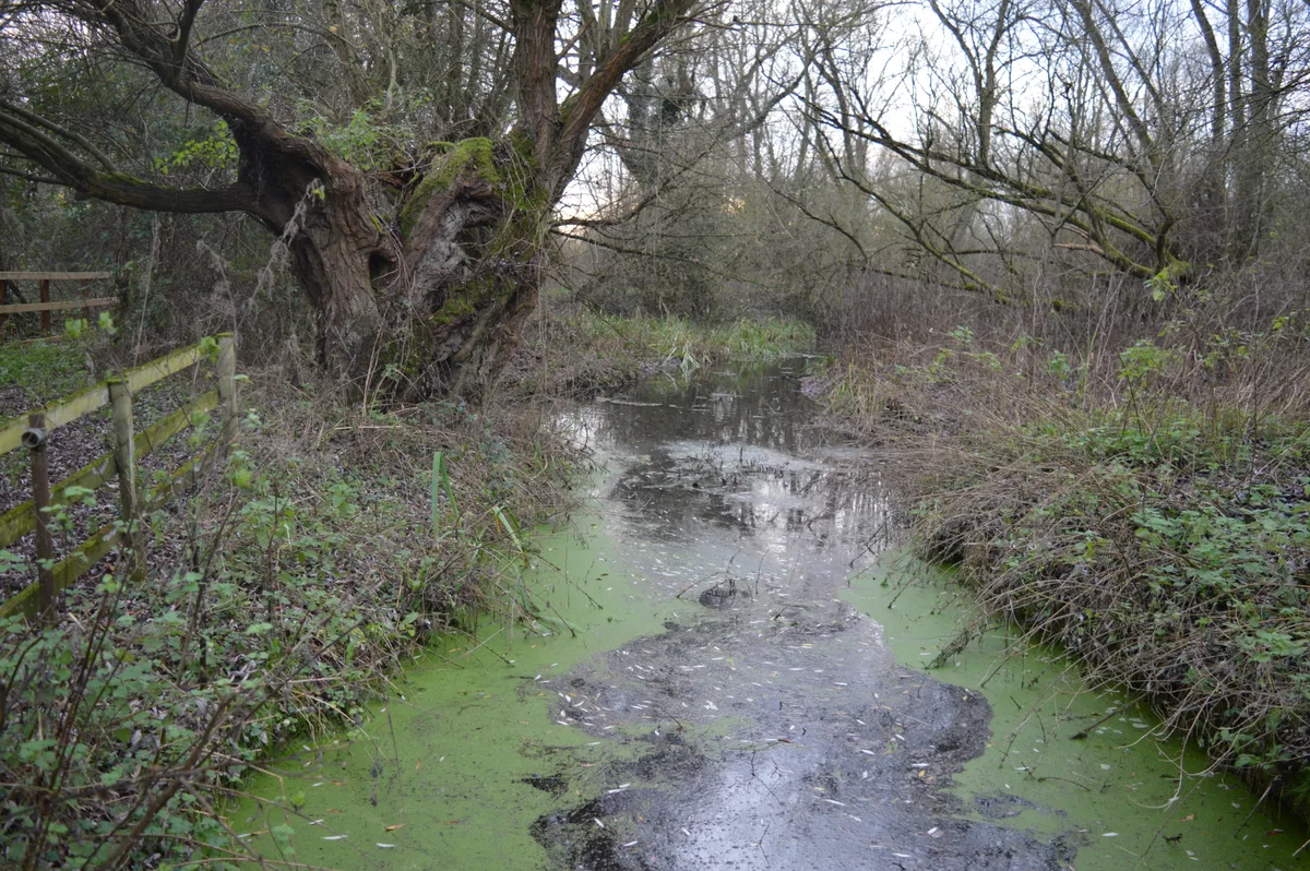
Begwary Brook
Wildlife reserves · 1.4 km

Knotts of Tempsford
Zoos & aquariums · 1.8 km

Tempsford
Museums · 2.0 km

Mossbury Manor
Manor houses · 2.1 km

The Birches
Campsites · 2.2 km
Nearby
📷 5Historic bridges · East of England
Tempsford Bridge
Tempsford Bridge — a Grade II*-listed bridge in england-london, United Kingdom.
📷 5Historic churches · East of England
Parish Church of Saint Mary Magdalen
Parish Church of Saint Mary Magdalen — Grade II* listed building-listed church in england-london, United Kingdom.
📷 5📷 5📷 5Burial mounds & barrows · East of England
Roundhill Barrow
Roundhill Barrow — a burial mound in england-london, United Kingdom.
📷 5Chapels · East of England
Congregational Chapel
Congregational Chapel — chapel in Roxton, Bedfordshire, England, UK.
Where to eat & stay near Black Cat Roundabout
Places to stay
📷 5📷 5 📷 5
📷 5Campsites · East of England
Jordans Close Scout Activity Centre
Jordans Close Scout Activity Centre — a campsite in england london.
 📷 5
📷 5Campsites · East of England
St Neots Camping and Caravanning Club
St Neots Camping and Caravanning Club — a campsite in england london.
 📷 5
📷 5Caravan parks · East of England
St Neots Mobile Home Park
St Neots Mobile Home Park — a caravan park in england london.
 📷 5
📷 5Caravan parks · East of England
Caravan Club Site (members)
Caravan Club Site (members) — a caravan park in england london.
Places to eat & drink
 📷 5
📷 5Historic pubs · East of England
The Anchor Public House
The Anchor Public House in England East, United Kingdom.
 📷 5
📷 5Historic pubs · East of England
Kings Arms Public House
Kings Arms Public House in England East, United Kingdom.
 📷 5
📷 5Historic pubs · East of England
Ye Olde Plough Public House
Ye Olde Plough Public House in England East, United Kingdom.
 📷 5
📷 5Historic pubs · East of England
Duncombe Arms Public House
Duncombe Arms Public House in England East, United Kingdom.
 📷 5
📷 5Historic pubs · East of England
The Plough Public House With Attached Stables And Hayloft
The Plough Public House With Attached Stables And Hayloft in England East, United Kingdom.
 📷 5
📷 5More memorials in this region
 📷 5
📷 5Memorials & monuments · East of England
386th B.G.(M), 9th Air Force USAAF Memorial
386th B.G.(M), 9th Air Force USAAF Memorial is a memorial in the United Kingdom.
 📷 5
📷 5Memorials & monuments · East of England
Ailesbury Mausoleum
Ailesbury Mausoleum is a memorial in the United Kingdom.
 📷 5
📷 5Memorials & monuments · East of England
Archie F. Daniels Memorial
Archie F. Daniels Memorial is a memorial in the United Kingdom.
 📷 5
📷 5Memorials & monuments · East of England
Barnwell War Memorial
Barnwell War Memorial is a memorial in the United Kingdom.
Frequently asked questions
- Where is Black Cat Roundabout?
- Black Cat Roundabout is in London, United Kingdom (postcode MK44 3DY), in the parish of Roxton.
- What is Black Cat Roundabout?
- Black Cat Roundabout — Monument, dating to 2004-01.
- How do I get to Black Cat Roundabout?
- The nearest railway station is St Neots, about 6.6 km away. Drivers can use postcode MK44 3DY.
- Is Black Cat Roundabout free to visit?
- Yes, Black Cat Roundabout is free to enter.
- How do I get to Black Cat Roundabout?
- The nearest railway station is St Neots, about 6.6 km away. Drivers can navigate to postcode MK44 3DY.