
Museums · South East England
Bisley, Surrey
In or near Chobham.
Bisley is a village and civil parish in the Borough of Surrey Heath in Surrey, England, approximately 25 miles (40 km) southwest of central London. It is midway between Woking (to the east) and Cambe

Alan Hunt — CC BY-SA 2.0 via Wikimedia Commons licence

Plan your visit
- Typical visit
- 1.5 h–3 h
- Best time of year
- Year-round
- Nearest railway station
- Brookwood · 3.0 km
- Family-friendly
- Limited wheelchair access
Getting there & planning your visit
To visit Bisley, Surrey, you can reach it via the nearest railway station, Brookwood, which is 3 km away. The postcode for navigation is GU24 9EJ. Please note that wheelchair accessibility is limited.
About
Bisley is a village and civil parish in the Borough of Surrey Heath in Surrey, England, approximately 25 miles (40 km) southwest of central London. It is midway between Woking (to the east) and Camberley (to the west). The village had a population of 3,965 in the 2011 Census. Much of the west of the parish is covered by an acidic heath, which is used by the Ministry of Defence. The National Shooting Centre, headquarters of the National Rifle Association, is within the historic bounds. Coldingley Men's Prison is also in the village. The village is close to junction 3 of the M3 motorway. The nearest railway station is at Brookwood, on the South West Main Line. Bisley is one of 14 parishes in the U.K. to contain a detached portion or exclave.
Photo gallery
Protected designations
- Site of Special Scientific Interest: Basingstoke Canal SSSI
- Site of Special Scientific Interest: Colony Bog and Bagshot Heath SSSI
Designations sourced from Natural England open data under OGL v3.
From the Wikipedia article
Bisley is a village and civil parish in the Borough of Surrey Heath in Surrey, England, approximately 25 miles (40 km) southwest of central London. It is midway between Woking (to the east) and Camberley (to the west). The village had a population of 3,965 in the 2011 Census. Much of the west of the parish is covered by an acidic heath, which is used by the Ministry of Defence. The National Shooting Centre, headquarters of the National Rifle Association, is within the historic bounds. Coldingley Men's Prison is also in the village. The village is close to junction 3 of the M3 motorway. The nearest railway station is at Brookwood, on the South West Main Line. Bisley is one of 14 parishes in the U.K. to contain a detached portion or exclave.
Excerpt from Wikipedia under CC BY-SA 4.0. See the source article linked in Sources below.
Background
History
The name 'Bisley' was first recorded in the 10th century as 'Busseleghe'. Its manor was from earliest written records under the feudal lordship of Chertsey Abbey as part of Godley Hundred. It is derived from the old English words 'Bysc', meaning bushes, and 'Leah', a clearing. Therefore, it means clearing where bushes grow or in the bushes. The versions recorded in the 13th century were Busheley and Bussley, from such Westminster and Lambeth Palace rolls as the Assize Rolls. In medieval times, the village continued to be the southern holding of the Chertsey Abbey estate. The late 12th century church (much of its nave), St John the Baptist, was invested as a proper church in the village by…
Sourced from Wikipedia under CC BY-SA 4.0.
- Coordinates
- 51.3300, -0.6400
- County
- Surrey
- District
- Surrey Heath
- Parish
- Bisley
- Postcode
- GU24 9EJ
- Parliamentary constituency
- Surrey Heath
- Nearest railway station
- Brookwood — 3 km
- Official site
- web.archive.org
Sources
- wikipedia: Bisley, Surrey (CC BY-SA 4.0)
Other places nearby

Bisley War Memorial
Memorials & monuments · 0.3 km

St John the Baptist's Well
Historic churches · 0.8 km

Mizen's Railway
Theme parks · 1.9 km
Dübs 3819
Memorials & monuments · 1.9 km

Bisley Clock Tower
Memorials & monuments · 2.2 km

Maple Acre
Campsites · 2.3 km

NRA Museum
Museums · 2.3 km
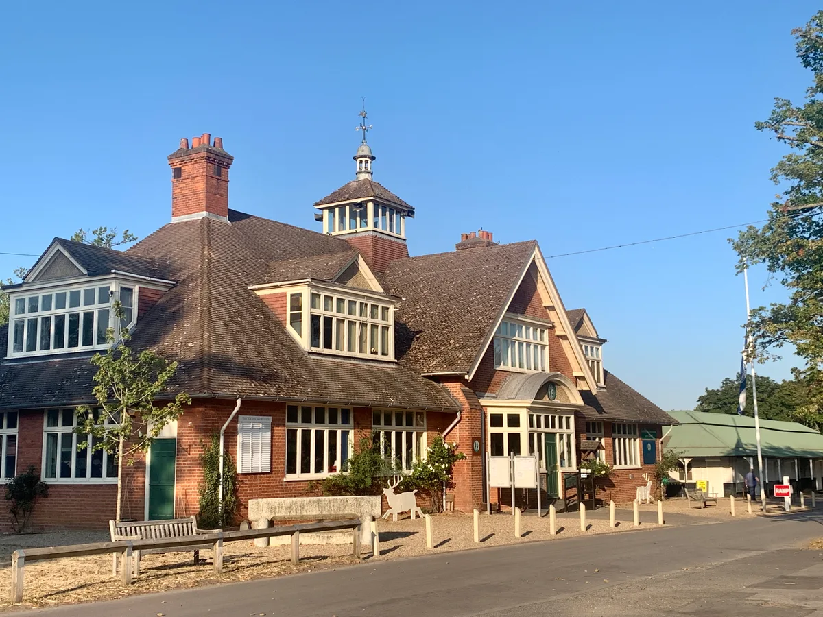
The Museum of The National Rifle Association
Museums · 2.3 km

National Rifle Association (United Kingdom)
Museums · 2.4 km

Wat Phra Dhammakaya London
Historic churches · 2.4 km

Sit Perpetuum Lawn
Campsites · 2.4 km

Sergeant's mess
Campsites · 2.5 km
Nearby
📷 5Memorials & monuments · South East England
Bisley War Memorial
Bisley War Memorial is a memorial in the United Kingdom.
📷 5Historic churches · South East England
St John the Baptist's Well
St John the Baptist's Well — a other in england-south-east, United Kingdom.
📷 5Theme parks · South East England
Mizen's Railway
Mizen's Railway — a theme park in england-south-east, United Kingdom.
📷 5Memorials & monuments · South East England
Dübs 3819
Dübs 3819 — a memorial in england-south-east, United Kingdom.
📷 5Memorials & monuments · South East England
Bisley Clock Tower
Bisley Clock Tower is a memorial in the United Kingdom.
📷 5Where to eat & stay near Bisley, Surrey
Places to stay
📷 5📷 5Campsites · South East England
Sit Perpetuum Lawn
Sit Perpetuum Lawn — a campsite in england south east.
📷 5📷 5 📷 5
📷 5 📷 5
📷 5Campsites · South East England
Furze Hill Camping Ground
Furze Hill Camping Ground — a campsite in england south east.
Places to eat & drink
 📷 7
📷 7 📷 5
📷 5Historic pubs · South East England
The Tumble Down Dick Pub
The Tumble Down Dick Pub in England South East, United Kingdom.
 📷 5
📷 5Historic pubs · South East England
Thatched Tavern Public House
Thatched Tavern Public House in England South East, United Kingdom.
 📷 7
📷 7 📷 7
📷 7Historic pubs · London
The Ship Inn And Ye Olde Sweet Shoppe
The Ship Inn And Ye Olde Sweet Shoppe in England London, United Kingdom.
 📷 7
📷 7Historic pubs · South East England
Rodboro Buildings
Rodboro Buildings in England South East, United Kingdom.
More museums in this region
 📷 5
📷 5Museums · South East England
Coldrum Long Barrow
Coldrum Long Barrow — neolithic chambered long barrow near Trottiscliffe, Kent, England, UK.
 📷 5
📷 5Museums · South East England
Guildford House
Guildford House — house in Guildford, Surrey, England, UK.
 📷 5
📷 5Museums · South East England
Huguenot Museum
Huguenot Museum — museum in Rochester, England, UK.
 📷 5
📷 5Museums · South East England
Medway megaliths
Medway megaliths — group of long barrows in Kent, England.
Frequently asked questions
- Where is Bisley, Surrey?
- Bisley, Surrey is in Surrey, South-East England, United Kingdom (postcode GU24 9EJ), in the parish of Bisley.
- What is Bisley, Surrey?
- Bisley is a village and civil parish in the Borough of Surrey Heath in Surrey, England, approximately 25 miles (40 km) southwest of central London. It is midway between Woking (to the east) and Cambe
- How do I get to Bisley, Surrey?
- The nearest railway station is Brookwood, about 3.0 km away. Drivers can use postcode GU24 9EJ.
- Is Bisley, Surrey a protected site?
- Yes — Bisley, Surrey is part of the Basingstoke Canal SSSI Site of Special Scientific Interest and the Colony Bog and Bagshot Heath SSSI Site of Special Scientific Interest.
- How do I get to Bisley, Surrey?
- The nearest railway station is Brookwood, about 3.0 km away. Drivers can navigate to postcode GU24 9EJ.