
Parks · London
Bingfield Park
In or near Covent Garden.
Bingfield Park — park in the London Borough of Islington, England.

Wikimedia Commons contributors — see linked file page for photographer and licence licence

Plan your visit
- Typical visit
- 1 h–2 h
- Nearest railway station
- Caledonian Road & Barnsbury · 0.6 km
- Free entry
- Family-friendly
- Dog-friendly
Getting there & planning your visit
Bingfield Park is located in Islington, London, with the postcode N1 0DE. The nearest railway station is Caledonian Road & Barnsbury, which is 0.6 km away. Entry to the park is free.
About
Bingfield Park is a public park in the United Kingdom. Wikidata describes it as: "park in the London Borough of Islington, England". Coordinates: 51.5397°, -0.1211°.
Photo gallery
Official information
Bingfield Park features the striking sculpture 'My World and Your World' by artist Eva Rothschild, which stands 16 meters tall and is designed to resemble branches of an inverted tree. The park serves as a social space for visitors to explore, meet friends, and enjoy picnics.
From the Wikipedia article
Bingfield Park is a small park area located in the Caledonian Ward and parish of St. Michaels area of the London Borough of Islington. The Park has existed since about 1970 when the Beaconsfield Buildings (built by the Victoria Dwellings Association — Patron Benjamin Disraeli, British prime minister, the Earl of Beaconsfield.) were purchased by the Greater London Council and demolished. These Buildings were preceded by small holdings and cottages and known as Strouds Vale and bordered on to the areas known as Sutton Gardens, Belle Isle and Copenhagen fields. Also demolished was The Clarance Terrace, a red bricked six storey high terrace of apartments fronting on to Rufford Street (formerly Almina Road). At the western and northern perimeters, the Park joins Rufford Street; at the south perimeter it meets Bingfield Street. It is close to the disused York Road Underground station and York Way. The Park has an all-weather sports pitch and an adventure playground for children at its eastern end. The Park is a popular recreational area for people living in the locality.
Excerpt from Wikipedia under CC BY-SA 4.0. See the source article linked in Sources below.
- Coordinates
- 51.5397, -0.1211
- District
- Islington
- Parish
- Islington, unparished area
- Postcode
- N1 0DE
- Parliamentary constituency
- Islington South and Finsbury
- Nearest railway station
- Caledonian Road & Barnsbury — 0.6 km
- Official site
- www.kingscross.co.uk
Sources
- wikidata: Q4914186 (CC0)
- wikipedia: Bingfield Park (CC BY-SA 4.0)
- commons: Bingfieldpark.jpg (CC BY-SA 4.0)
Other places nearby

Crumbles Castle
Castles · 0.1 km

My World And Your World
Public art & sculpture · 0.3 km

RIGPA Tibetan Buddhist Centre
Historic churches · 0.3 km

Variety Picture Palace
Theatres · 0.4 km

Everyman King's Cross
Theatres · 0.4 km

Lightroom
Museums · 0.4 km

Canopy Market
Farmers’ markets · 0.4 km

Everyman On The Corner
Cinemas · 0.5 km

Ark: High and Dry
Public art & sculpture · 0.5 km
Darlington Train Maquette
Public art & sculpture · 0.5 km

Queer Britain
Museums · 0.5 km

Copenhagen Cinema
Theatres · 0.5 km
Nearby
📷 5Castles · London
Crumbles Castle
Crumbles Castle — a castle in england-london, United Kingdom.
📷 5Public art & sculpture · London
My World And Your World
My World And Your World — a public art in england-london, United Kingdom.
📷 5Historic churches · London
RIGPA Tibetan Buddhist Centre
RIGPA Tibetan Buddhist Centre — a church in england-london, United Kingdom.
📷 5📷 5Theatres · London
Everyman King's Cross
Everyman King's Cross — a cinema heritage in england-london, United Kingdom.
📷 5Where to eat & stay near Bingfield Park
Places to stay
 📷 5
📷 5 📷 5
📷 5 📷 7
📷 7Hotels · London
Great Northern Hotel
Great Northern Hotel — a hotel in england london.
 📷 7
📷 7 📷 7
📷 7Hotels · London
St Pancras Renaissance London Hotel
St Pancras Renaissance London Hotel — a hotel in england london. Brand: Marriott.
 📷 5
📷 5Places to eat & drink
 📷 7
📷 7Historic pubs · London
The Penny Farthing Public House
The Penny Farthing Public House in England London, United Kingdom.
 📷 5
📷 5 📷 5
📷 5Historic pubs · London
Flying Scotsman
Flying Scotsman in England London, United Kingdom.
 📷 5
📷 5Historic pubs · London
The Lamb Tavern Public House
The Lamb Tavern Public House in England London, United Kingdom.
 📷 5
📷 5Historic pubs · London
The Cloudesley Arms Public House
The Cloudesley Arms Public House in England London, United Kingdom.
 📷 5
📷 5More parks in this region
 Flagship📷 10
 📷 10
📷 10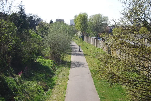 Flagship📷 10
Parks · London
Addiscombe Railway Park
Addiscombe Railway Park — park in London Borough of Croydon, United Kingdom.
 Flagship📷 10
Parks · London
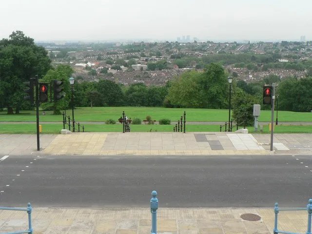
Alexandra Park
Alexandra Park — park in the London Borough of Haringey.
Frequently asked questions
- Where is Bingfield Park?
- Bingfield Park is in London, United Kingdom (postcode N1 0DE), in the parish of Islington, unparished area.
- What is Bingfield Park?
- Bingfield Park — park in the London Borough of Islington, England.
- How do I get to Bingfield Park?
- The nearest railway station is Caledonian Road & Barnsbury, about 0.6 km away. Drivers can use postcode N1 0DE.
- Is Bingfield Park free to visit?
- Yes, Bingfield Park is free to enter.
- How do I get to Bingfield Park?
- The nearest railway station is Caledonian Road & Barnsbury, about 0.6 km away. Drivers can navigate to postcode N1 0DE.