
Historic bridges · West Midlands
Bewdley Bridge
In or near Areley Kings.
Bewdley Bridge — a Grade I-listed bridge in england-west-midlands, United Kingdom.

Jaggery — CC BY-SA 2.0 via Wikimedia Commons licence

Plan your visit
- Typical visit
- 15 min–30 min
- Nearest railway station
- Bewdley · 0.5 km
- Free entry
- Dog-friendly
- Wheelchair accessible
Getting there & planning your visit
Bewdley Bridge is located in the West Midlands, with the nearest railway station being Bewdley, approximately 0.5 km away. Entry to the bridge is free, and it is wheelchair accessible. The postcode for navigation is DY12 2AE.
About
Bewdley Bridge is a Grade I-listed building in england-west-midlands, United Kingdom. Grade I status is conferred by Historic England (or Cadw, Historic Environment Scotland or NIEA equivalents) on buildings of exceptional national interest. See the linked Wikipedia article for full historical and architectural details.
Photo gallery
See it from the streetimagery from 2025
Imagery © Mapillary contributors, CC BY-SA 4.0
Heritage listing
Bewdley Bridge is a three-span masonry arch bridge over the River Severn at Bewdley, Worcestershire, designed by civil engineer Thomas Telford. The two side spans are each 52 feet (16 m), with the central span 60 feet (18 m). The central arch rises 18 feet (5.5 m). Smaller flood arches on the bank bridge the towpath. The bridge is 27 feet (8.2 m) wide.
From the Historic England List Entry under OGL v3.
Official information
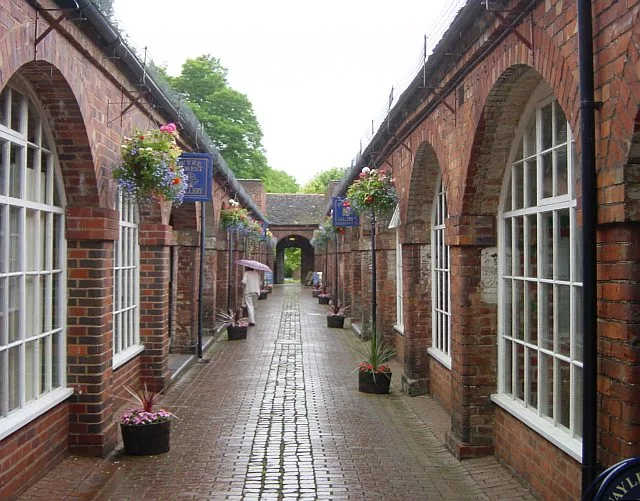
Bewdley Museum showcases the history and heritage of the riverside town of Bewdley through interactive displays and sensory experiences. Visitors can explore various exhibits, including a glimpse into the town's jails and local crafts. The museum also hosts workshops and events throughout the year.
Protected designations
- Site of Special Scientific Interest: River Teme SSSI
Designations sourced from Natural England open data under OGL v3.
From the Wikipedia article
Bewdley Bridge is a three-span masonry arch bridge over the River Severn at Bewdley, Worcestershire, designed by civil engineer Thomas Telford. The two side spans are each 52 feet (16 m), with the central span 60 feet (18 m). The central arch rises 18 feet (5.5 m). Smaller flood arches on the bank bridge the towpath. The bridge is 27 feet (8.2 m) wide.
Excerpt from Wikipedia under CC BY-SA 4.0. See the source article linked in Sources below.
Background
History
There has been a bridge at this location since 1447, each being destroyed and replaced. Parts of the 15th-century bridge were rediscovered in 2004 during excavations for new flood defences. The bridge was one of the main objectives of Oliver Cromwell, during the Battle of Worcester in 1651. Colonel Robert Lilburne, along with Major Mercer, five troops of Worcester Dragoons, Worcestershire horse and two troops of Colonel Rich's regiment were assigned to secure the bridge during the battle. One of the arches had previously been damaged by the Royalists in 1644 and rebuilt in timber. Severe flooding in 1795 destroyed the bridge, which at that time consisted of five pointed stone arches. A…
Sourced from Wikipedia under CC BY-SA 4.0.
- Coordinates
- 52.3765, -2.3139
- County
- Worcestershire
- District
- Wyre Forest
- Parish
- Bewdley
- Postcode
- DY12 2AE
- Parliamentary constituency
- Wyre Forest
- Phone
- 0845 607 7819
- Established
- 1798
- Nearest railway station
- Bewdley — 0.5 km
- Opening
- Daily 10am–4.30pm; access to the museum until 4pm
- Official site
- www.bewdleymuseum.co.uk
Sources
- wikidata: Q4899738 (CC0)
- wikipedia: Bewdley Bridge (CC BY-SA 4.0)
Other places nearby

Quay Side On North Side Of River Severn, Extending South From Severn Bridge For About 140 Metres And Two Flights Of Steps
Marinas · 0.1 km

Cock And Magpie Public House
Historic pubs · 0.1 km

Quay Side On South Side Of River Severn, Extending South From Severn Bridge For About 290 Metres Including Four Flights Of Steps
Marinas · 0.1 km

Bewdley
Museums · 0.1 km
Bewdley Museum
Museums · 0.1 km

George Hotel
Hotels · 0.1 km

Stanley Baldwin
Public art & sculpture · 0.1 km

The Black Boy Hotel
Historic pubs · 0.2 km

The Clock House
Hostels · 0.2 km

Butt Town
Caravan parks · 0.2 km
.jpg?width=1200)
Bailiff's House
Historic houses · 0.2 km
The Talbot Inn
Historic pubs · 0.2 km
Nearby
📷 5Marinas · West Midlands
Quay Side On North Side Of River Severn, Extending South From Severn Bridge For About 140 Metres And Two Flights Of Steps
Quay Side On North Side Of River Severn, Extending South From Severn Bridge For About 140 Metres And Two Flights Of Steps — a marina in england west midlands.
📷 7Historic pubs · West Midlands
Cock And Magpie Public House
Cock And Magpie Public House in England West Midlands, United Kingdom.
📷 5Marinas · West Midlands
Quay Side On South Side Of River Severn, Extending South From Severn Bridge For About 290 Metres Including Four Flights Of Steps
Quay Side On South Side Of River Severn, Extending South From Severn Bridge For About 290 Metres Including Four Flights Of Steps — a marina in england west midlands.
📷 5Museums · West Midlands
Bewdley
Bewdley ( BEWD-lee) is a town and civil parish in the Wyre Forest District in Worcestershire, England, on the banks of the River Severn. It is in the Severn Valley, and is 3+1⁄2 miles (5.5 kilometres
📷 3Museums · West Midlands
Bewdley Museum
Bewdley Museum — museum in Bewdley, England, United Kingdom.
📷 7Hotels · West Midlands
George Hotel
George Hotel — a hotel in england west midlands.
Where to eat & stay near Bewdley Bridge
Places to stay
📷 7Hotels · West Midlands
George Hotel
George Hotel — a hotel in england west midlands.
📷 5Hostels · West Midlands
The Clock House
The Clock House — a hostel in england west midlands.
📷 5 📷 5
📷 5Campsites · West Midlands
Riverside Caravan Park Bewdley
Riverside Caravan Park Bewdley — a campsite in england west midlands.
 📷 5
📷 5Caravan parks · West Midlands
Blackstone Meadow Holiday Park
Blackstone Meadow Holiday Park — a caravan park in england west midlands.
 📷 5
📷 5Caravan parks · West Midlands
Brant Caravan Park
Brant Caravan Park — a caravan park in england west midlands.
Places to eat & drink
📷 7Historic pubs · West Midlands
Cock And Magpie Public House
Cock And Magpie Public House in England West Midlands, United Kingdom.
📷 5Historic pubs · West Midlands
The Black Boy Hotel
The Black Boy Hotel — Historic pub — listed building or notable heritage status.
📷 7 📷 7
📷 7Historic pubs · West Midlands
Horn And Trumpet Public House
Horn And Trumpet Public House in England West Midlands, United Kingdom.
 📷 7
📷 7Historic pubs · West Midlands
Southern Part Of The Red Lion Public House
Southern Part Of The Red Lion Public House in England West Midlands, United Kingdom.
 📷 5
📷 5Historic pubs · West Midlands
Wood Colliers Arms Public House And Attached Railings
Wood Colliers Arms Public House And Attached Railings in England West Midlands, United Kingdom.
More bridges in this region
 📷 3
📷 3Historic bridges · West Midlands
Wolseley Bridge
Wolseley Bridge is a historic bridge in the United Kingdom.
 📷 3
📷 3Historic bridges · West Midlands
Bridge, Gatepiers, Walls And Ha Ha South Of Blithfield Hall
Bridge, Gatepiers, Walls And Ha Ha South Of Blithfield Hall — Grade II listed building-listed bridge in england-east-midlands, United Kingdom.
 📷 3
📷 3Historic bridges · West Midlands
Bridge Over River Swarbourn At West End Of Town Hill
Bridge Over River Swarbourn At West End Of Town Hill — Grade II listed building-listed bridge in england-east-midlands, United Kingdom.
 📷 3
📷 3Historic bridges · West Midlands
Viaduct over Trent and Mersey Canal at SK 0485 1780
Viaduct over Trent and Mersey Canal at SK 0485 1780 — Grade II listed building-listed bridge in england-east-midlands, United Kingdom.
Frequently asked questions
- Where is Bewdley Bridge?
- Bewdley Bridge is in Worcestershire, the West Midlands, United Kingdom (postcode DY12 2AE), in the parish of Bewdley.
- What is Bewdley Bridge?
- Bewdley Bridge — a Grade I-listed bridge in england-west-midlands, United Kingdom.
- How do I get to Bewdley Bridge?
- The nearest railway station is Bewdley, about 0.5 km away. Drivers can use postcode DY12 2AE.
- When was Bewdley Bridge built?
- Built or established in 1798.
- Is Bewdley Bridge a listed building?
- Bewdley Bridge is officially recognised as Grade I listed.
- Is Bewdley Bridge a protected site?
- Yes — Bewdley Bridge is part of the River Teme SSSI Site of Special Scientific Interest.
- Is Bewdley Bridge free to visit?
- Yes, Bewdley Bridge is free to enter.
- How do I get to Bewdley Bridge?
- The nearest railway station is Bewdley, about 0.5 km away. Drivers can navigate to postcode DY12 2AE.