
Parks · North East England
Benwell & Scotswood
In or near Whickham.
Benwell & Scotswood in England North East, United Kingdom.

Adrian Dust — CC BY-SA 2.0 via Wikimedia Commons licence

Plan your visit
- Typical visit
- 1 h–2 h
- Nearest railway station
- MetroCentre · 1.7 km
- Free entry
- Family-friendly
- Dog-friendly
Getting there & planning your visit
To visit Benwell & Scotswood park, the nearest railway station is MetroCentre, located 1.7 km away. The postcode for sat-nav is NE15 6SP, and entry to the park is free.
About
Benwell & Scotswood is a place of interest in England North East, United Kingdom — drawn from open-data sources for visitor reference. See the linked Wikipedia article for the full description.
Photo gallery
Official information
Benwell Vallum Crossing is a historical site featuring a stone-built causeway that crosses the Vallum earthwork, part of the Roman fortifications associated with Hadrian's Wall. Visitors can view the remnants of this significant crossing point, which played a role in controlling access to the military zone behind the wall.
From the Wikipedia article
Benwell and Scotswood is an electoral ward of Newcastle upon Tyne in North East England. The ward encompasses the portion of Benwell that falls into NE15 while the other portion that falls into NE4 is in the Elswick ward. This ward also encompasses Scotswood housing areas, Denton Burn housing areas, as well as the Newcastle Business Park, which is located on the banks of the River Tyne and houses offices of companies such as British Airways and the Automobile Association. The population of the ward is 13,759, which is 5.3% of the total population of Newcastle upon Tyne. Car ownership in the area is 45.1%, lower than the city average of 54.7%. The 2011 Census gave a population of 12,694.
Excerpt from Wikipedia under CC BY-SA 4.0. See the source article linked in Sources below.
Background
History
Scotswood grew during the industrial revolution and provided labour for the huge Vickers Armstrong military engineering group formerly Armstrong Whitworth. Scotswood Road, which Vickers Armstrong used to dominate, is a main route along the Tyne and is mentioned in the song "Blaydon Races". The Scotswood Bridge, which was known as the Chain Bridge, was the first bridge to be built over the Tyne in the industrial era. It opened in 1831 and was in use until 1967 when it had been superseded by a more modern structure, and was hence demolished. Benwell and Scotswood were both sites of a number of coalmines. On 30 March 1925 the Montague Main Colliery Disaster occurred, caused by an inrush of…
Sourced from Wikipedia under CC BY-SA 4.0.
- Coordinates
- 54.9740, -1.6690
- District
- Newcastle upon Tyne
- Parish
- Newcastle upon Tyne, unparished area
- Postcode
- NE15 6SP
- Parliamentary constituency
- Newcastle upon Tyne Central and West
- Nearest railway station
- MetroCentre — 1.7 km
- Opening
- Open any reasonable time during daylight hours - external viewing only.
- Official site
- www.english-heritage.org.uk
Sources
- wikidata: Q4890714 (CC0)
- wikipedia: Benwell and Scotswood (CC BY-SA 4.0)
Other places nearby
Benwell
Other places · 0.0 km
Benwell Nature Park
Parks · 0.1 km
The Mitre
Historic houses · 0.1 km

The Mitre
Historic pubs · 0.1 km

Royal Victoria School For The Blind
Historic houses · 0.2 km

Benwell Vallum Crossing
Natural landmarks · 0.3 km

Benwell Vallum Crossing
Archaeological sites · 0.3 km
Benwell Vallum
Archaeological sites · 0.3 km

Condercum
Reservoirs & lochs · 0.4 km
Condercum Hill
Mountains & hills · 0.5 km
Benwell Roman Temple
Archaeological sites · 0.5 km

Benwell Roman Temple
Archaeological sites · 0.5 km
Nearby
📷 4Other places · North East England
Benwell
Benwell in England North East, United Kingdom.
📷 3Parks · North East England
Benwell Nature Park
Benwell Nature Park — park in Newcastle upon Tyne, United Kingdom.
📷 4Historic houses · North East England
The Mitre
The Mitre in England North East, United Kingdom.
📷 5📷 4Historic houses · North East England
Royal Victoria School For The Blind
Royal Victoria School For The Blind in England North East, United Kingdom.
📷 3Natural landmarks · North East England
Benwell Vallum Crossing
Benwell Vallum Crossing — a other in scotland-lowlands, United Kingdom.
Where to eat & stay near Benwell & Scotswood
Places to stay
 📷 5
📷 5 📷 5
📷 5Hotels · North East England
The County Hotel
The County Hotel — a hotel in scotland lowlands.
Hotels · North East England
Maldron Hotel Newcastle
Maldron Hotel Newcastle — a hotel in scotland lowlands. 4-star. Brand: Maldron Hotels.
 📷 7
📷 7Hotels · North East England
Crowne Plaza Newcastle
Crowne Plaza Newcastle — a hotel in scotland lowlands.
 📷 5
📷 5Hostels · North East England
Albatross Hostel
Albatross Hostel — a hostel in scotland lowlands.
 📷 5
📷 5Hotels · North East England
Hampton by Hilton Newcastle
Hampton by Hilton Newcastle — a hotel in scotland lowlands. 3.5-star. Brand: Hampton.
Places to eat & drink
📷 5 📷 5
📷 5Historic pubs · North East England
The Balmoral Public House
The Balmoral Public House in Scotland Lowlands, United Kingdom.
 📷 5
📷 5Historic pubs · North East England
The Cordwainers' Public House
The Cordwainers' Public House in Scotland Lowlands, United Kingdom.
 📷 5
📷 5Historic pubs · North East England
Liberty House
Liberty House in Scotland Lowlands, United Kingdom.
 📷 5
📷 5Historic pubs · North East England
Theatre Royal Lounge And Restaurant; The Royal Public House
Theatre Royal Lounge And Restaurant; The Royal Public House in Scotland Lowlands, United Kingdom.
 📷 5
📷 5More parks in this region
 📷 3
📷 3 📷 4
📷 4Parks · North East England
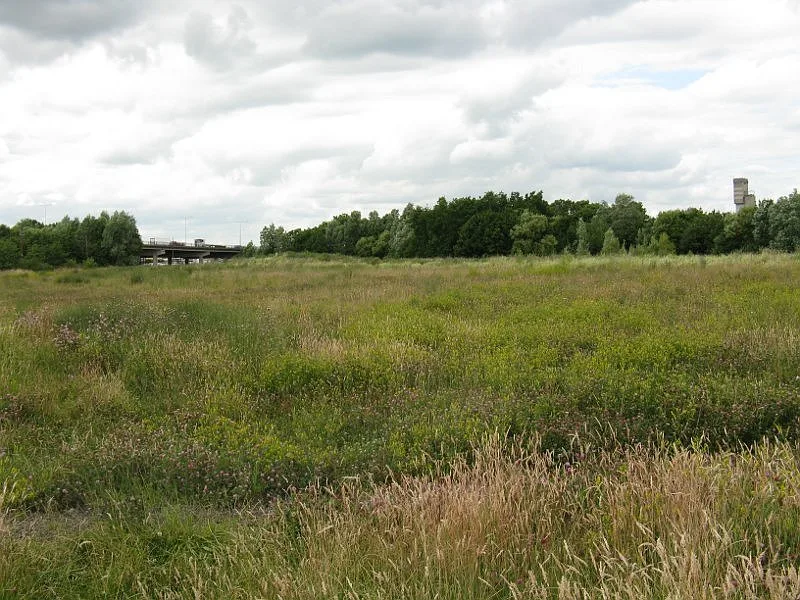
Maze Park Nature Reserve
Maze Park Nature Reserve — park in Middlesbrough, United Kingdom.
 📷 3
📷 3Parks · North East England
Portrack Incinerator
Portrack Incinerator — former waste and power plant in England.
 📷 3
📷 3Parks · North East England
Preston Park, Stockton-on-Tees
Preston Park, Stockton-on-Tees — public park in north eastern England.
Frequently asked questions
- Where is Benwell & Scotswood?
- Benwell & Scotswood is in North-East England, United Kingdom (postcode NE15 6SP), in the parish of Newcastle upon Tyne, unparished area.
- What is Benwell & Scotswood?
- Benwell & Scotswood in England North East, United Kingdom.
- How do I get to Benwell & Scotswood?
- The nearest railway station is MetroCentre, about 1.7 km away. Drivers can use postcode NE15 6SP.
- Is Benwell & Scotswood free to visit?
- Yes, Benwell & Scotswood is free to enter.
- How do I get to Benwell & Scotswood?
- The nearest railway station is MetroCentre, about 1.7 km away. Drivers can navigate to postcode NE15 6SP.