
Natural landmarks · Central Scotland
Ben Venue
In or near Brig o' Turk.
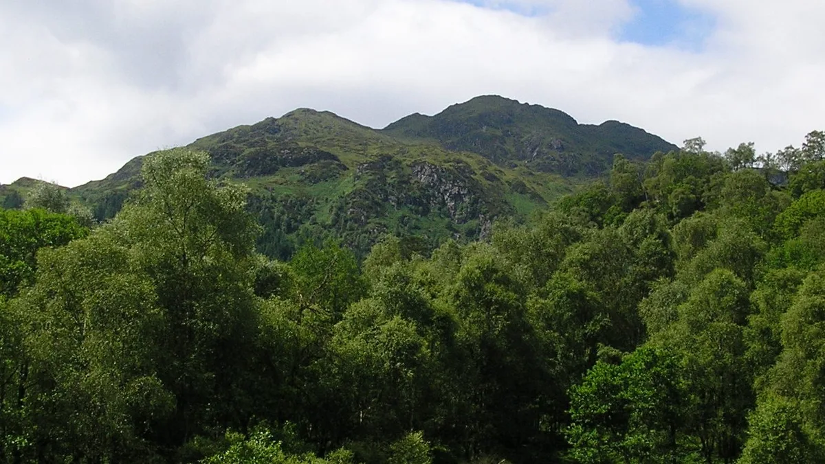
Ben Venue — mountain in Stirling, Scotland, UK.

Wikimedia Commons contributors — see linked file page for photographer and licence licence

Plan your visit
- Typical visit
- 1 h–2 h
- Free entry
- Dog-friendly
About
Ben Venue is a named natural landmark in the United Kingdom. Part of Trossachs. Wikidata describes it as: "mountain in Stirling, Scotland, UK". Coordinates: 56.2167°, -4.4500°.
Photo gallery
From the Wikipedia article
Ben Venue (Scottish Gaelic: A' Bheinn Mheanbh) is a mountain in the Trossachs area of Scotland. The name Ben Venue is derived from the Scottish Gaelic words meaning "the miniature mountain". The summit lies approximately 2 kilometres south-west of the pier at the southern end of Loch Katrine. At the foot of the mountain close to the shore of Loch Katrine is Bealach nam Bò meaning the "pass of the cattle", a reference to the lawless days when Highland cattle "lifters" used the pass to drive stolen herds to their land. Ben Venue is a popular walk and can be accessed from either Ledard farm track at Loch Ard, via the Beinn an Fhogharaidh ridge, or from the car park at the head of Loch Achray: both routes are approximately 5 km in length. A sign in the forestry warns that the mountain should not be approached or descended directly to or from Loch Katrine, as the slopes on this side are very steep and littered with dangerous cliffs. Several indistinct paths do exist on this side of the hill however. Ben Venue has two summits a short distance apart. The triangulation pillar on the eastern summit has a height of 728.1 m above sea level, and this height is often given as the height of Ben Venue as a whole. However the western summit is shown to be slightly higher, 729.5 m, on the Ordnance Survey's 1:25000 map. From (either) summit on a clear day the view extend to the Firth of Forth, the Clyde and Isle of Arran and the Paps of Jura. Good views can be seen along Loch Katrine, Ben A'an, Ben More, Stob Binnein, Ben Lomond and the Arrochar Alps.
Excerpt from Wikipedia under CC BY-SA 4.0. See the source article linked in Sources below.
- Coordinates
- 56.2167, -4.4500
- Address
- Stirling (council area), Scotland
Sources
- wikidata: Q2895592 (CC0)
- wikipedia: Ben Venue (CC BY-SA 4.0)
- commons: Ben Venue.JPG (CC BY-SA 4.0)
Other places nearby

Ben Venue East Top
Mountains & hills · 0.9 km
Ben Venue
Mountains & hills · 1.2 km

Stob an Lochain
Mountains & hills · 1.6 km

Beinn an Fhogharaidh
Mountains & hills · 1.7 km

Craig Leven
Mountains & hills · 2.0 km

Creag Innich
Mountains & hills · 2.1 km

Great Trossachs Path
Reservoirs & lochs · 2.3 km

Centenary Drinking Fountain
Memorials & monuments · 2.3 km

Trossachs
Mountains & hills · 2.4 km

Loch Katrine Eco Camp
Campsites · 2.4 km

Beinn Bhreac
Mountains & hills · 2.5 km

Dun Achray
Mountains & hills · 2.7 km
Nearby
📷 3Mountains & hills · Central Scotland
Ben Venue East Top
Ben Venue East Top — a mountain in scotland-central, United Kingdom.
📷 3📷 3Mountains & hills · Central Scotland
Stob an Lochain
Stob an Lochain — a mountain in scotland-central, United Kingdom.
📷 3Mountains & hills · Central Scotland
Beinn an Fhogharaidh
Beinn an Fhogharaidh in Scotland Islands, United Kingdom.
📷 5Mountains & hills · Central Scotland
Craig Leven
Craig Leven — a hill or mountain in scotland central.
📷 5Mountains & hills · Central Scotland
Creag Innich
Creag Innich — mountain in scotland central. Elevation: 521 m.
Where to eat & stay near Ben Venue
Places to stay
📷 5Campsites · Central Scotland
Loch Katrine Eco Camp
Loch Katrine Eco Camp — a campsite in scotland central.
 📷 5
📷 5Campsites · Central Scotland
Loch Achray South camping permit area March-September
Loch Achray South camping permit area March-September — a campsite in scotland central.
 📷 5
📷 5Campsites · Central Scotland
Loch Achray Campsite
Loch Achray Campsite — a campsite in scotland central.
 📷 5
📷 5Hotels · Central Scotland
Macdonald Forest Hills Hotel & Spa
Macdonald Forest Hills Hotel & Spa — a hotel in scotland central.
 📷 5
📷 5Campsites · Central Scotland
Loch Ard camping permit area March-September
Loch Ard camping permit area March-September — a campsite in scotland central.
 📷 5
📷 5Campsites · Central Scotland
Loch Chon Campsite
Loch Chon Campsite — a campsite in scotland highlands.
Places to eat & drink
 📷 5
📷 5Historic pubs · Central Scotland
The Drovers Inn
The Drovers Inn — Historic pub — listed building or notable heritage status.
More natural landmarks in this region
 📷 4
📷 4Natural landmarks · Central Scotland
Blackadder Water
Blackadder Water in England North East, United Kingdom.
 📷 3
📷 3Natural landmarks · Central Scotland
A6105 road
A6105 road in England North East, United Kingdom.
 📷 3
📷 3 📷 3
📷 3Frequently asked questions
- Where is Ben Venue?
- Ben Venue is in central Scotland, United Kingdom.
- What is Ben Venue?
- Ben Venue — mountain in Stirling, Scotland, UK.
- How do I get to Ben Venue?
- The nearest town is Brig o' Turk. Its coordinates are 56.2167°, -4.4500°.
- Is Ben Venue free to visit?
- Yes, Ben Venue is free to enter.