
Forts · South East England
Battle of Bosworth 1485
Also known as: Brwydr Maes Bosworth, Cath Pháirc Bosworth
In or near Higham on the Hill.
Battle of Bosworth 1485 is a fort in the United Kingdom.

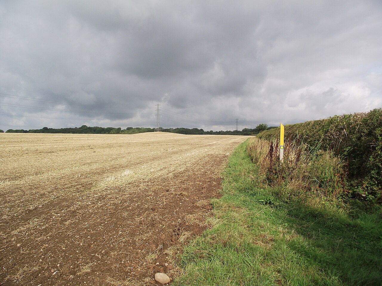
Wikimedia Commons contributors — see linked file page for photographer and licence licence

Plan your visit
- Typical visit
- 45 min–1.5 h
- Nearest railway station
- Shenton · 3.0 km
- Family-friendly
Getting there & planning your visit
To visit the Battle of Bosworth 1485, the nearest railway station is Shenton, located 3 km away. The postcode for the site is CV13 6BL. Entry details regarding fees and accessibility are not provided.
About
Battle of Bosworth 1485 is a historic fort or fortified site in the United Kingdom. Coordinates: 52.5768°, -1.4401°. This entry is part of The Great Britain Guide, a free, ad-free, open-data tourist directory.
Photo gallery
Official information
The Battle of Bosworth 1485 is a historical site commemorating the last significant battle of the Wars of the Roses, where King Richard III was defeated by Henry Tudor. Visitors can explore the battlefield and learn about the events that led to the end of Richard's reign and the rise of the Tudor dynasty.
From the Wikipedia article
The Battle of Bosworth or Bosworth Field ( BOZ-wərth) was the last significant battle of the Wars of the Roses, the civil war between the houses of Lancaster and York that extended across England and Wales in the latter half of the 15th century. Fought on 22 August 1485, the battle was won by an alliance of Lancastrians and disaffected Yorkists. Their leader Henry Tudor, Earl of Richmond, became the first Welsh monarch of England from the Tudor dynasty by his victory and subsequent marriage to the de facto Yorkist heiress, Elizabeth of York. His opponent Richard III, the last king of the House of York, was killed during the battle, the last English monarch to fall in battle. Historians consider Bosworth Field to mark the end of the Plantagenet dynasty, making it one of the defining moments of English history. Richard's reign began in 1483 when he ascended the throne after his twelve-year-old nephew, Edward V, was declared illegitimate, likely at Richard's instigation. The boy and his younger brother Richard soon disappeared, and their fate remains a mystery. Across the English Channel Henry Tudor, a descendant of the greatly diminished House of Lancaster, seized on Richard's difficulties and laid claim to the throne. Henry's first attempt to invade England in 1483 foundered in a storm, but his second arrived unopposed on 7 August 1485 on the south-west coast of Wales. Marching inland, Henry gathered support as he made for London. Richard hurriedly mustered his troops and intercepted Henry's army near Ambion Hill, south of the town of Market Bosworth in Leicestershire. Lord Stanley and Sir William Stanley also brought a force to the battlefield, but held back while they decided which side it would be most advantageous to support, initially lending only four knights to Henry's cause: Sir Robert Tunstall, Sir John Savage (nephew of Lord Stanley), Sir Hugh Persall and Sir Humphrey Stanley. Sir John Savage was placed in command of the left flank of Henry's army. Richard…
Excerpt from Wikipedia under CC BY-SA 4.0. See the source article linked in Sources below.
Background
History
During the 15th century, civil war raged across England as the Houses of York and Lancaster fought each other for the English throne. In 1471 the Yorkists defeated their rivals in the battles of Barnet and Tewkesbury. The Lancastrian King Henry VI and his only son, Edward of Westminster, died in the aftermath of the Battle of Tewkesbury. Their deaths left the House of Lancaster with no direct claimants to the throne. The Yorkist king, Edward IV, was in complete control of England. He attainted those who refused to submit to his rule, such as Jasper Tudor and his nephew Henry, naming them traitors and confiscating their lands. The Tudors tried to flee to France but strong winds forced them…
Sourced from Wikipedia under CC BY-SA 4.0.
- Coordinates
- 52.5768, -1.4401
- County
- Leicestershire
- District
- Hinckley and Bosworth
- Parish
- Sheepy
- Postcode
- CV13 6BL
- Parliamentary constituency
- Hinckley and Bosworth
- Nearest railway station
- Shenton — 3 km
- Official site
- www.philological.bham.ac.uk
Sources
- osm: w50728114 (ODbL)
- wikipedia: Battle of Bosworth Field (CC BY-SA 4.0)
- commons: Battle of Bosworth by Philip James de Loutherbourg.jpg (CC BY-SA 4.0)
Other places nearby

King Henry VII Crowned Here 1485
Memorials & monuments · 1.6 km

Church of St Margaret
Historic churches · 1.8 km

Stoke Golding
Villages · 2.1 km

Stoke Golding War Memorial
Memorials & monuments · 2.1 km

Church of St Peter
Historic churches · 2.3 km

Dadlington
Villages · 2.4 km

Upton Barn Caravan and Camping site
Caravan parks · 2.4 km
Higham on the Hill
Towns & cities · 2.4 km

Shenton
Villages · 2.4 km

Shenton Hall
Historic houses · 2.6 km
.jpg?width=1200)
Church of St John the Evangelist, Shenton
Historic churches · 2.6 km

St. Martin’s Catholic Voluntary Academy
Historic churches · 2.7 km
Nearby
📷 3Memorials & monuments · East Midlands
King Henry VII Crowned Here 1485
King Henry VII Crowned Here 1485 — a memorial in england-west-midlands, United Kingdom.
📷 3Historic churches · East Midlands
Church of St Margaret
Church of St Margaret — church in Stoke Golding, Leicestershire, England, UK.
📷 5📷 3Memorials & monuments · East Midlands
Stoke Golding War Memorial
Stoke Golding War Memorial — Grade II listed building-listed memorial in england-west-midlands, United Kingdom.
📷 3Historic churches · South East England
Church of St Peter
Church of St Peter — church in Higham on the Hill, Leicestershire, England, UK.
📷 5Where to eat & stay near Battle of Bosworth 1485
Places to stay
📷 5Caravan parks · South East England
Upton Barn Caravan and Camping site
Upton Barn Caravan and Camping site — a caravan park in england west midlands.
 📷 5
📷 5 📷 7
📷 7 📷 5
📷 5Caravan parks · South East England
Atherstone Stables
Atherstone Stables — a caravan park in england west midlands.
 📷 5
📷 5Hostels · West Midlands
Manor Court Care Home
Manor Court Care Home — a hostel in england west midlands.
 📷 5
📷 5Campsites · East Midlands
Fox Covert Scout Camp
Fox Covert Scout Camp — a campsite in england west midlands.
Places to eat & drink
 📷 3
📷 3Historic pubs · South East England
Blue Lion
Blue Lion — Historic pub — listed building or notable heritage status.
 📷 3
📷 3Historic pubs · West Midlands
The Old Swan
The Old Swan — Historic pub — listed building or notable heritage status.
 📷 3
📷 3Historic pubs · West Midlands
Market Tavern
Market Tavern — Historic pub — listed building or notable heritage status.
 📷 3
📷 3Historic pubs · West Midlands
New Swan Inn
New Swan Inn — Historic pub — listed building or notable heritage status.
 📷 3
📷 3Historic pubs · West Midlands
Bird in Hand
Bird in Hand — Historic pub — listed building or notable heritage status.
 📷 4
📷 4Historic pubs · West Midlands
Greyhound Inn
Greyhound Inn — Historic pub — listed building or notable heritage status.
More forts in this region
 📷 5
📷 5 📷 5
📷 5 📷 5
📷 5Forts · South East England
Darnet Fort
Darnet Fort is a fort in the United Kingdom.
 📷 5
📷 5Forts · South East England
Fort Amherst
Fort Amherst is a fort in the United Kingdom.
Frequently asked questions
- Where is Battle of Bosworth 1485?
- Battle of Bosworth 1485 is in Leicestershire, the West Midlands, United Kingdom (postcode CV13 6BL), in the parish of Sheepy.
- What is Battle of Bosworth 1485?
- Battle of Bosworth 1485 is a fort in the United Kingdom.
- How do I get to Battle of Bosworth 1485?
- The nearest railway station is Shenton, about 3.0 km away. Drivers can use postcode CV13 6BL.
- How do I get to Battle of Bosworth 1485?
- The nearest railway station is Shenton, about 3.0 km away. Drivers can navigate to postcode CV13 6BL.