Historic churches · South East England
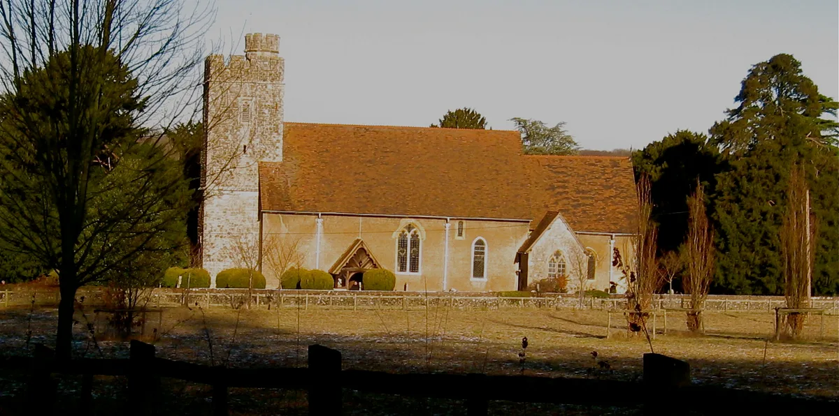
Barming
In or near Coxheath.
Barming is a civil parish in the Maidstone District of Kent, England. It lies to the west of Maidstone and at the 2011 census had a population of 2,690. The eastern end of the parish is part of the bu

David Anstiss — CC BY-SA 2.0 via Wikimedia Commons licence
_-_geograph.org.uk_-_2779837.jpg)
Plan your visit
- Typical visit
- 30 min–1 h
- Nearest railway station
- East Farleigh · 1.3 km
- Free entry
Getting there & planning your visit
To visit Barming, the nearest railway station is East Farleigh, located 1.3 km away. Entry to the church is free, and the postcode for sat-nav is ME16 9HB.
About
Barming is a civil parish in the Maidstone District of Kent, England. It lies to the west of Maidstone and at the 2011 census had a population of 2,690. The eastern end of the parish is part of the built-up area of Maidstone, although the remainder is much more rural. The River Medway forms its southern boundary. Barming is mentioned in the Domesday Book, and was then described as being divided into East and West; the latter being known as Little Barming, and having its own church until the 16th century. Barming Primary School dates back to 1854 but is no longer located on its original site. The area has undergone increased residential development in recent years due to its proximity to both Maidstone Hospital and the Maidstone East rail line to central London. The area has also suffered from significant disruption caused by sinkholes in the late 2010s, including the closure of the A26 road in the summer of 2018 as the road was repaired.
Photo gallery
See it from the streetimagery from 2025
Imagery © Mapillary contributors, CC BY-SA 4.0
Protected designations
- Area of Outstanding Natural Beauty: Kent Downs
Designations sourced from Natural England open data under OGL v3.
From the Wikipedia article
Barming is a civil parish in the Maidstone District of Kent, England. It lies to the west of Maidstone and at the 2011 census had a population of 2,690. The eastern end of the parish is part of the built-up area of Maidstone, although the remainder is much more rural. The River Medway forms its southern boundary. Barming is mentioned in the Domesday Book, and was then described as being divided into East and West; the latter being known as Little Barming, and having its own church until the 16th century. Barming Primary School dates back to 1854 but is no longer located on its original site. The area has undergone increased residential development in recent years due to its proximity to both Maidstone Hospital and the Maidstone East rail line to central London. The area has also suffered from significant disruption caused by sinkholes in the late 2010s, including the closure of the A26 road in the summer of 2018 as the road was repaired.
Excerpt from Wikipedia under CC BY-SA 4.0. See the source article linked in Sources below.
- Coordinates
- 51.2634, 0.4706
- County
- Kent
- District
- Maidstone
- Parish
- Barming
- Postcode
- ME16 9HB
- Parliamentary constituency
- Maidstone and Malling
- Nearest railway station
- East Farleigh — 1.3 km
Sources
- wikipedia: Barming (CC BY-SA 4.0)
Other places nearby
All Saints Church, West Farleigh
Historic churches · 1.3 km

East Farleigh railway station
Heritage railway stations · 1.4 km

East Farleigh Bridge
Historic bridges · 1.4 km

East Barming
Villages · 1.5 km

East Farleigh
Villages · 1.6 km

East Farleigh Village Sign
Public art & sculpture · 1.6 km

West Farleigh
Historic churches · 1.9 km

Teston Lane
Historic bridges · 2.0 km
Teston Bridge
Historic bridges · 2.0 km

University for the Creative Arts - Maidstone
Natural landmarks · 2.1 km
St Augustine Academy, Maidstone
Historic churches · 2.1 km

St. Simon Stock Catholic School
Historic churches · 2.1 km
Nearby
📷 5Historic churches · South East England
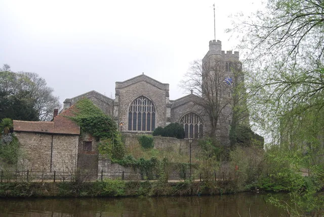
All Saints Church, West Farleigh
All Saints Church, West Farleigh — Grade I listed church in West Farleigh, Maidstone, Kent, England, UK.
📷 5Heritage railway stations · South East England
East Farleigh railway station
East Farleigh railway station — a Grade II*-listed railway station in england-london, United Kingdom.
📷 5Historic bridges · South East England
East Farleigh Bridge
East Farleigh Bridge — scheduled monument-listed bridge in england-london, United Kingdom.
📷 5📷 5📷 5Public art & sculpture · South East England
East Farleigh Village Sign
East Farleigh Village Sign — a public art in england-london, United Kingdom.
Where to eat & stay near Barming
Places to stay
 📷 5
📷 5Campsites · South East England
Hamlet Wood Scout Campsite
Hamlet Wood Scout Campsite — a campsite in england london. Brand: The Scout Association.
 📷 5
📷 5 📷 5
📷 5 📷 5
📷 5Campsites · South East England
Lower Grange Farm Scout Activity Centre
Lower Grange Farm Scout Activity Centre — a campsite in england london.
 📷 5
📷 5Campsites · South East England
Whitewater Action Medway
Whitewater Action Medway — a campsite in england london.
 📷 5
📷 5Campsites · South East England
Kits Coty Glamping
Kits Coty Glamping — a campsite in england london.
Places to eat & drink
 📷 7
📷 7Historic pubs · South East England
The Tickled Trout
The Tickled Trout in England South East, United Kingdom.
 📷 5
📷 5Historic pubs · South East England
The White Lion Public House
The White Lion Public House in England South East, United Kingdom.
 📷 7
📷 7Historic pubs · South East England
The Horse Shoes Public House
The Horse Shoes Public House in England South East, United Kingdom.
 📷 7
📷 7Historic pubs · South East England
The King And Queen Public House
The King And Queen Public House in England South East, United Kingdom.
 📷 5
📷 5 📷 5
📷 5Historic pubs · South East England
The Royal Albion Inn
The Royal Albion Inn in England South East, United Kingdom.
More places in this region
 📷 5
📷 5Historic churches · South East England
All Saints Church, Frindsbury
All Saints Church, Frindsbury — church in Medway, UK.
 📷 5
📷 5Historic churches · South East England
All Saints Church, Maidstone
All Saints Church, Maidstone — parish church associated with the Archbishop's Palace, Maidstone, Kent, England, UK.
📷 5Historic churches · South East England
All Saints Church, West Farleigh
All Saints Church, West Farleigh — Grade I listed church in West Farleigh, Maidstone, Kent, England, UK.
 📷 5
📷 5Historic churches · South East England
All Souls' Church, Sutton Green
All Souls' Church, Sutton Green — church in Guildford, England.
Frequently asked questions
- Where is Barming?
- Barming is in Kent, London, United Kingdom (postcode ME16 9HB), in the parish of Barming.
- What is Barming?
- Barming is a civil parish in the Maidstone District of Kent, England. It lies to the west of Maidstone and at the 2011 census had a population of 2,690. The eastern end of the parish is part of the bu
- How do I get to Barming?
- The nearest railway station is East Farleigh, about 1.3 km away. Drivers can use postcode ME16 9HB.
- Is Barming a protected site?
- Yes — Barming is part of the Kent Downs National Landscape (AONB).
- Is Barming free to visit?
- Yes, Barming is free to enter.
- How do I get to Barming?
- The nearest railway station is East Farleigh, about 1.3 km away. Drivers can navigate to postcode ME16 9HB.