Natural landmarks · Northern Ireland
Ballycarry
Also known as: Baile Cora
In or near Portavogie.
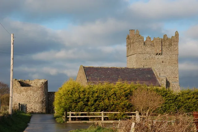
Ballycarry in Northern Ireland, United Kingdom.

Oliver Dixon — CC BY-SA 2.0 via Wikimedia Commons licence
Plan your visit
- Typical visit
- 1 h–2 h
- Free entry
- Dog-friendly
About
Ballycarry is a place of interest in Northern Ireland, United Kingdom — drawn from open-data sources for visitor reference. See the linked Wikipedia article for the full description.
Photo gallery
From the Wikipedia article
Ballycarry (from Irish Baile Cora, meaning 'town of the weir or rocky ford') is a village in County Antrim, Northern Ireland. It is midway between Larne and Carrickfergus, overlooking Islandmagee, and is part of the Mid and East Antrim Borough Council area. In the 2021 census it had a population of 1,479.
Excerpt from Wikipedia under CC BY-SA 4.0. See the source article linked in Sources below.
Background
History
Neolithic artefacts found in the village suggest ancient settlement, while the Lislaynan ecclesiastical settlement looks back to a thousand years of Christian witness. There was also a Norman settlement in the area, at Redhall, and at Brackenberg, now the centre of modern Ballycarry. An early Christian stone coffin lid which was uncovered at Redhall in the 18th century, was reinstated in the Templecorran cemetery and displays an early Christian cross engraved within an arc.
Sourced from Wikipedia under CC BY-SA 4.0.
- Coordinates
- 54.4630, -5.4500
- District
- Ards and North Down
- Postcode
- BT22 1EL
- Parliamentary constituency
- Strangford
Sources
- wikidata: Q4852022 (CC0)
- wikipedia: Ballycarry (CC BY-SA 4.0)
Other places nearby

Portavogie
Towns & cities · 0.4 km

Islanilalone
Archaeological sites · 1.1 km

RAF Kirkistown
Natural landmarks · 1.4 km
Kirkistown Circuit
Natural landmarks · 1.5 km

Ringboy
Villages · 2.1 km
Kirkistown Castle
Castles · 2.5 km

Kirkistown
Villages · 2.7 km

Burr Point
Natural landmarks · 2.9 km

The E Sculpture
Public art & sculpture · 3.1 km

Glastry
Villages · 3.3 km

Ballyhalbert Moat
Archaeological sites · 3.4 km

Somme Garden
Memorials & monuments · 3.6 km
Nearby
📷 5Towns & cities · Northern Ireland
Portavogie
Portavogie — village in County Down, Northern Ireland, UK.
📷 3Archaeological sites · Northern Ireland
Islanilalone
Islanilalone — a archaeological in northern-ireland, United Kingdom.
📷 2Natural landmarks · Northern Ireland
RAF Kirkistown
RAF Kirkistown in Northern Ireland, United Kingdom.
📷 4Natural landmarks · Northern Ireland
Kirkistown Circuit
Kirkistown Circuit in Northern Ireland, United Kingdom.
📷 5📷 3Castles · Northern Ireland
Kirkistown Castle
Kirkistown Castle — castle in Newtownards, County Down, Northern Ireland.
Where to eat & stay near Ballycarry
Places to stay
 📷 3
📷 3Campsites · Northern Ireland
The Lodge at Quarterland Bay Camp Site
The Lodge at Quarterland Bay Camp Site — a campsite in northern ireland.
 📷 5
📷 5Campsites · Northern Ireland
Castle Ward Caravan Park
Castle Ward Caravan Park — a campsite in northern ireland.
 📷 5
📷 5Campsites · Northern Ireland
EDYC Caravan and Camping Area
EDYC Caravan and Camping Area — a campsite in northern ireland.
 📷 5
📷 5Caravan parks · Northern Ireland
Ballywhiskin Caravan and Camping Park
Ballywhiskin Caravan and Camping Park — a caravan park in northern ireland.
 📷 5
📷 5Caravan parks · Northern Ireland
Strangford Holiday Park
Strangford Holiday Park — a caravan park in northern ireland.
 📷 5
📷 5Campsites · Northern Ireland
Delamont Country Park
Delamont Country Park — a campsite in northern ireland.
Places to eat & drink
 📷 7
📷 7More natural landmarks in this region
 Flagship📷 4
Natural landmarks · Northern Ireland
Lough Erne
Lough Erne — lake in County Fermanagh, Northern Ireland, UK.
 Flagship📷 4
Natural landmarks · Northern Ireland
Lough Neagh
Lough Neagh — large lake in Northern Ireland.
 📷 3
📷 3Natural landmarks · Northern Ireland
Ballysaggart Lough
Ballysaggart Lough — lake in the United Kingdom.
 📷 5
📷 5Natural landmarks · Northern Ireland
Belmore Mountain
Belmore Mountain — mountain in the United Kingdom.
Frequently asked questions
- Where is Ballycarry?
- Ballycarry is in Northern Ireland, United Kingdom (postcode BT22 1EL).
- What is Ballycarry?
- Ballycarry in Northern Ireland, United Kingdom.
- How do I get to Ballycarry?
- Drivers can use postcode BT22 1EL.
- Is Ballycarry free to visit?
- Yes, Ballycarry is free to enter.
- How do I get to Ballycarry?
- Drivers can navigate to postcode BT22 1EL. It sits within the Strangford parliamentary constituency.