Mountains & hills · Scottish Lowlands
Auchengibbert Hill
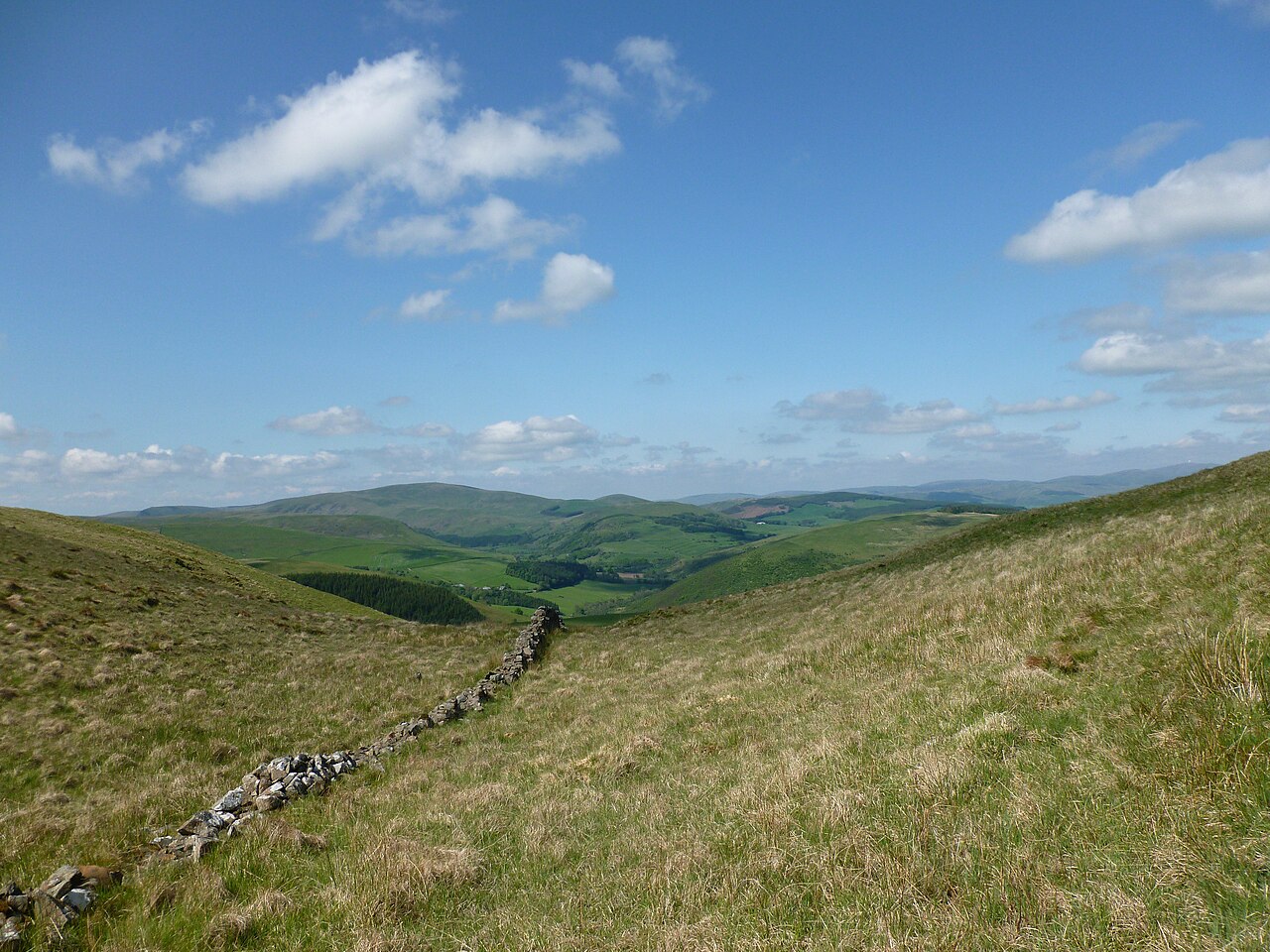
Auchengibbert Hill — a hill or mountain in scotland lowlands.
Alan O'Dowd — CC BY-SA 2.0 via Wikimedia Commons licence
Plan your visit
- Typical visit
- 3 h–8 h
- Best time of year
- Late spring – early autumn (May–Oct)
About
A British hill or mountain, named on Ordnance Survey maps and walked by hill-baggers. Auchengibbert Hill is a named hill or mountain in scotland lowlands, recorded in the GeoNames UK gazetteer. British landmarks of this type are typically marked on Ordnance Survey maps and recorded in the national gazetteer for cartographic and navigational reference. Coordinates and feature classification are sourced from the GeoNames open dataset.
Photo gallery
Place summary
Auchengibbert Hill is a mountain located in the Scottish Lowlands. It offers a range of walking trails that cater to various skill levels, providing opportunities for both casual walkers and experienced hikers. The surrounding landscape features typical Scottish scenery, including rolling hills and open moorland. Visitors can expect a tranquil environment, ideal for enjoying the natural beauty of the region.
AI-generated from the structured facts on this page (operator, designation, listing, era). Not a substitute for visiting.
- Coordinates
- 55.2296, -3.8785
Sources
- manual: geonames-12610304 (CC BY 4.0)
Other places nearby
Loading nearby places…
Nearby
📷 5Mountains & hills · Scottish Lowlands
Auchengibbert Hill
Auchengibbert Hill — mountain in scotland lowlands. Elevation: 372.5 m.
 📷 5
📷 5Mountains & hills · Scottish Lowlands
Bennan
Bennan — a hill or mountain in scotland lowlands.
 📷 5
📷 5Historic churches · Scottish Lowlands
Tynron Parish Church
Tynron Parish Church — category A listed building-listed church in scotland-lowlands, United Kingdom.
 📷 5
📷 5Vineyards · Scottish Lowlands
Tynron Doon
Tynron Doon — a UK vineyard in scotland lowlands, producing English or Welsh wine from cool-climate grape varieties.
 📷 3
📷 3Archaeological sites · Scottish Lowlands
Tynron Doon
Tynron Doon — a archaeological in scotland-lowlands, United Kingdom.
 📷 5
📷 5Villages · Scottish Lowlands
Tynron
Tynron — a village in scotland lowlands.
Where to eat & stay near Auchengibbert Hill
Places to stay
 📷 5
📷 5Caravan parks · Scottish Lowlands
Penpont Caravan Site
Penpont Caravan Site — a caravan park in scotland lowlands.
 📷 5
📷 5Caravan parks · Scottish Lowlands
DL Tait Rural
DL Tait Rural — a caravan park in scotland lowlands.
 📷 5
📷 5Campsites · Scottish Lowlands
Oakbank Farm Campsite
Oakbank Farm Campsite — a campsite in scotland lowlands.
 📷 5
📷 5Hotels · Scottish Lowlands
Friars Carse Country House Hotel
Friars Carse Country House Hotel — a hotel in scotland lowlands.
 📷 5
📷 5Campsites · Scottish Lowlands
Informal campsite- no facilities
Informal campsite- no facilities — a campsite in scotland lowlands.
 📷 3
📷 3Campsites · Scottish Lowlands
Barnsoul Caravan Park
Barnsoul Caravan Park — a campsite in scotland lowlands.
Places to eat & drink
 📷 5
📷 5Historic pubs · Scottish Lowlands
Auldgirth Inn
Auldgirth Inn in Scotland Lowlands, United Kingdom.
 📷 5
📷 5Historic pubs · Scottish Lowlands
Queensberry Arms Hotel
Queensberry Arms Hotel in Scotland Lowlands, United Kingdom.
 📷 5
📷 5Historic pubs · Scottish Lowlands
Hopetoun Arms Hotel, Leadhills
Hopetoun Arms Hotel, Leadhills in Scotland Lowlands, United Kingdom.
 📷 5
📷 5Historic pubs · Scottish Lowlands
75 Friars Vennel, Dumfries
75 Friars Vennel, Dumfries in Scotland Lowlands, United Kingdom.
 📷 5
📷 5Historic pubs · Scottish Lowlands
Rob Roy Public House, 63-65 Queensberry Street, Dumfries
Rob Roy Public House, 63-65 Queensberry Street, Dumfries in Scotland Lowlands, United Kingdom.
 📷 5
📷 5Historic pubs · Scottish Lowlands
73-77 English Street, Dumfries
73-77 English Street, Dumfries in Scotland Lowlands, United Kingdom.
More mountains in this region
 📷 3
📷 3Mountains & hills · Scottish Lowlands
Andrewhinney Hill
Andrewhinney Hill — Named summit at 677 m.
 📷 3
📷 3Mountains & hills · Scottish Lowlands
Arbory Hill
Arbory Hill — Named summit at 429 m.
 📷 3
📷 3Mountains & hills · Scottish Lowlands
Auchenton Hill ( East Mount Lowther)
Auchenton Hill ( East Mount Lowther) — Named summit at 631 m.
 📷 3
📷 3Mountains & hills · Scottish Lowlands
Bakestall
Bakestall — Named summit at 673.5 m.
Frequently asked questions
- Where is Auchengibbert Hill?
- Auchengibbert Hill is in the Scottish Lowlands, United Kingdom.
- What is Auchengibbert Hill?
- Auchengibbert Hill — a hill or mountain in scotland lowlands.
- How do I get to Auchengibbert Hill?
- Its coordinates are 55.2296°, -3.8785°.