
Historic houses · West Midlands
Aston Tump
In or near Wigmore.
Aston Tump — a historic house in wales-mid, United Kingdom.

Trevor Rickard — CC BY-SA 2.0 via Wikimedia Commons licence

Plan your visit
- Typical visit
- 1 h–2 h
- Nearest railway station
- Ludlow · 6.0 km
- Family-friendly
- Limited wheelchair access
About
Aston Tump is a historic house located in wales-mid, United Kingdom. Sourced from OpenStreetMap (ODbL licence); see local listings for visitor information, opening hours and admission details.
Photo gallery
Protected designations
- Site of Special Scientific Interest: Mortimer Forest SSSI
- Site of Special Scientific Interest: River Teme SSSI
Designations sourced from Natural England open data under OGL v3.
Place summary
Aston Tump is a historic house located in Mid Wales. It is notable for its architectural significance and historical value within the region.
AI-generated from the structured facts on this page (operator, designation, listing, era). Not a substitute for visiting.
- Coordinates
- 52.3425, -2.7913
- District
- Herefordshire, County of
- Parish
- Pipe Aston
- Postcode
- SY8 2HG
- Parliamentary constituency
- North Herefordshire
- Nearest railway station
- Ludlow — 6 km
Sources
- osm: way/1107545739 (ODbL)
Other places nearby

Aston Tump
Literary houses · 0.0 km

Aston Tump 1
Castles · 0.0 km
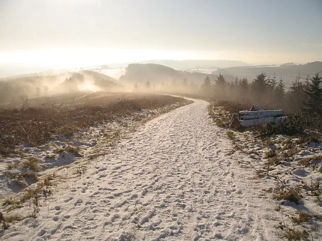
High Vinnalls
Mountains & hills · 1.7 km

Bringewood
Mountains & hills · 1.7 km
Bringewood Hill
Mountains & hills · 1.7 km

Cast Iron Grave Slabs
Memorials & monuments · 2.0 km

Elan aqueduct
Gardens · 2.0 km

Richards Castle
Castles · 2.7 km
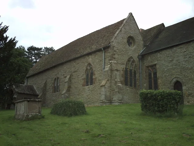
St Bartholomew's Church
Historic churches · 2.8 km

Richard's Castle
Castles · 2.8 km

Tower about 10 metres east of Church of St Bartholomew
Memorials & monuments · 2.8 km

Richard's Castle
Literary houses · 2.8 km
Nearby
📷 5📷 5📷 3📷 5📷 5Mountains & hills · West Midlands
Bringewood Hill
Bringewood Hill — mountain in wales mid. Elevation: 363 m.
📷 3Memorials & monuments · West Midlands
Cast Iron Grave Slabs
Cast Iron Grave Slabs — a memorial in wales-mid, United Kingdom.
Where to eat & stay near Aston Tump
Places to stay
 📷 5
📷 5Caravan parks · West Midlands
Orleton Rise Holiday Home Park
Orleton Rise Holiday Home Park — a caravan park in wales mid.
 📷 5
📷 5 📷 5
📷 5Caravan parks · West Midlands
Fairfield Holiday Park
Fairfield Holiday Park — a caravan park in wales mid.
 📷 7
📷 7 📷 5
📷 5Caravan parks · West Midlands
Home Farm Accommodation
Home Farm Accommodation — a caravan park in wales mid.
 📷 5
📷 5Places to eat & drink
 📷 5
📷 5 📷 7
📷 7Historic pubs · West Midlands
Clive Arms Public House
Clive Arms Public House in England West Midlands, United Kingdom.
 📷 5
📷 5Historic pubs · West Midlands
Wheatsheaf Inn and Chandlers Cottage
Wheatsheaf Inn and Chandlers Cottage in England West Midlands, United Kingdom.
 📷 7
📷 7Historic pubs · West Midlands
Old Bull Ring Tavern
Old Bull Ring Tavern in England West Midlands, United Kingdom.
 📷 5
📷 5 📷 5
📷 5More historic houses in this region
_-_geograph.org.uk_-_1441773.jpg?width=1200) 📷 3
📷 3Historic houses · West Midlands
Bishton Hall
Bishton Hall — country house in Staffordshire, England, UK.
 📷 3
📷 3Historic houses · West Midlands
Callowhill Hall
Callowhill Hall — house in Kingstone, East Staffordshire, England, UK.
 📷 3
📷 3Historic houses · West Midlands
Church House
Church House — building in Abbots Bromley, Staffordshire, England, UK.
 📷 3
📷 3Frequently asked questions
- Where is Aston Tump?
- Aston Tump is in Mid Wales, United Kingdom (postcode SY8 2HG), in the parish of Pipe Aston.
- What is Aston Tump?
- Aston Tump — a historic house in wales-mid, United Kingdom.
- How do I get to Aston Tump?
- The nearest railway station is Ludlow, about 6.0 km away. Drivers can use postcode SY8 2HG.
- Is Aston Tump a protected site?
- Yes — Aston Tump is part of the Mortimer Forest SSSI Site of Special Scientific Interest and the River Teme SSSI Site of Special Scientific Interest.
- How do I get to Aston Tump?
- The nearest railway station is Ludlow, about 6.0 km away. Drivers can navigate to postcode SY8 2HG.