Natural landmarks · Northern Ireland
Antrim Lower
Also known as: Aontroim Íochtarach
In or near Buckna.
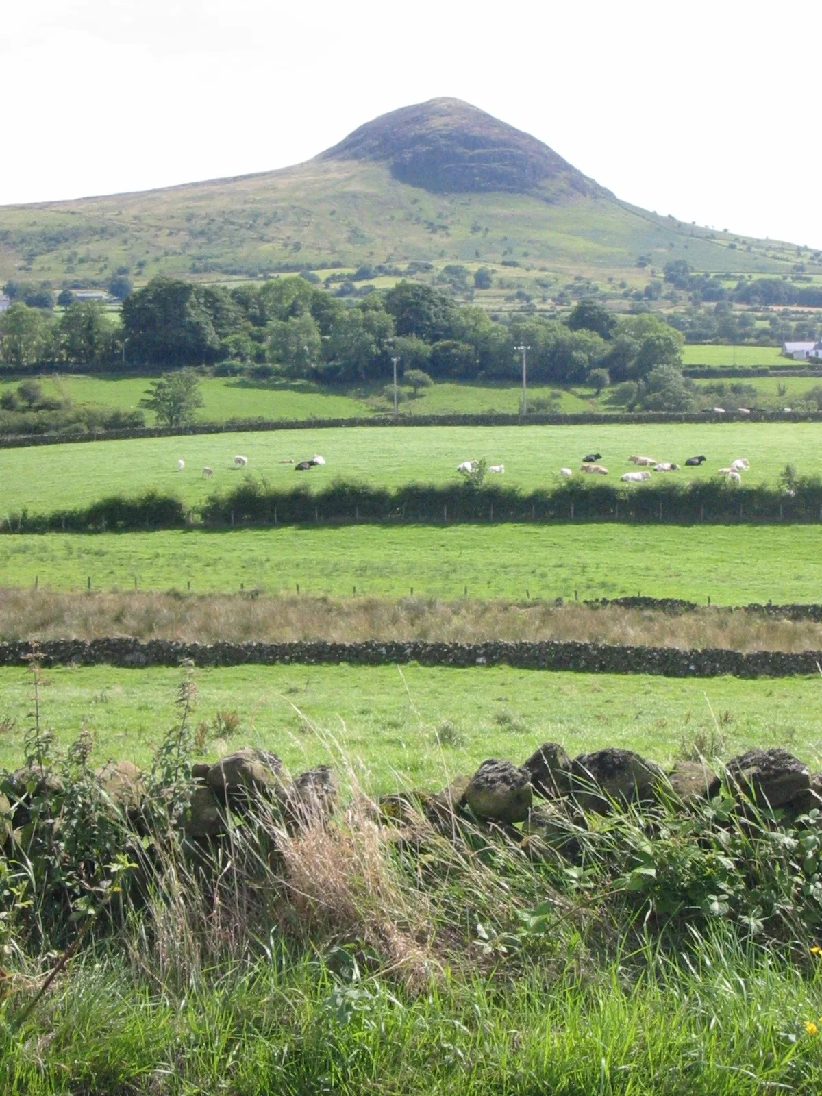
Antrim Lower in Northern Ireland, United Kingdom.

Kenneth Allen — CC BY-SA 2.0 via Wikimedia Commons licence
Plan your visit
- Typical visit
- 1 h–2 h
- Nearest railway station
- Ballymena · 9.7 km
- Free entry
- Dog-friendly
About
Antrim Lower is a place of interest in Northern Ireland, United Kingdom — drawn from open-data sources for visitor reference. See the linked Wikipedia article for the full description.
Photo gallery
From the Wikipedia article
Antrim Lower is a barony in County Antrim, Northern Ireland. It is bordered by six other baronies: Antrim Upper to the south; Toome Upper to the south-west; Toome Lower to the west; Kilconway to the north-west; Glenarm Lower to the north-east; and Glenarm Upper to the east. The River Braid flows through this barony.
Excerpt from Wikipedia under CC BY-SA 4.0. See the source article linked in Sources below.
- Coordinates
- 54.8712, -6.1334
- District
- Mid and East Antrim
- Postcode
- BT42 4QY
- Parliamentary constituency
- East Antrim
- Nearest railway station
- Ballymena — 9.7 km
Sources
- wikidata: Q2223081 (CC0)
- wikipedia: Antrim Lower (CC BY-SA 4.0)
Other places nearby

Ballygelly
Natural landmarks · 0.4 km

Slemish Mountain
Mountains & hills · 1.7 km
Slemish
Mountains & hills · 2.6 km

Slemish
Natural landmarks · 2.6 km

Buckna
Towns & cities · 3.3 km

Mid Antrim
Natural landmarks · 4.5 km

Douglas Top
Mountains & hills · 4.7 km

Carnalbanagh
Towns & cities · 4.7 km

Aghnadore
Natural landmarks · 4.7 km

Douglas Top
Mountains & hills · 4.8 km

Skerry Church Yard
Historic houses · 4.9 km

Aghacully
Natural landmarks · 4.9 km
Nearby
📷 2📷 5Mountains & hills · Northern Ireland
Slemish Mountain
Slemish Mountain — a hill or mountain in northern ireland.
📷 4📷 4Natural landmarks · Northern Ireland
Slemish
Slemish is a natural landmark in the United Kingdom.
📷 3Towns & cities · Northern Ireland
Buckna
Buckna — village in County Antrim, Northern Ireland, UK.
📷 4Where to eat & stay near Antrim Lower
Places to stay
 📷 3
📷 3 📷 5
📷 5Campsites · Northern Ireland
Glenarm Castle Ocean View Pods
Glenarm Castle Ocean View Pods — a campsite in northern ireland.
 📷 4
📷 4 📷 3
📷 3 📷 5
📷 5Hotels · Northern Ireland
DoubleTree by Hilton Belfast Templepatrick
DoubleTree by Hilton Belfast Templepatrick — a hotel in northern ireland. 4-star. Brand: Hilton.
 📷 5
📷 5Caravan parks · Northern Ireland
Six Mile Water Caravan Park
Six Mile Water Caravan Park — a caravan park in northern ireland.
Places to eat & drink
 📷 5
📷 5More natural landmarks in this region
 Flagship📷 4
Natural landmarks · Northern Ireland
Lough Erne
Lough Erne — lake in County Fermanagh, Northern Ireland, UK.
 Flagship📷 4
Natural landmarks · Northern Ireland
Lough Neagh
Lough Neagh — large lake in Northern Ireland.
 📷 3
📷 3Natural landmarks · Northern Ireland
Ballysaggart Lough
Ballysaggart Lough — lake in the United Kingdom.
 📷 5
📷 5Natural landmarks · Northern Ireland
Belmore Mountain
Belmore Mountain — mountain in the United Kingdom.
Frequently asked questions
- Where is Antrim Lower?
- Antrim Lower is in Northern Ireland, United Kingdom (postcode BT42 4QY).
- What is Antrim Lower?
- Antrim Lower in Northern Ireland, United Kingdom.
- How do I get to Antrim Lower?
- The nearest railway station is Ballymena, about 9.7 km away. Drivers can use postcode BT42 4QY.
- Is Antrim Lower free to visit?
- Yes, Antrim Lower is free to enter.
- How do I get to Antrim Lower?
- Drivers can navigate to postcode BT42 4QY. It sits within the East Antrim parliamentary constituency.