Mountains & hills · Scottish Highlands
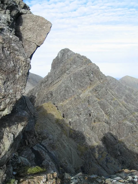
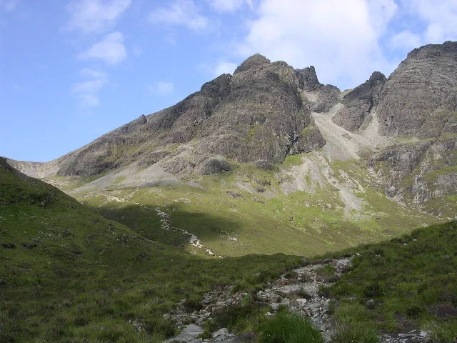
An Stac
An Stac — a hill or mountain in scotland highlands.

Ian Taylor — CC BY-SA 2.0 via Wikimedia Commons licence
Plan your visit
- Typical visit
- 3 h–8 h
- Best time of year
- Late spring – early autumn (May–Oct)
About
A British hill or mountain, named on Ordnance Survey maps and walked by hill-baggers. An Stac is a named hill or mountain in scotland highlands, recorded in the GeoNames UK gazetteer. British landmarks of this type are typically marked on Ordnance Survey maps and recorded in the national gazetteer for cartographic and navigational reference. Coordinates and feature classification are sourced from the GeoNames open dataset.
Photo gallery
Place summary
An Stac is a mountain located in the Scottish Highlands. It is known for its rugged terrain and striking geological features. The area offers opportunities for hiking and exploring the natural landscape. Visitors can expect dramatic views and a remote setting, typical of the Highlands.
AI-generated from the structured facts on this page (operator, designation, listing, era). Not a substitute for visiting.
- Coordinates
- 57.2156, -6.0732
Sources
- manual: geonames-12609856 (CC BY 4.0)
Other places nearby
Loading nearby places…
Nearby
📷 5Mountains & hills · Scottish Highlands
An Stac
An Stac — mountain in scotland highlands. Elevation: 528 m.
 📷 3
📷 3Natural landmarks · Scottish Highlands
Clach Glas
Clach Glas — mountain on the Isle of Skye, in Highland, Scotland, UK.
 📷 4
📷 4Mountains & hills · Scottish Highlands
Blà Bheinn
Blà Bheinn — Named summit at 928 m.
 📷 4
📷 4Natural landmarks · Scottish Highlands
Blà Bheinn
Blà Bheinn — 929m high mountain on the Isle of Skye, in Highland, Scotland, UK.
 📷 5
📷 5Mountains & hills · Scottish Highlands
Blabheinn
Blabheinn — a hill or mountain in scotland highlands.
 📷 5
📷 5Mountains & hills · Scottish Highlands
Sgurr nan Each
Sgurr nan Each — a hill or mountain in scotland highlands.
Where to eat & stay near An Stac
Places to stay
 📷 5
📷 5Campsites · Scottish Highlands
Camping Skye
Camping Skye — a campsite in scotland highlands.
 📷 5
📷 5Hostels · Scottish Highlands
Sligachan Bunkhouse
Sligachan Bunkhouse — a hostel in scotland highlands.
 📷 5
📷 5Hostels · Scottish Highlands
Broadford Backpackers Hostel
Broadford Backpackers Hostel — a hostel in scotland highlands.
 📷 5
📷 5Hostels · Scottish Highlands
Broadford Youth Hostel
Broadford Youth Hostel — a hostel in scotland highlands. Brand: Hostelling Scotland.
 📷 5
📷 5Campsites · Scottish Highlands
Sligachan Campsite
Sligachan Campsite — a campsite in scotland highlands.
 📷 5
📷 5Hostels · Scottish Highlands
Skye Basecamp
Skye Basecamp — a hostel in scotland highlands.
More mountains in this region
 📷 3
📷 3Mountains & hills · Scottish Highlands
A' Bhuidheanach Bheag
A' Bhuidheanach Bheag — Named summit at 936 m.
 📷 3
📷 3Mountains & hills · Scottish Highlands
A' Chailleach
A' Chailleach — Named summit at 997 m.
 📷 3
📷 3Mountains & hills · Scottish Highlands
A' Chailleach
A' Chailleach — Named summit at 930 m.
 📷 3
📷 3Mountains & hills · Scottish Highlands
A' Chaoirnich
A' Chaoirnich — Named summit at 875 m.
Frequently asked questions
- Where is An Stac?
- An Stac is in the Scottish Highlands, United Kingdom.
- What is An Stac?
- An Stac — a hill or mountain in scotland highlands.
- How do I get to An Stac?
- Its coordinates are 57.2156°, -6.0732°.