Mountains & hills · Scottish Highlands
An Dornabac
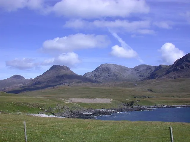
An Dornabac — a hill or mountain in scotland highlands.

John Ferguson — CC BY-SA 2.0 via Wikimedia Commons licence
Plan your visit
- Typical visit
- 3 h–8 h
- Best time of year
- Late spring – early autumn (May–Oct)
About
A British hill or mountain, named on Ordnance Survey maps and walked by hill-baggers. An Dornabac is a named hill or mountain in scotland highlands, recorded in the GeoNames UK gazetteer. British landmarks of this type are typically marked on Ordnance Survey maps and recorded in the national gazetteer for cartographic and navigational reference. Coordinates and feature classification are sourced from the GeoNames open dataset.
Photo gallery
Place summary
An Dornabac is a mountain located in the Scottish Highlands. It features rugged terrain typical of the region, attracting hikers and climbers. The area offers scenic views and a challenging landscape, making it a notable destination for outdoor enthusiasts.
AI-generated from the structured facts on this page (operator, designation, listing, era). Not a substitute for visiting.
- Coordinates
- 56.9890, -6.3593
Sources
- manual: geonames-12612739 (CC BY 4.0)
Other places nearby
Loading nearby places…
Nearby
📷 5Mountains & hills · Scottish Highlands
An Dornabac
An Dornabac — mountain in scotland highlands. Elevation: 263 m.
📷 5Mountains & hills · Scottish Highlands
Àrd Mheall
Àrd Mheall — mountain in scotland highlands. Elevation: 400 m.
 Flagship📷 5
Islands · Scottish Highlands
Rùm
Rùm — island in Lochaber, Highland, Scotland, UK, one of the Small Isles of the Inner Hebrides.
 📷 5
📷 5Mountains & hills · Scottish Highlands
Ard Nev
Ard Nev — a hill or mountain in scotland highlands.
 📷 5
📷 5Gorges · Scottish Highlands
Glen Harris
Glen Harris — a gorge in scotland highlands.
 📷 5
📷 5Vineyards · Scottish Highlands
Harris
Harris — a UK vineyard in scotland highlands, producing English or Welsh wine from cool-climate grape varieties.
Where to eat & stay near An Dornabac
Places to stay
 📷 5
📷 5Hostels · Scottish Highlands
Rum Bunkhouse
Rum Bunkhouse — a hostel in scotland highlands.
 📷 5
📷 5Campsites · Scottish Highlands
Canna Campsite
Canna Campsite — a campsite in scotland highlands.
 📷 5
📷 5Hostels · Scottish Highlands
Glebe Barn
Glebe Barn — a hostel in scotland highlands.
 📷 5
📷 5Campsites · Scottish Highlands
Eigg Camping Pods
Eigg Camping Pods — a campsite in scotland highlands.
 📷 5
📷 5Campsites · Scottish Highlands
Glenbrittle Campsite
Glenbrittle Campsite — a campsite in scotland highlands.
More mountains in this region
 📷 3
📷 3Mountains & hills · Scottish Highlands
A' Bhuidheanach Bheag
A' Bhuidheanach Bheag — Named summit at 936 m.
 📷 3
📷 3Mountains & hills · Scottish Highlands
A' Chailleach
A' Chailleach — Named summit at 997 m.
 📷 3
📷 3Mountains & hills · Scottish Highlands
A' Chailleach
A' Chailleach — Named summit at 930 m.
 📷 3
📷 3Mountains & hills · Scottish Highlands
A' Chaoirnich
A' Chaoirnich — Named summit at 875 m.
Frequently asked questions
- Where is An Dornabac?
- An Dornabac is in the Scottish Highlands, United Kingdom.
- What is An Dornabac?
- An Dornabac — a hill or mountain in scotland highlands.
- How do I get to An Dornabac?
- Its coordinates are 56.9890°, -6.3593°.