Mountains & hills · Scottish Highlands
An Dornabac
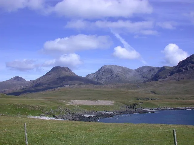
An Dornabac — mountain in scotland highlands. Elevation: 263 m.

John Ferguson — CC BY-SA 2.0 via Wikimedia Commons licence
Plan your visit
- Typical visit
- 3 h–8 h
- Best time of year
- Late spring – early autumn (May–Oct)
About
An Dornabac is a mountain located in scotland highlands. Elevation: 263 m. A named British peak recorded in OpenStreetMap. Peaks are typically named on Ordnance Survey 1:50k mapping.
Photo gallery
Place summary
An Dornabac is a mountain located in the Scottish Highlands. Known for its rugged terrain and dramatic landscapes, it offers a challenging environment for experienced hikers and climbers. The area is characterised by its natural beauty, featuring glens and lochs typical of the Highlands. Visitors can expect a remote setting, ideal for outdoor activities and exploration.
AI-generated from the structured facts on this page (operator, designation, listing, era). Not a substitute for visiting.
- Coordinates
- 56.9888, -6.3587
Sources
- osm: n2806542426 (ODbL)
Other places nearby
Loading nearby places…
Nearby
📷 5Mountains & hills · Scottish Highlands
An Dornabac
An Dornabac — a hill or mountain in scotland highlands.
📷 5Mountains & hills · Scottish Highlands
Àrd Mheall
Àrd Mheall — mountain in scotland highlands. Elevation: 400 m.
 Flagship📷 5
Islands · Scottish Highlands
Rùm
Rùm — island in Lochaber, Highland, Scotland, UK, one of the Small Isles of the Inner Hebrides.
 📷 5
📷 5Gorges · Scottish Highlands
Glen Harris
Glen Harris — a gorge in scotland highlands.
 📷 5
📷 5Mountains & hills · Scottish Highlands
Ard Nev
Ard Nev — a hill or mountain in scotland highlands.
 📷 5
📷 5Vineyards · Scottish Highlands
Harris
Harris — a UK vineyard in scotland highlands, producing English or Welsh wine from cool-climate grape varieties.
Where to eat & stay near An Dornabac
Places to stay
 📷 5
📷 5Hostels · Scottish Highlands
Rum Bunkhouse
Rum Bunkhouse — a hostel in scotland highlands.
 📷 5
📷 5Campsites · Scottish Highlands
Canna Campsite
Canna Campsite — a campsite in scotland highlands.
 📷 5
📷 5Hostels · Scottish Highlands
Glebe Barn
Glebe Barn — a hostel in scotland highlands.
 📷 5
📷 5Campsites · Scottish Highlands
Eigg Camping Pods
Eigg Camping Pods — a campsite in scotland highlands.
 📷 5
📷 5Campsites · Scottish Highlands
Glenbrittle Campsite
Glenbrittle Campsite — a campsite in scotland highlands.
More mountains in this region
 📷 3
📷 3Mountains & hills · Scottish Highlands
A' Bhuidheanach Bheag
A' Bhuidheanach Bheag — Named summit at 936 m.
 📷 3
📷 3Mountains & hills · Scottish Highlands
A' Chailleach
A' Chailleach — Named summit at 997 m.
 📷 3
📷 3Mountains & hills · Scottish Highlands
A' Chailleach
A' Chailleach — Named summit at 930 m.
 📷 3
📷 3Mountains & hills · Scottish Highlands
A' Chaoirnich
A' Chaoirnich — Named summit at 875 m.
Frequently asked questions
- Where is An Dornabac?
- An Dornabac is in the Scottish Highlands, United Kingdom.
- What is An Dornabac?
- An Dornabac — mountain in scotland highlands. Elevation: 263 m.
- How do I get to An Dornabac?
- Its coordinates are 56.9888°, -6.3587°.