Mountains & hills · Scottish Highlands
An Cabar
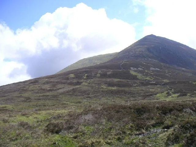
An Cabar — mountain in scotland highlands. Elevation: 946 m.

Mick Garratt — CC BY-SA 2.0 via Wikimedia Commons licence
Plan your visit
- Typical visit
- 3 h–8 h
- Best time of year
- Late spring – early autumn (May–Oct)
About
An Cabar is a mountain located in scotland highlands. Elevation: 946 m. A named British peak recorded in OpenStreetMap. Peaks are typically named on Ordnance Survey 1:50k mapping.
Photo gallery
Place summary
An Cabar is a mountain located in the Scottish Highlands. It is known for its distinctive topography and offers various opportunities for outdoor activities. Visitors can expect rugged terrain and scenic views typical of the region. The area is popular for hiking and exploring the natural landscape.
AI-generated from the structured facts on this page (operator, designation, listing, era). Not a substitute for visiting.
- Coordinates
- 57.6624, -4.5987
Sources
- osm: n268248293 (ODbL)
Other places nearby
Loading nearby places…
Nearby
 📷 3
📷 3Mountains & hills · Scottish Highlands
An Cabar
An Cabar — a mountain in scotland-highlands, United Kingdom.
 📷 5
📷 5Forests & woodlands · Scottish Highlands
Ben Wyvis National Nature Reserve
Ben Wyvis National Nature Reserve is a forest or woodland in the United Kingdom.
 📷 3
📷 3Mountains & hills · Scottish Highlands
Tom na Caillich
Tom na Caillich — a mountain in scotland-highlands, United Kingdom.
 📷 3
📷 3Mountains & hills · Scottish Highlands
Glas Leathad Mòr
Glas Leathad Mòr — a mountain in scotland-highlands, United Kingdom, 1046 m.
 📷 5
📷 5Mountains & hills · Scottish Highlands
Ben Wyvis
Ben Wyvis — Named summit at 1046 m.
 📷 5
📷 5Natural landmarks · Scottish Highlands
Ben Wyvis
Ben Wyvis — mountain in Highland, Scotland, UK.
Where to eat & stay near An Cabar
Places to stay
 📷 5
📷 5B&Bs · Scottish Highlands
Holly Lodge
Holly Lodge — a bed-and-breakfast in scotland highlands.
 📷 5
📷 5Campsites · Scottish Highlands
Riverside Campsite
Riverside Campsite — a campsite in scotland highlands.
 📷 5
📷 5Caravan parks · Scottish Highlands
Dingwall Camping and Caravanning Club
Dingwall Camping and Caravanning Club — a caravan park in scotland highlands.
 📷 5
📷 5Hostels · Scottish Highlands
Fairburn Activity Centre
Fairburn Activity Centre — a hostel in scotland highlands.
 📷 5
📷 5Hotels · Scottish Highlands
Conon Bridge Hotel
Conon Bridge Hotel — a hotel in scotland highlands.
 📷 5
📷 5Campsites · Scottish Highlands
Black Rock Holiday Park
Black Rock Holiday Park — a campsite in scotland highlands.
More mountains in this region
 📷 3
📷 3Mountains & hills · Scottish Highlands
A' Bhuidheanach Bheag
A' Bhuidheanach Bheag — Named summit at 936 m.
 📷 3
📷 3Mountains & hills · Scottish Highlands
A' Chailleach
A' Chailleach — Named summit at 997 m.
 📷 3
📷 3Mountains & hills · Scottish Highlands
A' Chailleach
A' Chailleach — Named summit at 930 m.
 📷 3
📷 3Mountains & hills · Scottish Highlands
A' Chaoirnich
A' Chaoirnich — Named summit at 875 m.
Frequently asked questions
- Where is An Cabar?
- An Cabar is in the Scottish Highlands, United Kingdom.
- What is An Cabar?
- An Cabar — mountain in scotland highlands. Elevation: 946 m.
- How do I get to An Cabar?
- Its coordinates are 57.6624°, -4.5987°.