
Viewpoints · East Midlands
Ambion Hill
In or near Cadeby.
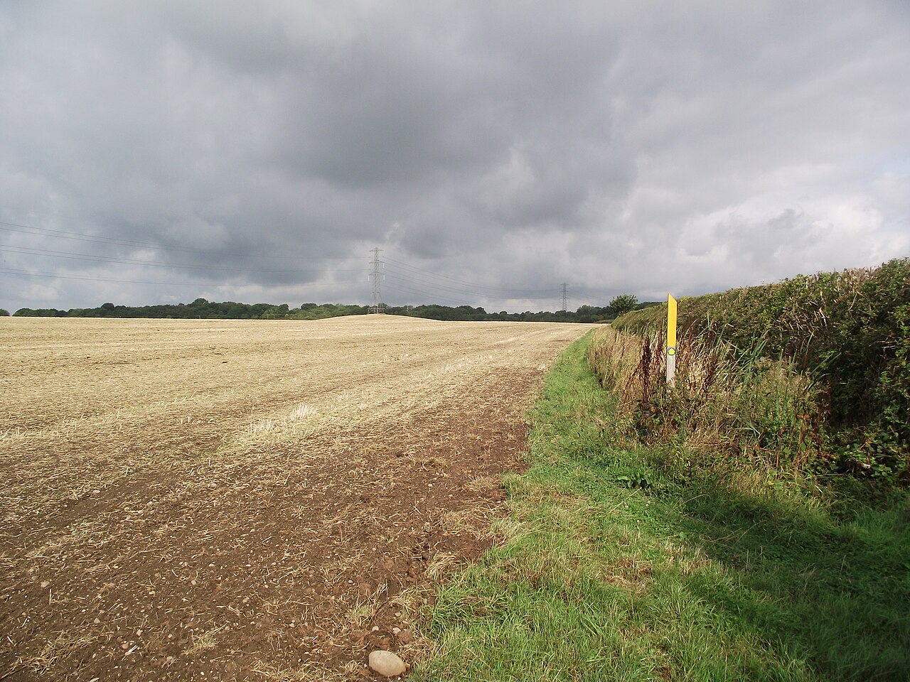
Ambion Hill is a viewpoint in the United Kingdom.

Philip Halling — CC BY-SA 2.0 via Wikimedia Commons licence

Plan your visit
- Typical visit
- 20 min–45 min
- Best time of year
- Clear days year-round
- Nearest railway station
- Shenton · 0.5 km
- Free entry
- Dog-friendly
Getting there & planning your visit
To visit Ambion Hill, the nearest railway station is Shenton, which is 0.5 km away. The postcode for navigation is CV13 0AB, and entry is free. The site is accessible for visitors.
About
Ambion Hill is a named viewpoint in Leicestershire, the West Midlands, marked on Ordnance Survey maps for its outlook. It sits within the Hinckley and Bosworth parliamentary constituency. The nearest railway station is Shenton, about 0.5 km away. Postcode area CV13.
Photo gallery
Official information
Bosworth Battlefield Heritage Centre and Country Park offers visitors an interactive experience exploring the history of the Battle of Bosworth and medieval warfare. The site features exhibition galleries, guided walks, and family-friendly activities in a scenic rural setting.
From the Wikipedia article
Ambion Hill is a hill in west Leicestershire, England, south of the town of Market Bosworth and lying south of the Sutton Cheney to Shenton road and north of Dadlington and of Fenn Lanes Roman road. The Ashby Canal passes to the south of the hill. The hill is the site of the deserted medieval village of Anebein. Ambion Hill was long considered to be the site of the Battle of Bosworth Field and is where the Bosworth Battlefield Heritage Centre is situated. The chronicler Raphael Holinshed wrote in 1577 that Richard III "pitched his field on a hill called Anne Beame, refreshed his soldiers and took his rest". This was taken by the 18th-century antiquary William Hutton to mean that Ambion Hill was the site of the battle. Hutton's book The Battle of Bosworth Field, published in 1788, was very influential in causing the hill to be accepted as the site of the battle. Leicestershire County Council set up the battlefield visitor centre at what was Ambion Hill Farm, in 1974. The work of Leicester University historian Daniel Williams was used to interpret the battle. Numerous historians challenged the Ambion Hill location for the battle and this led to a large-scale project (from 2005 to 2009) by the Battlefields Trust, headed by Glenn Foard, to attempt to definitively find the true location of the battlefield. It is now accepted that the core of the battlefield lies either side of Fenn Lanes, about two miles south-west of the visitor centre and that Ambion Hill was Richard III's camp on the night before the battle. The battlefield heritage centre now has a viewing point with the Fenn Lane Farm site and other notable points marked. Ambion Hill remains within the revised registered battlefield. A cairn built in 1813 marks the well from which according to tradition Richard III is said to have drunk prior to the battle. The cortège carrying Richard III's remains visited the hill during the procession before their interment in Leicester Cathedral in 2015.
Excerpt from Wikipedia under CC BY-SA 4.0. See the source article linked in Sources below.
- Coordinates
- 52.5979, -1.4085
- County
- Leicestershire
- District
- Hinckley and Bosworth
- Parish
- Dadlington & Sutton Cheney
- Postcode
- CV13 0AB
- Parliamentary constituency
- Hinckley and Bosworth
- Phone
- 01455 291048
- Nearest railway station
- Shenton — 0.5 km
- Opening
- April to October 10am–5pm; November to March 10am–4pm; last entry one hour before closing
- Official site
- www.bosworthbattlefield.org.uk
Sources
- osm: n2150518846 (ODbL)
- wikipedia: Ambion Hill (CC BY-SA 4.0)
Other places nearby
King Richard III
Memorials & monuments · 0.0 km
John Devere
Memorials & monuments · 0.0 km
Henry Percy
Memorials & monuments · 0.0 km
Henry Tudor
Memorials & monuments · 0.0 km
George Stanley
Memorials & monuments · 0.0 km
John Savage & Gilbert Talbot
Memorials & monuments · 0.0 km
Lord Stanley
Memorials & monuments · 0.0 km
Sir William Stanley
Memorials & monuments · 0.0 km

King Richard's Well
Natural landmarks · 0.2 km

Bosworth Field Visitor Centre
Museums · 0.2 km

Bosworth Battlefield
Memorials & monuments · 0.3 km

Shenton Hall
Historic houses · 1.4 km
Nearby
📷 3Memorials & monuments · East Midlands
King Richard III
King Richard III — a memorial in england-west-midlands, United Kingdom.
📷 3Memorials & monuments · East Midlands
John Devere
John Devere — a memorial in england-west-midlands, United Kingdom.
📷 3Memorials & monuments · East Midlands
Henry Percy
Henry Percy — a memorial in england-west-midlands, United Kingdom.
📷 3Memorials & monuments · East Midlands
Henry Tudor
Henry Tudor — a memorial in england-west-midlands, United Kingdom.
📷 4Memorials & monuments · East Midlands
George Stanley
George Stanley — a memorial in england-west-midlands, United Kingdom.
📷 3Memorials & monuments · East Midlands
John Savage & Gilbert Talbot
John Savage & Gilbert Talbot — a memorial in england-west-midlands, United Kingdom.
Where to eat & stay near Ambion Hill
Places to stay
 📷 5
📷 5Caravan parks · South East England
Upton Barn Caravan and Camping site
Upton Barn Caravan and Camping site — a caravan park in england west midlands.
 📷 5
📷 5Campsites · East Midlands
Fox Covert Scout Camp
Fox Covert Scout Camp — a campsite in england west midlands.
 📷 5
📷 5 📷 5
📷 5Campsites · South East England
Spinney View Huts
Spinney View Huts — a campsite in england west midlands.
 📷 7
📷 7 📷 5
📷 5Caravan parks · South East England
Atherstone Stables
Atherstone Stables — a caravan park in england west midlands.
Places to eat & drink
 📷 3
📷 3Historic pubs · South East England
Blue Lion
Blue Lion — Historic pub — listed building or notable heritage status.
 📷 3
📷 3Historic pubs · West Midlands
The Old Swan
The Old Swan — Historic pub — listed building or notable heritage status.
 📷 3
📷 3Historic pubs · West Midlands
Market Tavern
Market Tavern — Historic pub — listed building or notable heritage status.
 📷 3
📷 3Historic pubs · West Midlands
New Swan Inn
New Swan Inn — Historic pub — listed building or notable heritage status.
 📷 3
📷 3Historic pubs · West Midlands
Bird in Hand
Bird in Hand — Historic pub — listed building or notable heritage status.
 📷 5
📷 5Historic pubs · East Midlands
Narborough Arms
Narborough Arms in England East Midlands, United Kingdom.
More viewpoints in this region
 📷 3
📷 3Viewpoints · East Midlands
ast view (Boston - Grimsby)
ast view (Boston - Grimsby) is a viewpoint in the United Kingdom.
 📷 3
📷 3 📷 3
📷 3 📷 4
📷 4Viewpoints · East Midlands
Bennerley Viaduct
Bennerley Viaduct is a viewpoint in the United Kingdom.
Frequently asked questions
- Where is Ambion Hill?
- Ambion Hill is in Leicestershire, the West Midlands, United Kingdom (postcode CV13 0AB), in the parish of Dadlington & Sutton Cheney.
- What is Ambion Hill?
- Ambion Hill is a viewpoint in the United Kingdom.
- How do I get to Ambion Hill?
- The nearest railway station is Shenton, about 0.5 km away. Drivers can use postcode CV13 0AB.
- Is Ambion Hill free to visit?
- Yes, Ambion Hill is free to enter.
- How do I get to Ambion Hill?
- The nearest railway station is Shenton, about 0.5 km away. Drivers can navigate to postcode CV13 0AB.